Palash Upazila
Palash (Bengali: পলাশ) is an upazila of Narsingdi District[1] in the Division of Dhaka, Bangladesh.
Palash
পলাশ | |
|---|---|
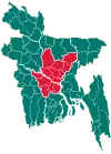
 Palash Location in Bangladesh | |
| Coordinates: 23°57′N 90°37.5′E | |
| Country | |
| Division | Dhaka Division |
| District | Narsingdi District |
| Area | |
| • Total | 94.43 km2 (36.46 sq mi) |
| Population (1991) | |
| • Total | 174,040 |
| • Density | 1,800/km2 (4,800/sq mi) |
| Time zone | UTC+6 (BST) |
| Website | Official Map of Palash |
Geography
Palash is located at 23.9500°N 90.6250°E. It has 31350 households and total area 94.43 km2.
Demographics
According to the official 1991 census, Palash had a population of 174,040. Males constitute 53.4% of the population, and females 46.6%. This Upazila's eighteen up population is 89627. Palash has an average literacy rate of 88.6% [2] By 2011 that population had grown to 212,612, consisting of 46,780 households.[3]
Administration
Palash Upazila is divided into Ghorasal Municipality four union parishads: Charsindur, Danga, Gazaria, and Jinardi. The union parishads are subdivided into 51 mauzas and 100 villages.[4]
Ghorasal Municipality is subdivided into 9 wards and 51 mahallas.[4]
References
- Md. Iftekhar Uddin Bhuiyan (2012), "Palash Upazila", in Sirajul Islam and Ahmed A. Jamal (ed.), Banglapedia: National Encyclopedia of Bangladesh (Second ed.), Asiatic Society of Bangladesh
- "Population Census Wing, BBS". Archived from the original on 2005-03-27. Retrieved November 10, 2006.
- "Census 2011" (PDF). Bangladesh. p. 27. Archived from the original (PDF) on May 8, 2016. Retrieved March 7, 2016.
- "District Statistics 2011: Narsingdi" (PDF). Bangladesh Bureau of Statistics. Archived from the original (PDF) on 13 November 2014. Retrieved 14 July 2014.