Sreepur Upazila, Gazipur
Sreepur (Bengali: শ্রীপুর) is an upazila (sub-district) of Gazipur District in central Bangladesh, part of the Dhaka Division.[2]
Sreepur
শ্রীপুর | |
|---|---|
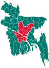
 Sreepur Location in Bangladesh | |
| Coordinates: 24°12′N 90°28′E | |
| Country | Bangladesh |
| Division | Dhaka Division |
| District | Gazipur District |
| Government | |
| • Ex Minister | Adv.Rahmat Ali MP[1] |
| Area | |
| • Total | 465.24 km2 (179.63 sq mi) |
| Population (1991) | |
| • Total | 320,530 |
| • Density | 690/km2 (1,800/sq mi) |
| Time zone | UTC+6 (BST) |
| Postal code | 1740 |
| Website | sreepur |
Geography
Sreepur is located at 24.2000°N 90.4667°E. It has 65435 households and total area 465.24 km2.
Demographics
At the 1991 census Bangladesh census, Sreepur had a population of 320,530, of which 166,988 were aged 18 or older. Males constituted 51.13% of the population, and females 48.87%. Sreepur had an average literacy rate of 30.3% (7+ years), against the national average of 32.4%.[3]
Administration
Sreepur Upazila is divided into Sreepur Municipality and eight union parishads: Barmi, Gazipur, Gosinga, Kaoraid, Maona, Prahladpur, Rajabari, and Telihati. The union parishads are subdivided into 81 mauzas and 172 villages.[4]
Sreepur Municipality is subdivided into 9 wards and 20 mahallas.[4]
References
- http://www.dcgazipur.gov.bd/index.php?option=com_content&view=article&id=78&Itemid=88
- Bagchi, Tapan (2012). "Sreepur Upazila (Gazipur District)". In Islam, Sirajul; Jamal, Ahmed A. (eds.). Banglapedia: National Encyclopedia of Bangladesh (Second ed.). Asiatic Society of Bangladesh.
- "Population Census Wing, BBS". Archived from the original on 2005-03-27. Retrieved November 10, 2006.
- "District Statistics 2011: Gazipur" (PDF). Bangladesh Bureau of Statistics. Archived from the original (PDF) on 13 November 2014. Retrieved 14 July 2014.
External links