Kuliarchar Upazila
Kuliarchar (Bengali: কুলিয়ারচর) is an upazila of Kishoreganj District[1] in the Division of Dhaka, Bangladesh.
Kuliarchar
কুলিয়ারচর | |
|---|---|
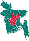
 Kuliarchar Location in Bangladesh | |
| Coordinates: 24°9.3′N 90°54′E | |
| Country | |
| Division | Dhaka Division |
| District | Kishoreganj District |
| Area | |
| • Total | 104.01 km2 (40.16 sq mi) |
| Population (1991) | |
| • Total | 133,327 |
| • Density | 1,300/km2 (3,300/sq mi) |
| Time zone | UTC+6 (BST) |
| Website | Official Map of Kuliarchar |
Geography
Kuliarchar is located at 24.1542°N 90.9000°E. It has 26143 households and total area 104.01 km2. It is in north east side of Bangladesh.
Demographics
As of the 1991 Bangladesh census, Kuliarchar has a population of 133327. Males constitute 50.61% of the population, and females 49.39%. This Upazila's eighteen up population is 67006. Kuliarchar has an average literacy rate of 21.6% (7+ years), and the national average of 32.4% literate.[2]
Administration
Kuliarchar Upazila is divided into Kuliarchar Municipality and six union parishads: Chhaysuti, Faridpur, Gobaria Abdullahpur, Osmanpur, Ramdi, and Salua. The union parishads are subdivided into 46 mauzas and 97 villages.[3]
Kuliarchar Municipality is subdivided into 9 wards and 37 mahallas.[3]
Kuliarchar has one degree college, one technical college, 10 High school, 72 Primary school, 7 Reg. primary schools and some madrasas.
References
- Md. Abul Kashem Bhuiyan (2012), "Kuliarchar Upazila", in Sirajul Islam and Ahmed A. Jamal (ed.), Banglapedia: National Encyclopedia of Bangladesh (Second ed.), Asiatic Society of Bangladesh
- "Population Census Wing, BBS". Archived from the original on 2005-03-27. Retrieved November 10, 2006.
- "District Statistics 2011: Kishoreganj" (PDF). Bangladesh Bureau of Statistics. Archived from the original (PDF) on 13 November 2014. Retrieved 14 July 2014.
| Upazila/Thana: | ||
|---|---|---|
