Sonargaon Upazila
Sonargaon (Bengali: সোনারগাঁও) is an upazila of Narayanganj District[1] in the Division of Dhaka, Bangladesh.
Sonargaon
সোনারগাঁও | |
|---|---|
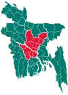
 Sonargaon Location in Bangladesh | |
| Coordinates: 23°39.5′N 90°36.5′E | |
| Country | |
| Division | Dhaka Division |
| District | Narayanganj District |
| Area | |
| • Total | 171.66 km2 (66.28 sq mi) |
| Population (1991) | |
| • Total | 261,881 |
| • Density | 1,500/km2 (4,000/sq mi) |
| Time zone | UTC+6 (BST) |
| Website | Official Map of Sonargaon |
Demographics
As of the 1991 Bangladesh census, Sonargaon has a population of 261,881 in 44,405 households. Males constitute 52.11% of the population, and females 47.89%. The population over 18 years of age is 118,319.
Sonargaon has an average literacy rate of 33.1% (7+ years), compared with the national average of 32.4%.[2]
Food
Local food includes Gurer Zilapi, Murali, Binni Khoi, Shwandesh, etc.
Administration
Sonargaon Upazila is divided into Sonargaon Municipality and ten union parishads: Baidyerbazar, Baradi, Jampur, Kachpur, Mugrapara, Naogaon, Pirijpur, Sadipur, Shambhupura, and Shanmandi. The union parishads are subdivided into 351 mauzas and 487 villages.[3]
Sonargaon Municipality is subdivided into 9 wards and 60 mahallas.[3]
References
- Shamsuddoha Chowdhury (2012), "Sonargaon Upazila", in Sirajul Islam and Ahmed A. Jamal (ed.), Banglapedia: National Encyclopedia of Bangladesh (Second ed.), Asiatic Society of Bangladesh
- "Population Census Wing, BBS". Archived from the original on 2005-03-27. Retrieved November 10, 2006.
- "District Statistics 2011: Narayanganj" (PDF). Bangladesh Bureau of Statistics. Archived from the original (PDF) on 13 November 2014. Retrieved 14 July 2014.
| Upazila/Thana: | ||
|---|---|---|