Lake Park, Florida
Lake Park is a town in Palm Beach County, Florida, United States. The population was 8,155 at the 2010 census. As of 2018, the population recorded by the U.S. Census Bureau was 8,605.[5]
Lake Park, Florida | |
|---|---|
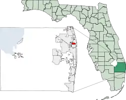
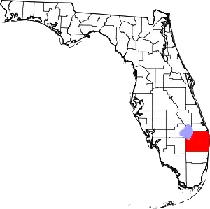
 Location of Lake Park in Palm Beach County, Florida | |
| Coordinates: 26°48′1″N 80°3′51″W | |
| Country | |
| State | |
| County | Palm Beach |
| Government | |
| • Type | Manager-council |
| • Mayor | Michael O'Rourke |
| Area | |
| • Total | 2.44 sq mi (6.31 km2) |
| • Land | 2.08 sq mi (5.40 km2) |
| • Water | 0.35 sq mi (0.91 km2) |
| Elevation | 13 ft (4 m) |
| Population (2010) | |
| • Total | 8,155 |
| • Estimate (2019)[2] | 8,556 |
| • Density | 4,103.60/sq mi (1,584.50/km2) |
| Time zone | UTC-5 (Eastern (EST)) |
| • Summer (DST) | UTC-4 (EDT) |
| ZIP codes | 33403, 33408, 33410 |
| Area code(s) | 561 |
| FIPS code | 12-38600[3] |
| GNIS feature ID | 0285268[4] |
| Website | www |
Geography
Lake Park is located at 26°48′1″N 80°3′51″W (26.800389, -80.064237).[6]
According to the United States Census Bureau, the town has a total area of 2.3 square miles (6.0 km2), of which 2.2 square miles (5.7 km2) is land and 0.2 square miles (0.52 km2) (7.66%) is water.
History
Kelsey City, now known as Lake Park, was the first zoned municipality in the State of Florida.[7] It was designed and planned by Dr. John Nolan of Boston, Massachusetts, and the Olmsted Brothers, the landscaping firm of Frederick Law Olmsted's sons, Frederick Jr and John Charles. Since then, the boundaries of Lake Park have expanded to 2.35 square miles (6.1 km2) of residential, business, industrial and mixed-use land. The Lake Park Town Hall, constructed in 1927 and listed on the National Register of Historic Places, survived the 1928 Okeechobee hurricane and served as a shelter for town residents during the storm.
Demographics
| Historical population | |||
|---|---|---|---|
| Census | Pop. | %± | |
| 1930 | 470 | — | |
| 1940 | 379 | −19.4% | |
| 1950 | 489 | 29.0% | |
| 1960 | 3,589 | 633.9% | |
| 1970 | 6,993 | 94.8% | |
| 1980 | 6,909 | −1.2% | |
| 1990 | 6,704 | −3.0% | |
| 2000 | 8,721 | 30.1% | |
| 2010 | 8,155 | −6.5% | |
| 2019 (est.) | 8,556 | [2] | 4.9% |
| U.S. Decennial Census[8] | |||
As of the census[3] of 2000, there were 8,721 people, 3,346 households, and 2,024 families residing in the town. The population density was 4,018.8 inhabitants per square mile (1,551.7/km2). There were 3,650 housing units at an average density of 1,682.0 per square mile (649.4/km2). The racial makeup of the town was 41.26% White (38% were Non-Hispanic White,)[9] 48.80% African American, 0.34% Native American, 2.89% Asian, 1.27% from other races, and 5.44% from two or more races. Hispanic or Latino of any race were 5.80% of the population.
There were 3,346 households, out of which 31.0% had children under the age of 18 living with them, 37.1% were married couples living together, 16.7% had a female householder with no husband present, and 39.5% were non-families. 29.3% of all households were made up of individuals, and 9.0% had someone living alone who was 65 years of age or older. The average household size was 2.58 and the average family size was 3.28.
In the town, the population was spread out, with 26.6% under the age of 18, 9.4% from 18 to 24, 32.8% from 25 to 44, 18.5% from 45 to 64, and 12.8% who were 65 years of age or older. The median age was 34 years. For every 100 females, there were 96.3 males. For every 100 females age 18 and over, there were 95.1 males.
The median income for a household in the town was $33,983, and the median income for a family was $37,047. Males had a median income of $26,476 versus $23,518 for females. The per capita income for the town was $18,212. About 12.5% of families and 16.8% of the population were below the poverty line, including 28.8% of those under age 18 and 12.3% of those age 65 or over.
As of 2000, speakers of English as a first language accounted for 76.01% of all residents, while French Creole made up 13.11%, Spanish was at 5.83%, French consisted of 2.35%, Vietnamese made up 1.34%, and Chinese as a mother tongue made up 0.59% of the population.[10]
As of 2000, Lake Park had the sixth highest percentage of Haitian residents in the US, with 14.50% of the populace.[11] It also had the nineteenth highest percentage of Jamaican residents in the US, at 5.80% of the town's population (tied with the Carol City section of Miami Gardens.)[12]
References
- "2019 U.S. Gazetteer Files". United States Census Bureau. Retrieved July 2, 2020.
- "Population and Housing Unit Estimates". United States Census Bureau. May 24, 2020. Retrieved May 27, 2020.
- "U.S. Census website". United States Census Bureau. Retrieved 2008-01-31.
- "US Board on Geographic Names". United States Geological Survey. 2007-10-25. Retrieved 2008-01-31.
- "Population and Housing Unit Estimates". Retrieved August 25, 2019.
- "US Gazetteer files: 2010, 2000, and 1990". United States Census Bureau. 2011-02-12. Retrieved 2011-04-23.
- "Kelsey City (Lake Park)". Palm Beach County Historical Society. Retrieved 30 May 2015.
- "Census of Population and Housing". Census.gov. Retrieved June 4, 2015.
- "Demographics of Lake Park, FL". MuniNetGuide.com. Retrieved 2007-11-13.
- "MLA Data Center Results of Lake Park, FL". Modern Language Association. Retrieved 2007-11-13.
- "Ancestry Map of Haitian Communities". Epodunk.com. Archived from the original on 2012-12-11. Retrieved 2007-11-13.
- "Ancestry Map of Jamaican Communities". Epodunk.com. Archived from the original on 2007-10-11. Retrieved 2007-11-13.
External links
- Town of Lake Park Official website
- Lake Park Marina Official website

