Walton County, Florida
Walton County is located on the Emerald Coast in the northwestern part of the U.S. state of Florida, with its southern border on the Gulf of Mexico. As of the 2010 census, the population was 55,043.[1] Its county seat is DeFuniak Springs.[2] The county is home to the highest natural point in Florida: Britton Hill, at 345 feet (105 m).
Walton County | |
|---|---|
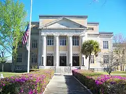
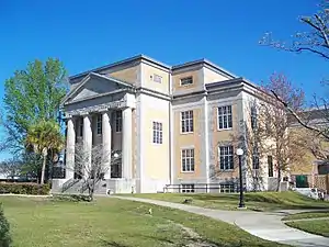 Walton County Courthouse | |
Seal | |
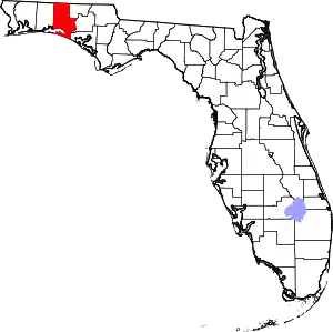 Location within the U.S. state of Florida | |
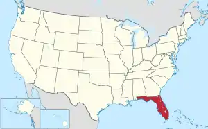 Florida's location within the U.S. | |
| Coordinates: 30°37′N 86°10′W | |
| Country | |
| State | |
| Founded | December 29, 1824 |
| Named for | George Walton, Jr. |
| Seat | DeFuniak Springs |
| Largest city | Miramar Beach |
| Area | |
| • Total | 1,240 sq mi (3,200 km2) |
| • Land | 1,038 sq mi (2,690 km2) |
| • Water | 202 sq mi (520 km2) 16.3%% |
| Population | |
| • Estimate (2019) | 74,071 |
| • Density | 71/sq mi (27/km2) |
| Time zone | UTC−6 (Central) |
| • Summer (DST) | UTC−5 (CDT) |
| Congressional district | 1st |
| Website | www |
Walton County is included in the Crestview-Fort Walton Beach-Destin, FL Metropolitan Statistical Area.
History
Walton County was organized by European Americans in 1824. It was named for Colonel George Walton, Jr., secretary of the Florida Territory from 1821 to 1826. Walton, the son of George Walton, a signer of the Declaration of Independence, was born 15 August 1786 in Augusta, Georgia, and died 20 March 1859 in Petersburg, Virginia.[3]
Between 1763 and 1783 the territory that has since become Walton County was part of the colony of British West Florida. During this time British settlers permanently settled in the area, becoming the first English-speaking people to permanently reside in what is now Walton County. During this period Scottish settlers migrated from the backcountry of the Carolinas and settled in the Defuniak Springs area while English settlers, most of whom were either farmers or fishermen, settled in the southern portion of the county by the sea, settling throughout the area that has since become Santa Rosa Beach, Sandestin, Miramar Beach, Point Washington, Seaside and Topsail Hill Preserve State Park and Point Washington State Forest. While the Scottish settlers had come from a recently established Scottish-majority settlement in North Carolina, the English settlers came largely from the English regions of Norfolk, Dorset and the western half of Sussex. Both the Scots village in the northern portion of the county and the English community along the coast were largely self-contained and had economies that were entirely operational without external trade, as all products in use were made within the two respective communities, and the only external trade was between the Scots in Defuniak Springs and the English farmers/fishermen by the coast. Neither community exported the goods they produced for profit, nor did they have any imported goods at all as both communities relied on self-produced subsistence agriculture.[4][5][6] The original settlements were in the Euchee (Yuchi) Valley, near the landing on the Choctawhatchee River that was maintained by a mixed-race Yuchi named Sam Story, whose mother was Yuchi and father was an early Scots trader in the area. The white settlers founded one of the first Presbyterian churches in Northwest Florida. It is still an operating parish and has a historical cemetery. When the Spanish regained control of Florida in 1783, roughly two-thirds of the British settlers in Pensacola left the colony to find permanent habitation elsewhere, including in the Bahamas and Bermuda, however none of the English or Scottish settlers in what has since become Walton County left with them. The Spanish came to regard the English and Scottish settlers in what has since become Walton County as "stubborn" and "ungovernable" as the Spanish were unable to make them obey Spanish law. They unanimously refused to convert to Catholicism, despite the fact that Spanish law said they were only allowed to remain in Florida if they did so and the Spanish were unable to compel them to pay taxes to the local Spanish government. As settlers from the newly created United States of America began migrating into north Florida the English and Scottish settlers in what has since become Walton County became gradually absorbed into this community, which would subsequently become the majority population in North Florida.[4][5][6][7]
Geography
According to the U.S. Census Bureau, the county has a total area of 1,240 square miles (3,200 km2), of which 1,038 square miles (2,690 km2) is land and 202 square miles (520 km2) (16.3%) is water.[8] The county is one of the largest in area in the state, stretching from the Alabama state line to the Emerald Coast.
Adjacent counties
- Covington County, Alabama - northwest
- Geneva County, Alabama - northeast
- Holmes County - east
- Washington County - east
- Bay County - southeast
- Okaloosa County - west
National protected areas
- Choctawhatchee National Forest (part)
- Point Washington State Forest (part)
Demographics
| Historical population | |||
|---|---|---|---|
| Census | Pop. | %± | |
| 1830 | 1,207 | — | |
| 1840 | 1,461 | 21.0% | |
| 1850 | 1,817 | 24.4% | |
| 1860 | 3,037 | 67.1% | |
| 1870 | 3,041 | 0.1% | |
| 1880 | 4,201 | 38.1% | |
| 1890 | 4,816 | 14.6% | |
| 1900 | 9,346 | 94.1% | |
| 1910 | 16,460 | 76.1% | |
| 1920 | 12,119 | −26.4% | |
| 1930 | 14,576 | 20.3% | |
| 1940 | 14,246 | −2.3% | |
| 1950 | 14,725 | 3.4% | |
| 1960 | 15,576 | 5.8% | |
| 1970 | 16,087 | 3.3% | |
| 1980 | 21,300 | 32.4% | |
| 1990 | 27,760 | 30.3% | |
| 2000 | 40,601 | 46.3% | |
| 2010 | 55,043 | 35.6% | |
| 2019 (est.) | 74,071 | [9] | 34.6% |
| U.S. Decennial Census[10] 1790-1960[11] 1900-1990[12] 1990-2000[13] 2010-2015[1] 2019[14] | |||
As of the census[15] of 2000, there were 40,601 people, 16,548 households, and 11,120 families residing in the county. The population density was 38 people per square mile (15/km2). There were 29,083 housing units at an average density of 28 per square mile (11/km2). The racial makeup of the county was 88.41% White, 6.98% Black or African American, 1.28% Native American, 0.45% Asian, 0.04% Pacific Islander, 0.75% from other races, and 2.09% from two or more races. 2.17% of the population were Hispanic or Latino of any race.
There were 16,548 households, out of which 26.40% had children under the age of 18 living with them, 53.00% were married couples living together, 10.10% had a female householder with no husband present, and 32.80% were non-families. 27.10% of all households were made up of individuals, and 10.10% had someone living alone who was 65 years of age or older. The average household size was 2.35 and the average family size was 2.83.
In the county, the population was spread out, with 21.70% under the age of 18, 7.10% from 18 to 24, 28.50% from 25 to 44, 26.90% from 45 to 64, and 15.80% who were 65 years of age or older. The median age was 40 years. For every 100 females there were 105.20 males. For every 100 females age 18 and over, there were 105.00 males.
The median income for a household in the county was $32,407, and the median income for a family was $37,663. Males had a median income of $26,799 versus $21,208 for females. The per capita income for the county was $18,198. About 11.60% of families and 14.40% of the population were below the poverty line, including 21.00% of those under age 18 and 10.90% of those age 65 or over.
Government
County Government
| Position | Name | Party | |
|---|---|---|---|
| Commissioner, District 1 | Boots McCormick | Republican | |
| Commissioner, District 2 | Danny Glidewell | Republican | |
| Commissioner, District 3 | Michael Barker | Republican | |
| Commissioner, District 4 | Trey Nick | Republican | |
| Commissioner, District 5 | Tony Anderson | Republican | |
Politics
| Year | Republican | Democratic | Other |
|---|---|---|---|
| 2020 | 75.23% 32,947 | 23.61% 10,338 | 1.17% 510 |
| 2016 | 75.98% 25,756 | 20.28% 6,876 | 3.73% 1,266 |
| 2012 | 75.19% 21,490 | 23.34% 6,671 | 1.47% 421 |
| 2008 | 72.08% 19,561 | 26.43% 7,174 | 1.49% 404 |
| 2004 | 73.22% 17,555 | 25.91% 6,213 | 0.87% 208 |
| 2000 | 66.51% 12,186 | 30.80% 5,643 | 2.70% 494 |
| 1996 | 49.68% 7,709 | 34.42% 5,342 | 15.90% 2,467 |
| 1992 | 42.25% 5,726 | 28.69% 3,888 | 29.07% 3,940 |
| 1988 | 69.30% 7,490 | 29.93% 3,235 | 0.77% 83 |
| 1984 | 74.01% 7,126 | 25.99% 2,503 | |
| 1980 | 50.28% 4,694 | 46.70% 4,360 | 3.02% 282 |
| 1976 | 35.35% 2,927 | 62.76% 5,196 | 1.88% 156 |
| 1972 | 85.93% 6,217 | 13.66% 988 | 0.41% 30 |
| 1968 | 13.45% 963 | 14.86% 1,064 | 71.70% 5,135 |
| 1964 | 60.51% 3,753 | 39.49% 2,449 | |
| 1960 | 28.95% 1,484 | 71.05% 3,642 | |
| 1956 | 33.24% 1,606 | 66.76% 3,225 | |
| 1952 | 29.48% 1,502 | 70.52% 3,593 | |
| 1948 | 17.16% 652 | 62.28% 2,366 | 20.56% 781 |
| 1944 | 21.15% 689 | 78.85% 2,569 | |
| 1940 | 17.74% 694 | 82.26% 3,217 | |
| 1936 | 15.51% 510 | 84.49% 2,778 | |
| 1932 | 10.96% 305 | 89.04% 2,477 | |
| 1928 | 61.36% 1,475 | 37.77% 908 | 0.87% 21 |
| 1924 | 18.77% 220 | 70.39% 825 | 10.84% 127 |
| 1920 | 30.66% 619 | 64.24% 1,297 | 5.10% 103 |
| 1916 | 37.14% 549 | 50.95% 753 | 11.91% 176 |
| 1912 | 7.01% 74 | 57.95% 612 | 35.04% 370 |
| 1908 | 37.96% 369 | 51.85% 504 | 10.19% 99 |
| 1904 | 42.65% 322 | 46.89% 354 | 10.46% 79 |
Libraries
Walton County has 4 branches, including the historic DeFuniak Springs Library.
Schools
The county is served by the Walton County School District.
Elementary Schools
- Bay Elementary, Santa Rosa Beach
- Freeport Elementary, Freeport
- Maude Saunders Elementary School, DeFuniak Springs
- Mossy Head Elementary, Mossy Head
- Van R. Butler Elementary, Santa Rosa Beach
- West DeFuniak Elementary, DeFuniak Springs
Middle Schools
- Emerald Coast Middle School, Santa Rosa Beach
- Freeport Middle School, Freeport
- Walton Middle School, DeFuniak Springs
High Schools
- Freeport High School, Freeport
- Seaside School, Seaside
- South Walton High School, Santa Rosa Beach
- Walton High School, DeFuniak Springs
K-12
- Paxton School, Paxton
Charter School
- Walton Academy, DeFuniak Springs
- Seaside Neighborhood School, Seaside
- Seacoast Collegiate High School, Seaside
Communities
Cities
Town
Census-designated place
Other unincorporated communities
- Alys Beach
- Argyle
- Blue Mountain Beach
- Bruce
- Darlington
- Eucheanna (Euchee Valley)
- Glendale
- Grayton Beach
- Inlet Beach
- Liberty
- Mossy Head
- Red Bay
- Rosemary Beach
- Santa Rosa Beach
- Seacrest
- Seaside
Gallery
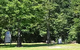
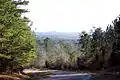 The hilly terrain of Walton County differs from most of the rest of Florida.
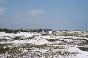 South Walton contains many neighborhoods nestled in sugary-white sand dunes.
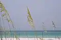 The coast of Walton County is fringed by emerald Gulf waters.
Transportation
Airports
Highways
- US Highway 331
- US Highway 90
- US Highway 98
- State Highway 20
- State Highway 83
- Interstate 10
- Florida State Road 30A
Notable people
- Sean Dietrich, writer
- Mary Vinson, artist
References
- "State & County QuickFacts". United States Census Bureau. Retrieved February 15, 2014.
- "Find a County". National Association of Counties. Retrieved June 7, 2011.
- Publications of the Florida Historical Society. Florida Historical Society. 1908. p. 34.
- Fabel, Robin F. A. (1988). The Economy of British West Florida, 1763–1783. Tuscaloosa, Alabama: The University of Alabama Press. p. 179. ISBN 0-8173-0312-X.
- Born, John D. (1968). Governor Johnstone and trade in British West Florida, 1764–1767. Wichita, Kansas: Wichita State University. pp. 113, 115. OCLC 00455135.
- Johnson, Cecil (1971). British West Florida, 1763–1783. Archon Books. pp. 99, 101–102.
- McKinnon, John Love (1968) [1911]. History of Walton County (Reprint ed.). The Byrd Printing Co. pp. 85–89.
- "US Gazetteer files: 2010, 2000, and 1990". United States Census Bureau. February 12, 2011. Retrieved April 23, 2011.
- "Population and Housing Unit Estimates". Retrieved December 12, 2019.
- "U.S. Decennial Census". United States Census Bureau. Retrieved June 16, 2014.
- "Historical Census Browser". University of Virginia Library. Retrieved June 16, 2014.
- "Population of Counties by Decennial Census: 1900 to 1990". United States Census Bureau. Retrieved June 16, 2014.
- "Census 2000 PHC-T-4. Ranking Tables for Counties: 1990 and 2000" (PDF). United States Census Bureau. Retrieved June 16, 2014.
- "QuickFacts. Florida counties". Retrieved May 20, 2020.
- "U.S. Census website". United States Census Bureau. Retrieved May 14, 2011.
- Leip, David. "Dave Leip's Atlas of U.S. Presidential Elections". uselectionatlas.org. Retrieved June 16, 2018.
- Reference: http://uselectionatlas.org/RESULTS/datagraph.php?fips=12&year=1988&off=0&elect=0&f=0
External links
| Wikimedia Commons has media related to Walton County, Florida. |
Government links/Constitutional offices
Special districts
Judicial branch
Media links
Places adjacent to Walton County, Florida | ||||||||||
|---|---|---|---|---|---|---|---|---|---|---|
| ||||||||||
Municipalities and communities of Walton County, Florida, United States | ||
|---|---|---|
| Cities | | |
| Town | ||
| CDP | ||
| Unincorporated communities | ||
| ||
| Topics | 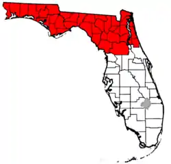 Map of North Florida | |
|---|---|---|
| Counties | ||
| Major cities | ||
| Cities and towns 100k+ | ||
| Cities and towns 25k–100k | ||
| Cities and towns 10k–25k | ||
| Metro areas | ||
| Regions | ||
| Authority control |
|---|
