List of sovereign states and dependent territories in South America
This is a list of sovereign states and dependent territories in South America. It includes both fully recognized states and dependent territories of both South American and non-South American states. It lists 12 sovereign states and 4 non-sovereign territories.
.svg.png.webp)
South America is bordered on the west by the Pacific Ocean and on the north and east by the Atlantic Ocean. North America and the Caribbean Sea lie to the northwest. South America has an area of approximately 17,840,000 square kilometres (6,890,000 sq mi), or almost 3.5% of Earth's surface. As of 2008, its population is more than 380 million, according to estimates of population in The World Factbook. South America ranks fourth among all continents in area (after Asia, Africa, and North America) and fifth in population (after Asia, Africa, Europe, and North America).[1]
The division between North and South America is unclear, lying somewhere in the Isthmus of Panama.
Sovereign states
A sovereign state is a political association with effective sovereignty over a population for whom it makes decisions in the national interest.[2] According to the Montevideo Convention, a state must have a permanent population, a defined territory, a government, and the capacity to enter into relations with other states.[3] The following states are all members of the United Nations[4] and members of the Union of South American Nations.[5]
| Flag | Map | English short and formal names, and ISO code[6][7][8] | Domestic short and formal names [6][7] |
Capital [8][9][10] |
Population [11] |
Area [12] |
|---|---|---|---|---|---|---|
 |
 |
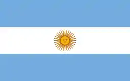
Argentina Argentine Republic ARG |
Spanish: Argentina — República Argentina | Buenos Aires Spanish: Ciudad de Buenos Aires |
45,460,188 | 2,780,400 km2 (1,073,518 sq mi) |
.svg.png.webp) |
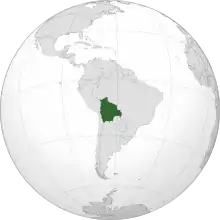 |
Bolivia Plurinational State of Bolivia BOL |
Spanish: Bolivia — Estado Plurinacional de Bolivia Quechua: Buliwya Aymara: Wuliwya |
Sucre (official) and La Paz (seat of government) Spanish: Sucre[n 1] |
11,773,734 | 1,098,581 km2 (424,164 sq mi) |
 |
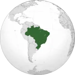 |
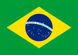
Brazil Federative Republic of Brazil BRA |
Portuguese: Brasil — República Federativa do Brasil | Brasília Portuguese: Brasília |
213,602,686 | 8,514,877 km2 (3,287,612 sq mi) |
 |
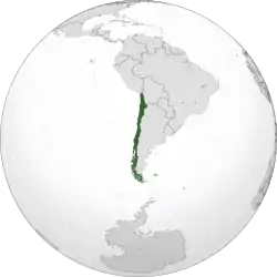 |
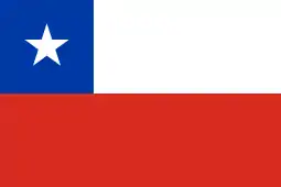
Chile [n 2] Republic of Chile CHL |
Spanish: Chile — República de Chile | Santiago[n 3] Spanish: Santiago |
19,314,173 | 756,102 km2 (291,933 sq mi) |
 |
 |
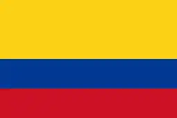
Colombia Republic of Colombia COL |
Spanish: Colombia — República de Colombia | Bogotá / Santa Fe de Bogotá Spanish: Bogotá |
51,444,203 | 1,138,910 km2 (439,736 sq mi) |
 |
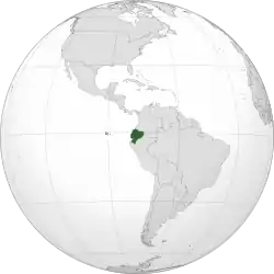 |
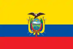
Ecuador Republic of Ecuador ECU |
Spanish: Ecuador — República del Ecuador Quechua: Ikwadur |
Quito Spanish: Quito |
17,846,773 | 283,561 km2 (109,484 sq mi) |
 |
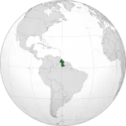 |
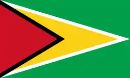
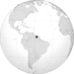
Guyana Co-operative Republic of Guyana GUY |
English: Guyana — Co-operative Republic of Guyana | Georgetown English: Georgetown |
788,820 | 214,969 km2 (83,000 sq mi) |
 |
 |
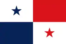
Panama Republic of Panama PAN |
English: Panama Spanish: Panamá |
Panama City Spanish: Panama Citys |
4,360,169 | 75,417 km2 (29,119 sq mi) |
 |
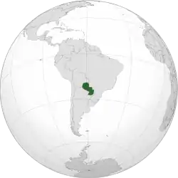 |
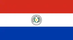
Paraguay Republic of Paraguay PRY |
Spanish: Paraguay — República del Paraguay Guarani: Paraguai — Tetã Paraguai |
Asunción Spanish: Asunción |
7,188,700 | 406,752 km2 (157,048 sq mi) |
 |
 |
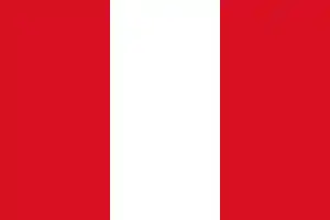
Peru Republic of Peru PER |
Spanish: Perú — República del Perú Quechua: Piruw Aymara: Piruw |
Lima Spanish: Lima |
33,362,082 | 1,285,216 km2 (496,225 sq mi) |
 |
 |
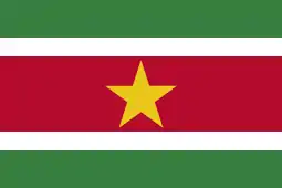
Suriname Republic of Suriname SUR |
Dutch: Suriname — Republiek Suriname | Paramaribo Dutch: Paramaribo |
590,088 | 163,820 km2 (63,251 sq mi) |
 |
 |
Trinidad and Tobago Co-operative Republic of Trinidad and Tobago TTO |
English: Trinidad and Tobago | Port of Spain English: Port of Spain |
1,403,220 | 5,131 km2 (1,981 sq mi) |
 |
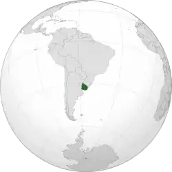 |
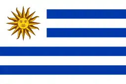
Uruguay Eastern Republic of Uruguay[n 4] URY |
Spanish: Uruguay — República Oriental del Uruguay | Montevideo Spanish: Montevideo |
3,481,746 | 176,215 km2 (68,037 sq mi) |
 |
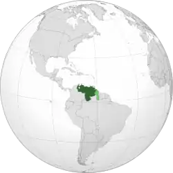 |
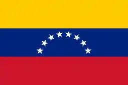
Venezuela Bolivarian Republic of Venezuela VEN |
Spanish: Venezuela — República Bolivariana de Venezuela | Caracas Spanish: Caracas |
27,931,667 | 912,050 km2 (352,144 sq mi) |
Non-sovereign territories
External territories
| Flag | Map | English name[6][8] | Legal status | Domestic name | Capital[9] | Population[11] | Area[12] |
|---|---|---|---|---|---|---|---|
 |
 |
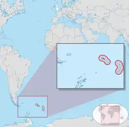
Bouvet Island[n 5] BVT |
Dependency of Norway | Norwegian: Bouvetøya | N/A | No permanent population | 49 km2 (19 sq mi) |
 |
.svg.png.webp) |
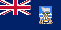
Falkland Islands FLK |
British overseas territory | English: Falkland Islands Spanish: Islas Malvinas |
Stanley English: Stanley |
3,619[13] | 12,173 km2 (4,700 sq mi) |
 |
 |
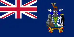
South Georgia and the South Sandwich Islands[n 5] SGS |
British overseas territory | English: South Georgia and the South Sandwich Islands | King Edward Point English: King Edward Point |
No permanent population[n 6] | 3,903 km2 (1,507 sq mi) |

.svg.png.webp)
Economic statistics
| Country/Territory | Currency | GDP (PPP) per capita[n 8] (2008 est. in U.S. dollars) |
Notes |
|---|---|---|---|
| Argentina | Argentine peso | 14,200 | [15] |
| Bolivia | Boliviano | 4,500 | [16] |
| Bouvet Island† (Norway) | Norwegian Krone | 0 | |
| Brazil | Brazilian real | 10,100 | [17] |
| Chile | Chilean peso | 14,900 | [18] |
| Colombia | Colombian peso | 8,900 | [19] |
| Ecuador | United States dollar | 7,500 | [20] |
| Falkland Islands (United Kingdom) | Falkland Islands pound | 35,400 (2002 est.) | [21] |
| French Guiana (France) | Euro | 6,000 (2001 est.) | [22][23] |
| Guyana | Guyanese dollar | 3,900 | [24] |
| Paraguay | Paraguayan guaraní | 4,200 | [25] |
| Peru | Peruvian nuevo sol | 8,400 | [26] |
| South Georgia and the South Sandwich Islands† (United Kingdom) |
Falkland Islands Pound | 0 | |
| Suriname | Surinamese dollar | 8,900 | [27] |
| Uruguay | Uruguayan peso | 12,200 | [28] |
| Venezuela | Venezuelan bolívar | 13,500 | [29] |
† Geographically a part of Antarctica, but due to geopolitical reasons, the United Nations geoscheme has included Bouvet Island and South Georgia and the South Sandwich Islands in South America instead.
See also
- List of South American countries by population
- List of South American countries by population density
- List of South American countries by GDP per capita
- List of South American countries by GDP (PPP)
- List of predecessors of sovereign states in South America
- List of sovereign states and dependent territories in the Americas
Notes
- While Sucre is the constitutional capital, La Paz is the seat of the government.
- Includes Easter Island in the Pacific Ocean, a Chilean territory frequently reckoned in Oceania.
- While Santiago is the constitutional capital of Chile, Valparaíso is the site of legislative meetings.
- Also translated as "Oriental Republic of Uruguay".
- Sometimes grouped with Antarctica rather than South America.
- Present inhabitants are the British Government officer, deputy postmaster, scientists, and support staff from the British Antarctic Survey who maintain scientific bases on Bird Island and in the capital, King Edward Point, as well as museum staff at Grytviken.
- The territory has been fully integrated into the French central state.
- The CIA's estimate for GDP per capita (PPP) is used in the article. For the World Bank and International Monetary Fund's estimates, see List of countries by GDP (PPP) per capita.
References
- The New York Times Guide to Essential Knowledge: A Desk Reference for the Curious Mind (2nd ed.), New York: St. Martin's Press, 2007, p. 598, ISBN 0-312-37659-6, OCLC 173243876
- Ashley, Richard K (1 June 1988). "Untying the Sovereign State: A Double Reading of the Anarchy Problematique". Millennium - Journal of International Studies. Sage Journals Online. 4 (2): 227–262. doi:10.1177/03058298880170020901. Retrieved 15 February 2012.
- "Montevideo Convention on the Rights and Duties of States". Council on Foreign Relations. 26 December 1933. Retrieved 15 February 2012.
- "United Nations Member States". United Nations. Retrieved 15 February 2012.
- "Estados Miembros" (in Spanish). Secretaria General de UNASUR. Archived from the original on 27 June 2012. Retrieved 15 February 2012.
- "Field Listing :: Names". Central Intelligence Agency. Retrieved 7 February 2012.
- "UNGEGN List of Country Names" (PDF). United Nations Statistics Division. 2007. Retrieved 2011-02-24.
- "List of countries, territories and currencies". Europa. 7 February 2012. Retrieved 7 February 2012.
- "Field Listing :: Capital". Central Intelligence Agency. Retrieved 7 February 2012.
- "UNGEGN World Geographical Names". United Nations Group of Experts on Geographical Names. 9 December 2011. Retrieved 7 February 2012.
- "Country Comparison :: Population". Central Intelligence Agency. Retrieved 7 February 2012.
- "Field Listing :: Area". Central Intelligence Agency. Retrieved 7 February 2012.
- "2016 Census Report". Policy and Economic Development Unit, Falkland Islands Government. 2017. Archived from the original (PDF) on 24 January 2018.
- INSEE. "Estimation de population par région, sexe et grande classe d'âge – Années 1975 à 2019" (in French). Retrieved 2019-01-15.
- "The World Factbook: Argentina". CIA Directorate of Intelligence. 2008-05-15. Retrieved 2008-06-12.
- "The World Factbook: Bolivia". CIA Directorate of Intelligence. 2008-05-15. Retrieved 2008-06-12.
- "The World Factbook: Brazil". CIA Directorate of Intelligence. 2008-05-15. Retrieved 2008-06-12.
- "The World Factbook: Chile". CIA Directorate of Intelligence. 2008-05-15. Retrieved 2008-06-12.
- "The World Factbook: Colombia". CIA Directorate of Intelligence. 2008-05-15. Retrieved 2008-06-12.
- "The World Factbook: Ecuador". CIA Directorate of Intelligence. 2008-05-15. Retrieved 2008-06-12.
- "The World Factbook: Falkland Islands (Islas Malvinas)". CIA Directorate of Intelligence. 2008-05-15. Retrieved 2008-06-12.
- Americas Review 2003/2004: Economic and Business Report (21st ed.). London: Kogan Page. 2003. p. 79. ISBN 0-7494-4064-3. ISSN 1351-4571.
- "Résultats régionaux des enquêtes de recensement de 2004 à 2007" (in French). INSEE. Retrieved 2008-06-12.
- "The World Factbook: Guyana". CIA Directorate of Intelligence. 2008-05-15. Retrieved 2008-06-12.
- "The World Factbook: Paraguay". CIA Directorate of Intelligence. 2008-05-15. Retrieved 2008-06-12.
- "The World Factbook: Peru". CIA Directorate of Intelligence. 2008-05-15. Retrieved 2008-06-12.
- "The World Factbook: Suriname". CIA Directorate of Intelligence. 2008-05-15. Retrieved 2008-06-12.
- "The World Factbook: Uruguay". CIA Directorate of Intelligence. 2008-05-15. Retrieved 2008-06-12.
- "The World Factbook: Venezuela". CIA Directorate of Intelligence. 2008-05-15. Retrieved 2008-06-12.