Cayenne
Cayenne (/keɪˈɛn/;[5] French pronunciation: [kajɛn] (![]() listen)) is the capital city of French Guiana, an overseas region and department of France located in South America. The city stands on a former island at the mouth of the Cayenne River on the Atlantic coast. The city's motto is "fert aurum industria", which means "work brings wealth".[6]
listen)) is the capital city of French Guiana, an overseas region and department of France located in South America. The city stands on a former island at the mouth of the Cayenne River on the Atlantic coast. The city's motto is "fert aurum industria", which means "work brings wealth".[6]
Cayenne | |
|---|---|
Capital, prefecture and commune | |
 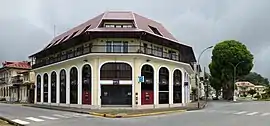 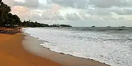 City center and beaches of Cayenne | |
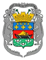 Coat of arms | |
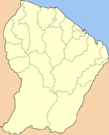 Location of the commune (in red) within French Guiana | |
Location of Cayenne 
| |
| Coordinates: 4°56′14″N 52°19′34″W | |
| Country | France |
| Overseas region and department | French Guiana |
| Arrondissement | Cayenne |
| Intercommunality | Centre Littoral |
| Government | |
| • Mayor (2020–2026) | Sandra Trochimara |
| Area 1 | 23.60 km2 (9.11 sq mi) |
| • Urban (2010) | 206.9 km2 (79.9 sq mi) |
| • Metro (2010) | 5,087 km2 (1,964 sq mi) |
| Population (2018-01-01)[1] | 63,652 |
| • Density | 2,700/km2 (7,000/sq mi) |
| • Urban | 122,737 |
| • Urban density | 590/km2 (1,500/sq mi) |
| • Metro | 144,501 |
| • Metro density | 28/km2 (74/sq mi) |
| Time zone | UTC−03:00 |
| INSEE/Postal code | 97302 /97300 |
| 1 French Land Register data, which excludes lakes, ponds, glaciers > 1 km2 (0.386 sq mi or 247 acres) and river estuaries. | |
At the 2018 census, there were 144,501 inhabitants in the metropolitan area of Cayenne (as defined by INSEE),[4] 63,652 of whom lived in the city (commune) of Cayenne proper.[2]
Geography
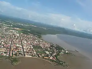
Cayenne is located on the banks of the estuary of the Cayenne River on the Atlantic Ocean. The city occupies part of the Cayenne Island. It is located 268 kilometres (167 mi) from Saint-Laurent-du-Maroni and 64 kilometres (40 mi) from Kourou.[7]
Distances to some cities:
- Paris: 7,100 kilometres (4,400 mi).
- Fort-de-France, capital of Martinique: 1,500 kilometres (930 mi).[8]
- Nouméa, capital of New Caledonia (France) : 15,427 kilometres (9,586 mi)
- Paramaribo, capital of Suriname: 342 kilometres (213 mi) to the northwest
- Macapá, capital of the state of Amapá, Brazil: 554 kilometres (344 mi) to the southeast
- Mexico City, capital of Mexico: 5,534 kilometres (3,439 mi) to the northwest
- San Diego, southwestern city in California, United States: 7,363 kilometres (4,575 mi) to the northwest
Climate
Under the Köppen climate classification, Cayenne has an equatorial climate (Af) bordering on a tropical monsoon climate (Am). Average high and low temperatures are nearly identical throughout the course of the year averaging about 30 °C (86 °F) and 23 °C (73 °F) respectively, although temperatures are somewhat cooler in the wet season unlike the dry season. Cayenne sees copious precipitation during the year, more subject to the Intertropical Convergence Zone (ITCZ) than the trade winds. The city features a very lengthy wet season and a very short dry season. The dry season covers only two months of the year (September and October) while the wet season covers the remainder of the year. Precipitation is seen even during the dry season, a trait commonly seen in places featuring tropical climates. Cayenne averages roughly 3,750 millimetres (150 in) of rain each year.
| Climate data for Cayenne (CAY), elevation: 4 m (13 ft), 1981–2010 normals, extremes 1948–present | |||||||||||||
|---|---|---|---|---|---|---|---|---|---|---|---|---|---|
| Month | Jan | Feb | Mar | Apr | May | Jun | Jul | Aug | Sep | Oct | Nov | Dec | Year |
| Record high °C (°F) | 32.5 (90.5) |
32.3 (90.1) |
32.2 (90.0) |
33.0 (91.4) |
33.2 (91.8) |
33.7 (92.7) |
34.5 (94.1) |
35.0 (95.0) |
35.2 (95.4) |
35.1 (95.2) |
34.6 (94.3) |
34.1 (93.4) |
35.2 (95.4) |
| Average high °C (°F) | 29.1 (84.4) |
29.2 (84.6) |
29.6 (85.3) |
29.9 (85.8) |
29.9 (85.8) |
30.2 (86.4) |
30.8 (87.4) |
31.6 (88.9) |
32.1 (89.8) |
32.2 (90.0) |
31.5 (88.7) |
30.1 (86.2) |
30.5 (86.9) |
| Daily mean °C (°F) | 26.2 (79.2) |
26.3 (79.3) |
26.5 (79.7) |
26.8 (80.2) |
26.7 (80.1) |
26.6 (79.9) |
26.6 (79.9) |
27.0 (80.6) |
27.2 (81.0) |
27.3 (81.1) |
27.0 (80.6) |
26.6 (79.9) |
26.7 (80.1) |
| Average low °C (°F) | 23.3 (73.9) |
23.4 (74.1) |
23.5 (74.3) |
23.7 (74.7) |
23.5 (74.3) |
22.9 (73.2) |
22.4 (72.3) |
22.4 (72.3) |
22.2 (72.0) |
22.3 (72.1) |
22.5 (72.5) |
23.1 (73.6) |
22.9 (73.2) |
| Record low °C (°F) | 17.4 (63.3) |
18.9 (66.0) |
18.5 (65.3) |
19.0 (66.2) |
18.8 (65.8) |
18.9 (66.0) |
19.0 (66.2) |
19.0 (66.2) |
18.7 (65.7) |
18.6 (65.5) |
17.2 (63.0) |
18.0 (64.4) |
17.2 (63.0) |
| Average precipitation mm (inches) | 451.2 (17.76) |
309.4 (12.18) |
334.3 (13.16) |
448.4 (17.65) |
579.4 (22.81) |
411.4 (16.20) |
245.7 (9.67) |
143.6 (5.65) |
55.7 (2.19) |
63.3 (2.49) |
133.4 (5.25) |
340.5 (13.41) |
3,516.3 (138.44) |
| Average precipitation days (≥ 1.0 mm) | 23.6 | 20.0 | 20.7 | 22.2 | 26.4 | 25.2 | 20.6 | 14.2 | 7.1 | 7.6 | 11.9 | 21.6 | 221.1 |
| Average relative humidity (%) | 82 | 80 | 82 | 84 | 85 | 82 | 78 | 74 | 71 | 71 | 76 | 81 | 79 |
| Mean monthly sunshine hours | 95.1 | 92.4 | 120.0 | 123.5 | 122.4 | 150.4 | 200.5 | 234.4 | 253.4 | 256.4 | 211.5 | 143.3 | 2,003 |
| Source: Meteo France[10][11] | |||||||||||||
Administration

Cayenne is a commune of the French Republic and as such it is ruled by a mayor and a municipal council. The current mayor is Marie-Laure Phinéra-Horth, a former member of the Guianese Socialist Party who is supported by various left-wing parties. Marie-Laure Phinéra-Horth has been mayor of Cayenne since 2010. She is the daughter of a former president of the General Council of French Guiana, Stéphan Phinéra-Horth, from the Guianese Socialist Party, who ruled the department of French Guiana from 1994 to 1998.
As in the rest of France, the small size of the commune of Cayenne (only 23.6 km2), which does not cover the entire urban area of Cayenne, has led to the creation of an intercommunal authority which groups Cayenne and 5 suburban communes: the communauté d'agglomération du Centre Littoral (5,087 km2). Marie-Laure Phinéra-Horth has been president of the communauté d'agglomération du Centre Littoral since 2014. This intercommunal structure, which levies its own taxes, is the sole authority in charge of refuse collection, water supply and sewage treatment, urban planning, and public transport over the 5,087 km2 of Cayenne and its suburbs.
Until 2015, the commune of Cayenne was divided in six cantons, but these were abolished in 2015 when the department and the region of French Guiana were abolished and replaced by the French Guiana Territorial Collectivity.
History
Ignored by Spanish explorers, who found the region too hot and poor to be claimed, the region was not colonized until 1604, when a French settlement was founded. However, it was soon destroyed by the Portuguese, who were determined to enforce the provisions of the Treaty of Tordesillas. French colonists returned in 1643 and founded Cayenne, but they were forced to leave once more following Amerindian attacks. In 1664, France finally succeeded at establishing a permanent settlement at Cayenne. Over the next decade the colony changed hands between the French, Dutch, and English, before being restored to France. It was captured by an Anglo-Portuguese force at the invasion of Cayenne in 1809 and administered from Brazil until 1814, when it was returned to French control. It was used as a French penal colony from 1854 to 1938.
The city's population has recently grown dramatically, owing to high levels of immigration (chiefly from the West Indies and Brazil) as well as a high birthrate.
Population
Historical population
| 1961 | 1967 | 1974 | 1982 | 1990 | 1999 | 2008 | 2013 | 2018 | |||
|---|---|---|---|---|---|---|---|---|---|---|---|
| Cayenne (commune) | 18,615 | 24,518 | 30,461 | 38,091 | 41,067 | 50,594 | 58,008 | 55,198 | 61,268 | ||
| Cayenne (metropolitan area) | 21,505 | 28,257 | 35,812 | 49,118 | 66,803 | 92,059 | 115,425 | 123,085 | 144,501 | ||
| Cayenne (metropolitan area) % p.a. | n/a | 4.64% | 3.44% | 4.37% | 3.91% | 3.64% | 2.60% | 1.29% | 3.26% | ||
| Official figures from population censuses.[12][2][4] | |||||||||||
Average population growth of the Cayenne metropolitan area:
- 1961–1967: +1,122 people per year (+4.6% per year)
- 1967–1974: +1,079 people per year (+3.4% per year)
- 1974–1982: +1,799 people per year (+4.4% per year)
- 1982–1990: +2,206 people per year (+3.9% per year)
- 1990–1999: +2,812 people per year (+3.6% per year)
- 1999–2008: +2,650 people per year (+2.6% per year)
- 2008–2013: +1,532 people per year (+1.3% per year)
- 2013–2018: +4,283 people per year (+3.3% per year)
Migrations
The places of birth of the 121,490 residents in the Cayenne metropolitan area at the 2012 census were the following:[13]
- 56.5% were born in French Guiana
- 12.0% in Metropolitan France
- 3.0% in Martinique
- 1.4% in Guadeloupe
- 0.3% in other parts of Overseas France
- 26.7% in foreign countries (notably Haiti and Brazil, followed by Suriname and Guyana); among these, 25.0% were immigrants and 1.7% were children of French citizens born abroad
These were the countries of birth of the immigrants living in the Cayenne metropolitan area at the 2009 census:[14]
- born in Haiti: 12,184
- born in Brazil: 7,627
- born in Suriname: 2,691
- born in Guyana: 2,537
- born in China: 924
- born in other countries: 3,713
Sanitary conditions
Health conditions in Cayenne and French Guiana are generally good. The principal illnesses that cause mortality are circulatory, infectious and parasitic diseases, as well as cancer. A branch of the Pasteur Institute in Paris, located in Cayenne, conducts research on tropical and endemic local diseases and is renowned throughout Latin America. Life expectancy averages about 76 years for men and 83 years for women.[15] The main hospital of the city is the Andrée-Rosemon Hospital which opened in 1992.[16]
Economy
Cayenne is an important seaport in South America. The major port of Dégrad des Cannes is on the estuary of the river Mahury, replacing Larivot and the Îles du Salut. Timber, rosewood essence, rum, and gold are exported in small quantities. In the mid-1960s sugarcane and pineapple were planted around the city, and a pineapple cannery and a shrimp-processing plant were later built. A seafront avenue links Cayenne with the suburbs of Chaton and Montabo, where the French Institute of Tropical America and the Pasteur Institute are located. Historic landmarks include the Church of the Holy Saviour and a prefecture on the Place d’Armes. The Félix Eboué International Airport is the only international airport serving Cayenne.[17]
Heritage
The palmists place

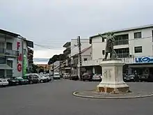
Initially it was a place arranged to ventilate the city after the demolition of the walls in 1810. The place being occupied by herbs, it was therefore called Place de la Savane. Later they planted royal palms of Guisanbourg, and it became the place of the Palmistes. In 1880, a bronze column was erected bearing the bust of the Republic commemorating the taking of the Bastille. Under Governor Gerville-Reache transformed the place into an English garden, with artificial hills, flower beds and ornamental plants. Because of the rains, the place was regularly flooded, which is why Governor Chanel in 1925 bordered it with a network of cemented canals that can still be found today. There is a statue of Félix Éboué, an illustrious Guianan character, in place of the Merlet fountain. Today it is a place of life, meeting Cayenese. In the evening, trailers sell French fries, sandwiches, bamis and nassi (Javanese specialties), local juices and other takeaways.
The Botanical Garden
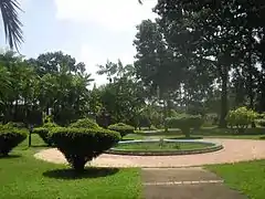
In 1786, Louis XVI had a garden that served as a deposit and nursery for various plants and trees from various destinations. Louis Claude Richard, director of the garden was responsible for bringing from India muscadiers, rattans, trees in, feet of cardamom and pepper. During this period, it was called King's Garden. In 1821 a house was built for the botanist. In 1879, he changed his name and became Botanical Garden is a floral park in the city center. It covers an area of three hectares. There is a Gaston Monnerville statue in the center of the garden.
The market and the Place du Coq
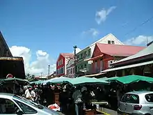
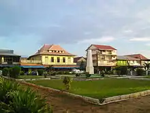
These two adjoining buildings are located near the old port of Cayenne. As early as 1703, a Place du Port appears on a map of the city of Cayenne, it then becomes Place du Marché in 1842. In 1888, a covered market and a public garden were built there. In 1907 the municipal council led by the mayor Eugène Gobert decides the removal of the garden for the construction of a new covered market, the one that we know today. In 1920 on the site of the old market was inaugurated the war memorial of the First World War surmounted by a rooster, which gave it the current name of the place.
Saint-Sauveur Cathedral
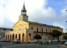
In 1823, the Reverend Father Nicolas Guiller and Baron Pierre Bernard Milius, administrator of French Guiana decided to replace the old church of Cayenne, the Church of St. Nicholas to the current place Leopold Heder. Work begun in 1825 was completed in 1833. The church was inaugurated in 1861. It is classified as a Historic Monument.
The high altar, the pulpit and the confessional of the chapel of the penitentiary of Ilet la Mère were transferred to the cathedral in 1876.
In 1933, the Apostolic Prefecture of French Guiana was transformed into a vicariate, the Apostolic Prefect became bishop. The church also changes status and becomes cathedral. It is consecrated as a cathedral on 9 November 1934 by Bishop Gourtay, then the first bishop of Guiana. In 1952, it was enlarged, during the work the workers found an inset lead cassette containing 21 coins, the oldest of which dates from Napoleon I and 20 seals from the time of Charles X.
Between 1952 and 1954 to the east on 13 m, the ceiling, the stained glass windows, the floors of the tribune, are replaced.
The Saint-Sauveur Cathedral of Cayenne has been recently renovated.
Culture
Carnival of Cayenne
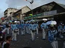
The carnival is one of the major events of the Capital. It takes place between Epiphany in early January and Ash Wednesday in February or March.
Description and origin

This festival belongs to the Guianan Creole culture. It is originally carnival as practiced in Europe. At the beginning of the colonization, the colonists practiced the carnival, but it was forbidden to the slaves. Braving ban, the slaves practiced the carnival, in the clandestine festivals. They were regaining some freedom, commemorating Africans, fertility and harvest, and making fun of settlers.
The fat days close the carnival :
- Fat Sunday: this is the day of the grand parade, the biggest carnival parade. concurrent groups to get prizes based on their performance.
- fat Monday: burlesque marriages, men dress up for brides and women for married couples.
- Mardi Gras: the carnivals go by in Diab rouj, everyone dresses in red and black.
- Ash Wednesday: black and white devils bury Vaval, the king of the carnival.
Carnival of the streets
Groups disguised according to the theme of the year, and around decorated characters, to the rhythm of drums and brass. The preparation of the groups last from the month before the carnival. The groups parade in front of the thousands of spectators who are massed on the sidewalks and the stands arranged for the occasion.
The most known groups are:
- Kassialata
- Reno Band
- OsBand
- les Belles de la Madeleine
Brazilian bands similar to those at the Rio Carnival are also appreciated for their alluring rhythms and costumes. The Asian community of Cayenne also participates in the changes made by a characteristic touch, with the dragons.
The masked balls

The night business, called "Universities", organizes masked balls during which men come to dance with the Touloulous. Evenings are held on Friday and Saturday nights. This tradition is peculiar to French Guiana, it does not exist anywhere else.
Since the 1990s, Tololo parties have been held, where men disguise themselves and play the role of the Touloulous. These evenings are more and more popular and take place several times during the carnival.
The carnival dances are mazurka, biguine and piké djouk. It is the Touloulou who invites men to dance, and they can not refuse. Only the Touloulous have the right to dance, if a woman is not disguised, the orchestra stops.
The Cayenne Ballroom is called Nana, where the Blues Star band plays.
Main sights

Cayenne centres on its main commercial street, the Avenue Général de Gaulle. At the east end of the avenue near the coast is the Place des Palmistes and the Place de Grenoble (also known as the Place Léopold Héder). Most of the official buildings are located in this area: the Hôtel de Ville (the town hall) built by Jesuits in the 1890s, the Post Office, the Préfecture, residence of French Guiana's Préfect, and the Musée Départmental Franconie. To the west of this area lies Fort Cépérou, built in the 17th century, though now mostly in ruins. To the south lie the Place du Coq and Place Victor Schoelcher (named in honour of the anti-slavery activist) and a market.
To the south of this compact region is the Village Chinois (known as Chicago), separated from the rest of Cayenne by the Canal Laussat. It has a reputation for being a dangerous area.
Other buildings in the city include Cayenne Cathedral, municipal library, the municipal museum and a museum of French Guianese Culture (Musée des Cultures Guyanaise) and a scientific research institute (IRD or Institut de recherche pour le développement, formerly Orstom). The Jardin botanique de Cayenne is the city's botanical garden.
Transport
Cayenne is served by the Cayenne – Félix Eboué Airport, which is located in the neighbouring commune of Matoury. There are two flights a day to Paris (Orly Airport), served by Air France and Air Caraïbes. The flight time from Cayenne to Paris is 8 hours and 10 minutes, and from Paris to Cayenne it is 8 hours and 30 minutes. There are also flights to Fort-de-France, Pointe-à-Pitre, Belém, and Fortaleza.
French Guiana's main seaport is the port of Dégrad des Cannes, located on the estuary of the Mahury River, in the commune of Remire-Montjoly, a south-eastern suburb of Cayenne. Almost all of French Guiana's imports and exports pass through the port of Dégrad des Cannes. Built in 1969, it replaced the old harbour of Cayenne which was congested and could not cope with modern traffic.
Education
Cayenne is home to the University of French Guiana, formerly a campus of the University of the French West Indies until a strike concerning university funding lead to the creation of a separate institution in 2014.[18]
Cayenne in popular culture
The French folk song "Cayenne", tells the story of a pimp who shoots a well-to-do client who grossly disrespected a prostitute, and is then convicted and transferred to the infamous penitentiary.
In The Hardy Boys #12: Footprints Under the Window, the Hardys' investigations take them to Cayenne.
The 1955 film We're No Angels involves three prisoners who escape from Devil's Island and settle incognito into a family store in Cayenne.
References
- "Populations légales 2018". INSEE. Retrieved 4 January 2021.
- INSEE. "Historique des populations communales". Retrieved 6 January 2021.
- INSEE. "Base des unités urbaines". Archived from the original on 3 January 2018. Retrieved 31 December 2017.
- INSEE. "Base des aires urbaines". Archived from the original on 24 July 2018. Retrieved 31 December 2017.
- Cayenne Archived 6 April 2016 at the Wayback Machine, Oxford Dictionaries
- "page concernant le blason de la ville sur le site page de Redris". Pagesperso-orange.fr. Archived from the original on 26 December 2008. Retrieved 13 March 2011.
- "Distances and duration of bonds in the dugout". Archived from the original on 12 June 2013. Retrieved 7 August 2011.
- Situation Géographique Préfecture de Guyane, archived 15 September 2008 from the original
- Confins. "Avancées et reculs de la mangrove à Cayenne". Archived from the original on 12 January 2019. Retrieved 12 January 2019.
- "Climatological Information for Cayenne, France". Meteo France. 7 August 2019.
- "CAYENNE–MATOURY (973)" (PDF). Fiche Climatologique: Statistiques 1981–2010 et records (in French). Meteo France. Retrieved 7 August 2019.
- SPLAF (Site sur la Population et les Limites Administratives de la France). "Agglomérations et villes de la Guyane". Archived from the original on 14 January 2019. Retrieved 14 January 2019.
- "Recensement de la population de 2012 – Individus localisés au canton-ou-ville en 2012". INSEE. Archived from the original on 24 February 2019. Retrieved 2 February 2019.
- "Panorama de la population immigrée en Guyane" (PDF). INSEE. Archived (PDF) from the original on 3 February 2019. Retrieved 2 February 2019.
- "French Guiana | history – geography – territorial collectivity, France". Encyclopædia Britannica. Archived from the original on 27 November 2016. Retrieved 8 December 2016.
- "Centre Hospitalier de Cayenne Andrée Rosemon (Cayenne)". Hopital.fr (in French). Retrieved 6 May 2020.
- "Cayenne | French Guiana". Encyclopædia Britannica. Archived from the original on 20 December 2016. Retrieved 8 December 2016.
- nouvelobs.com/education/20140121.AFP8128/decret-sur-le-statut-experimental-de-l-universite-de-guyane-fin-janvier-fioraso.html
External links
| Wikimedia Commons has media related to Cayenne. |
 Cayenne travel guide from Wikivoyage
- . Encyclopædia Britannica. 5 (11th ed.). 1911.
- Préfecture de Guyane Official website
.jpg.webp)