National Register of Historic Places listings in Alachua County, Florida
This is a list of the National Register of Historic Places listings in Alachua County, Florida.
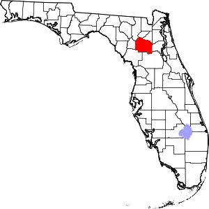
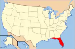
Location of Alachua County in Florida
This is intended to be a complete list of the properties and districts on the National Register of Historic Places in Alachua County, Florida, United States. The locations of National Register properties and districts for which the latitude and longitude coordinates are included below, may be seen in a map.[1]
There are 63 properties and districts listed on the National Register in the county, including two National Historic Landmarks.
- This National Park Service list is complete through NPS recent listings posted February 5, 2021.[2]
| Alachua - Baker - Bay - Bradford - Brevard - Broward - Calhoun - Charlotte - Citrus - Clay - Collier - Columbia - DeSoto - Dixie - Duval - Escambia - Flagler - Franklin - Gadsden - Gilchrist - Glades - Gulf - Hamilton - Hardee - Hendry - Hernando - Highlands - Hillsborough (Tampa) - Holmes - Indian River - Jackson - Jefferson - Lafayette - Lake - Lee - Leon - Levy - Liberty - Madison - Manatee - Marion - Martin - Miami-Dade (Miami) - Monroe - Nassau - Okaloosa - Okeechobee - Orange - Osceola - Palm Beach - Pasco - Pinellas - Polk - Putnam - St. Johns - St. Lucie - Santa Rosa - Sarasota - Seminole - Sumter - Suwannee - Taylor - Union - Volusia - Wakulla - Walton - Washington |
Current listings
| [3] | Name on the Register[4] | Image | Date listed[5] | Location | City or town | Description |
|---|---|---|---|---|---|---|
| 1 | Anderson Hall | 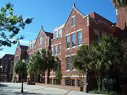 Anderson Hall |
June 27, 1979 (#79000652) |
West University Avenue 29°39′05″N 82°20′32″W |
Gainesville | |
| 2 | Axline House |  Axline House |
May 5, 2015 (#15000207) |
18507 S. Cty. Rd. 325 29°29′00″N 82°09′32″W |
Hawthorne vicinity | |
| 3 | Maj. James B. Bailey House | 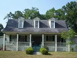 Maj. James B. Bailey House |
December 5, 1972 (#72000301) |
1121 Northwest 6th Street 29°39′47″N 82°19′52″W |
Gainesville | |
| 4 | Baird Hardware Company Warehouse |  Baird Hardware Company Warehouse |
November 25, 1985 (#85003053) |
619 South Main Street 29°38′39″N 82°19′28″W |
Gainesville | |
| 5 | Bethlehem Presbyterian Church |  Bethlehem Presbyterian Church |
February 1, 2018 (#100002065) |
16979 SW 137 Ave. 29°31′42″N 82°31′23″W |
Archer | |
| 6 | Dan Branch House |  Dan Branch House |
November 12, 2015 (#15000782) |
5707 SW. 17 Dr. 29°35′58″N 82°20′35″W |
Gainesville | |
| 7 | Boulware Springs Water Works | 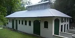 Boulware Springs Water Works |
June 20, 1985 (#85001255) |
3400 Southeast 15th Street 29°37′15″N 82°18′25″W |
Gainesville | |
| 8 | Bryan Hall |  Bryan Hall |
June 27, 1979 (#79000653) |
West University Avenue and 13th Street 29°39′03″N 82°20′26″W |
Gainesville | |
| 9 | Buckman Hall | 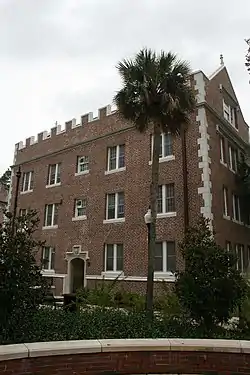 Buckman Hall |
January 11, 1974 (#74000609) |
Buckman Drive (Southwest 17th Street) 29°39′02″N 82°20′43″W |
Gainesville | |
| 10 | City of Alachua Downtown Historic District |  City of Alachua Downtown Historic District |
July 14, 2000 (#00000787) |
Roughly bounded by Northwest 150th Avenue, Northwest 145th Terrace, Northwest 143rd Place, and Northwest 138th Terrace 29°47′23″N 82°29′41″W |
Alachua | |
| 11 | Cox Family Log House |  Cox Family Log House |
May 1, 2017 (#100000931) |
1639 NW. 11th Rd. 29°39′46″N 82°20′37″W |
Gainesville | |
| 12 | Cox Furniture Store | 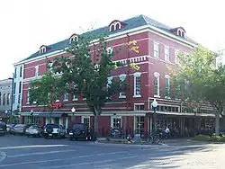 Cox Furniture Store |
June 10, 1994 (#94000579) |
19 Southeast First Avenue 29°39′03″N 82°19′28″W |
Gainesville | |
| 13 | Cox Furniture Warehouse | 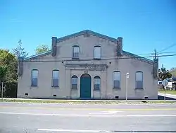 Cox Furniture Warehouse |
June 10, 1994 (#94000580) |
602 South Main Street 29°38′44″N 82°19′32″W |
Gainesville | |
| 14 | Devil's Millhopper |  Devil's Millhopper |
March 7, 2017 (#100000709) |
Devil's Millhopper Geological State Park 29°42′25″N 82°23′42″W |
Gainesville vicinity | |
| 15 | Dixie Hotel, Hotel Kelley | 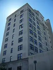 Dixie Hotel, Hotel Kelley |
August 16, 1982 (#82002369) |
408 West University Avenue 29°39′07″N 82°19′44″W |
Gainesville | |
| 16 | Dudley Farm | 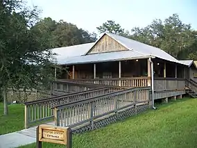 Dudley Farm |
October 4, 2002 (#02001081) |
18730 West Newberry Road 29°39′15″N 82°32′37″W |
Newberry | Designated a National Historic Landmark in 2021. |
| 17 | Engineering Industries Building | 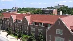 Engineering Industries Building |
June 24, 2008 (#08000547) |
Stadium Road and Gale Lemerand Drive (North-South Drive) 29°38′54″N 82°20′53″W |
Gainesville | part of the University of Florida Campus MPS |
| 18 | Epworth Hall | 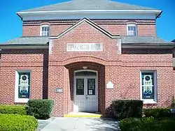 Epworth Hall |
July 25, 1973 (#73000562) |
419 Northeast 1st Street 29°39′18″N 82°20′36″W |
Gainesville | |
| 19 | Evinston Community Store and Post Office | 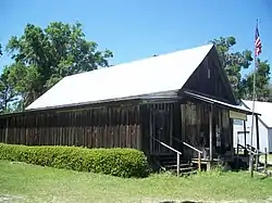 Evinston Community Store and Post Office |
May 5, 1989 (#89000321) |
County Road 225, north of the Alachua/Marion county border 29°29′06″N 82°13′34″W |
Evinston | |
| 20 | Flint Hall |  Flint Hall |
June 27, 1979 (#79000654) |
West University Avenue 29°39′06″N 82°20′37″W |
Gainesville | |
| 21 | Floyd Hall | 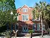 Floyd Hall |
June 27, 1979 (#79000655) |
University of Florida campus 29°38′59″N 82°20′38″W |
Gainesville | |
| 22 | High Springs Historic District |  High Springs Historic District |
October 31, 1991 (#91001540) |
Roughly bounded by Northwest 14th Street, Northwest 6th Avenue, Southeast 7th Street, and Southwest 5th Avenue 29°49′32″N 82°35′48″W |
High Springs | |
| 23 | Hotel Thomas |  Hotel Thomas |
July 16, 1973 (#73000563) |
Bounded by Northeast 2nd and 5th Streets and Northeast 6th and 7th Avenues 29°39′45″N 82°19′47″W |
Gainesville | |
| 24 | Hawthorne Cemetery |  Hawthorne Cemetery |
May 4, 2015 (#14000172) |
FL 20 29°35′48″N 82°04′21″W |
Hawthorne | |
| 25 | The Hub | 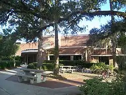 The Hub |
June 24, 2008 (#08000551) |
Stadium Road between Buckman Drive and Fletcher Drive 29°38′55″N 82°20′44″W |
Gainesville | Part of the University of Florida Campus MPS |
| 26 | Island Grove Masonic Lodge No. 125 |  Island Grove Masonic Lodge No. 125 |
December 7, 2010 (#10000984) |
20114 Southeast 219 Avenue 29°27′12″N 82°06′24″W |
Island Grove | NRHP No. 10000984 |
| 27 | A. Quinn Jones House | 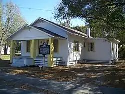 A. Quinn Jones House |
January 27, 2010 (#09001278) |
1013 NW. 7th Avenue 29°39′26″N 82°20′08″W |
Gainesville | |
| 28 | Kanapaha |  Kanapaha |
May 2, 1986 (#86000915) |
8500 State Road 24 29°35′40″N 82°26′07″W |
Gainesville | |
| 29 | Lake Pithlachocco Canoe Site | 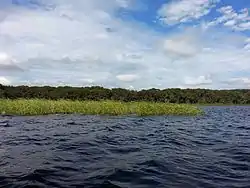 Lake Pithlachocco Canoe Site |
March 27, 2001 (#01000303) |
Address Restricted |
Gainesville | |
| 30 | Liberty Hill Schoolhouse |  Liberty Hill Schoolhouse |
August 28, 2003 (#03000825) |
7600 Northwest 23rd Avenue 29°40′33″N 82°25′24″W |
Gainesville | |
| 31 | Library East |  Library East |
June 27, 1979 (#79000656) |
Murphree Way 29°39′02″N 82°20′31″W |
Gainesville | |
| 32 | Masonic Temple |  Masonic Temple |
May 29, 1998 (#98000589) |
215 North Main Street 29°39′12″N 82°19′30″W |
Gainesville | |
| 33 | Matheson House |  Matheson House |
June 4, 1973 (#73000564) |
528 Southeast 1st Avenue 29°39′03″N 82°19′13″W |
Gainesville | |
| 34 | Mary Phifer McKenzie House |  Mary Phifer McKenzie House |
April 26, 1982 (#82002370) |
617 East University Avenue 29°39′05″N 82°19′10″W |
Gainesville | |
| 35 | Melrose Historic District |  Melrose Historic District |
January 12, 1990 (#89002305) |
Roughly bounded by Seminole Ridge Road, Grove Street, South Street, Quail Street, and Melrose Bay 29°42′45″N 82°03′03″W |
Melrose | |
| 36 | Micanopy Historic District |  Micanopy Historic District |
January 28, 1983 (#83003512) |
Roughly Cholokka Boulevard from U.S. Route 441 to Ocala Street then Smith Street west to Okehumkee Street 29°30′21″N 82°16′58″W |
Micanopy | |
| 37 | Mission San Francisco de Potano | April 30, 2009 (#09000251) |
Off County Road 236 north of High Springs[6] 29°53′01″N 82°33′59″W |
Gainesville | It is an archaeological site (8AL272, Fox Pond) in Ichetucknee Springs State Park | |
| 38 | Neilson House |  Neilson House |
June 4, 1973 (#73000566) |
State Road 325 29°38′58″N 82°11′06″W |
Windsor | |
| 39 | Newberry Historic District |  Newberry Historic District |
December 24, 1987 (#87002150) |
Roughly bounded by Northwest Second Avenue, Northwest Second Street, Lucile Street, and Northwest Ninth Street 29°38′45″N 82°36′49″W |
Newberry | |
| 40 | Newell Hall | 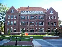 Newell Hall |
June 27, 1979 (#79000657) |
Stadium Road 29°38′56″N 82°20′43″W |
Gainesville | |
| 41 | Newnansville Town Site |  Newnansville Town Site |
December 4, 1974 (#74000608) |
State Road 235, northeast of Alachua[7] 29°48′31″N 82°28′36″W |
Alachua | |
| 42 | Northeast Gainesville Residential District |  Northeast Gainesville Residential District |
February 12, 1980 (#80000942) |
Roughly bounded by 1st and 9th Streets and 10th and East University Avenues 29°39′23″N 82°19′11″W |
Gainesville | |
| 43 | Old Gainesville Depot | 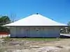 Old Gainesville Depot |
November 22, 1996 (#96001369) |
203 Southeast Depot Avenue 29°38′41″N 82°19′24″W |
Gainesville | |
| 44 | Old WRUF Radio Station | 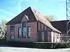 Old WRUF Radio Station |
September 21, 1989 (#89001479) |
Museum Road and Newell Drive 29°39′12″N 82°20′36″W |
Gainesville | |
| 45 | Old P.K. Yonge Laboratory School | 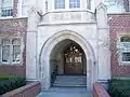 Old P.K. Yonge Laboratory School |
January 26, 1990 (#89002302) |
Southwest 13th Street on the University of Florida campus 29°38′48″N 82°20′17″W |
Gainesville | |
| 46 | Peabody Hall |  Peabody Hall |
June 27, 1979 (#79000658) |
University of Florida campus 29°38′59″N 82°20′31″W |
Gainesville | |
| 47 | Pleasant Street Historic District | 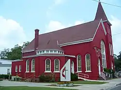 Pleasant Street Historic District |
April 20, 1989 (#89000323) |
Roughly bounded by Northwest 8th Avenue, Northwest 1st Street, Northwest 2nd Avenue, and Northwest 6th Street 29°39′21″N 82°19′43″W |
Gainesville | |
| 48 | Carlos and Marjorie Proctor Log House and Cottage |  Carlos and Marjorie Proctor Log House and Cottage |
June 25, 2018 (#100002620) |
2250 NW 8th Ave. 29°39′34″N 82°21′19″W |
Gainesville | |
| 49 | Marjorie Kinnan Rawlings House and Farm Yard | 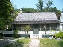 Marjorie Kinnan Rawlings House and Farm Yard |
September 29, 1970 (#70000176) |
18700 South County Road 325 29°28′53″N 82°09′37″W |
Cross Creek | |
| 50 | Rochelle School | 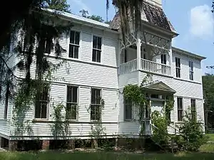 Rochelle School |
April 2, 1973 (#73000565) |
Off State Road 234 29°35′34″N 82°13′25″W |
Rochelle | |
| 51 | Rolfs Hall | 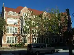 Rolfs Hall |
September 11, 1986 (#86002411) |
Buckman Drive on the University of Florida campus 29°38′57″N 82°20′30″W |
Gainesville | |
| 52 | Shady Grove Primitive Baptist Church | 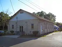 Shady Grove Primitive Baptist Church |
October 5, 2005 (#05001115) |
804 Southwest Fifth Street 29°38′47″N 82°19′47″W |
Gainesville | |
| 53 | Southeast Gainesville Residential District | 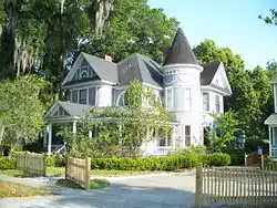 Southeast Gainesville Residential District |
January 14, 1988 (#87002435) |
Roughly bounded by East University Avenue, Southeast Ninth Street, Southeast Fifth Avenue, and Sweetwater Branch 29°38′57″N 82°19′04″W |
Gainesville | |
| 54 | Star Garage | 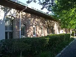 Star Garage |
December 17, 1985 (#85003197) |
119 Southeast First Avenue 29°39′02″N 82°19′25″W |
Gainesville | |
| 55 | Stephens House |  Stephens House |
July 31, 2017 (#100001386) |
19802 Old Bellamy Rd. 29°50′12″N 82°29′44″W |
Alachua | |
| 56 | Thomas Hall | 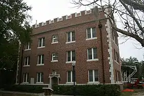 Thomas Hall |
October 1, 1974 (#74000610) |
Fletcher Drive on the University of Florida campus 29°39′03″N 82°20′46″W |
Gainesville | |
| 57 | U.S. Post Office |  U.S. Post Office |
July 10, 1979 (#79000659) |
25 Southeast 2nd Place 29°38′57″N 82°19′27″W |
Gainesville | |
| 58 | University of Florida Campus Historic District |  University of Florida Campus Historic District |
April 20, 1989 (#89000322) |
Bounded by West University Avenue, Southwest 13th Street, Stadium Road, and North-South Drive 29°39′01″N 82°20′38″W |
Gainesville | |
| 59 | Waldo Historic District |  Waldo Historic District |
February 2, 2001 (#01000034) |
Roughly bounded by Northwest 1st Avenue, Main Street, Southwest 5th Boulevard, and Southwest 4th Street 29°47′28″N 82°10′14″W |
Waldo | |
| 60 | Weil-Cassisi House |  Weil-Cassisi House |
November 9, 2015 (#15000587) |
3105 SW. 5th Ct. 29°37′26″N 82°19′49″W |
Gainesville | |
| 61 | Winecoff House |  Winecoff House |
February 14, 2002 (#02000001) |
102 Northeast Seminary Avenue 29°30′16″N 82°16′54″W |
Micanopy | |
| 62 | Women's Gymnasium | 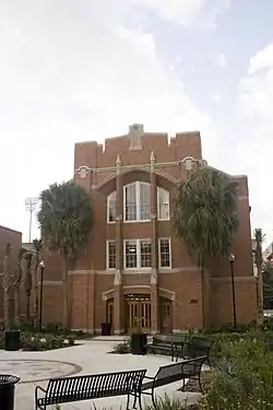 Women's Gymnasium |
June 27, 1979 (#79000660) |
East-West Road 29°39′01″N 82°20′49″W |
Gainesville | |
| 63 | Yulee-Mallory-Reid Dormitory Complex | 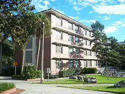 Yulee-Mallory-Reid Dormitory Complex |
June 24, 2008 (#08000552) |
13th Street and Inner Road, SW. 29°38′50″N 82°20′28″W |
Gainesville | Part of the University of Florida Campus MPS |
See also
| Wikimedia Commons has media related to National Register of Historic Places in Alachua County, Florida. |
References
- The latitude and longitude information provided in this table was derived originally from the National Register Information System, which has been found to be fairly accurate for about 99% of listings. Some locations in this table may have been corrected to current GPS standards.
- "National Register of Historic Places: Weekly List Actions". National Park Service, United States Department of the Interior. Retrieved on February 5, 2021.
- Numbers represent an alphabetical ordering by significant words. Various colorings, defined here, differentiate National Historic Landmarks and historic districts from other NRHP buildings, structures, sites or objects.
- "National Register Information System". National Register of Historic Places. National Park Service. March 13, 2009.
- The eight-digit number below each date is the number assigned to each location in the National Register Information System database, which can be viewed by clicking the number.
- Location derived from its GNIS feature record; the NRIS lists the site as "Address restricted"
- Location derived from its GNIS feature record; the NRIS lists the site as "Address restricted"
Municipalities and communities of Alachua County, Florida, United States | ||
|---|---|---|
| Cities | | |
| Towns | ||
| Unincorporated communities | ||
| Footnotes | ‡This populated place also has portions in an adjacent county or counties | |
| ||
This article is issued from Wikipedia. The text is licensed under Creative Commons - Attribution - Sharealike. Additional terms may apply for the media files.