National Register of Historic Places listings in Sarasota County, Florida
This is a list of the National Register of Historic Places listings in Sarasota County, Florida.
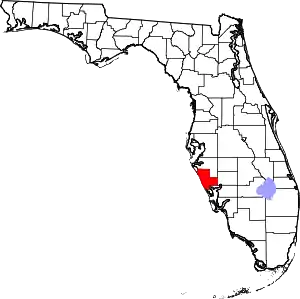
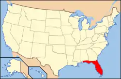
Location of Sarasota County in Florida
This is intended to be a complete list of the properties and districts on the National Register of Historic Places in Sarasota County, Florida, United States. The locations of National Register properties and districts for which the latitude and longitude coordinates are included below, may be seen in a map.[1]
There are 97 properties and districts listed on the National Register in the county. One property was once listed, but has since been delisted.
- This National Park Service list is complete through NPS recent listings posted February 5, 2021.[2]
| Alachua - Baker - Bay - Bradford - Brevard - Broward - Calhoun - Charlotte - Citrus - Clay - Collier - Columbia - DeSoto - Dixie - Duval - Escambia - Flagler - Franklin - Gadsden - Gilchrist - Glades - Gulf - Hamilton - Hardee - Hendry - Hernando - Highlands - Hillsborough (Tampa) - Holmes - Indian River - Jackson - Jefferson - Lafayette - Lake - Lee - Leon - Levy - Liberty - Madison - Manatee - Marion - Martin - Miami-Dade (Miami) - Monroe - Nassau - Okaloosa - Okeechobee - Orange - Osceola - Palm Beach - Pasco - Pinellas - Polk - Putnam - St. Johns - St. Lucie - Santa Rosa - Sarasota - Seminole - Sumter - Suwannee - Taylor - Union - Volusia - Wakulla - Walton - Washington |
Current listings
| [3] | Name on the Register[4] | Image | Date listed[5] | Location | City or town | Description |
|---|---|---|---|---|---|---|
| 1 | American National Bank Building | 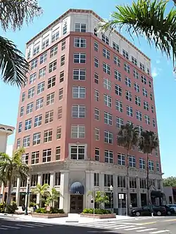 American National Bank Building |
September 9, 1998 (#98001154) |
1330 Main Street 27°20′06″N 82°32′37″W |
Sarasota | |
| 2 | Appleby Building |  Appleby Building |
June 28, 2001 (#01000683) |
501-513 Kumquat Court 27°20′24″N 82°32′26″W |
Sarasota | |
| 3 | William Martin Armistead House |  William Martin Armistead House |
March 30, 2009 (#09000165) |
1510 Hyde Park Street 27°18′55″N 82°32′22″W |
Sarasota | |
| 4 | Armada Road Multi-Family District | 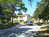 Armada Road Multi-Family District |
December 18, 1989 (#89002049) |
Roughly bounded by Granada Avenue, Harbor Drive South, Armada Road South, and Park Boulevard South 27°05′48″N 82°26′58″W |
Venice | Part of the Venice MPS |
| 5 | Bacheller-Brewer Model Home Estate | 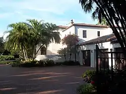 Bacheller-Brewer Model Home Estate |
February 10, 1992 (#91002034) |
1903 Lincoln Drive 27°19′31″N 82°31′55″W |
Sarasota | |
| 6 | Bacon and Tomlin, Inc. |  Bacon and Tomlin, Inc. |
March 22, 1984 (#84003829) |
201 South Palm Avenue 27°20′02″N 82°32′30″W |
Sarasota | Part of the Sarasota MRA |
| 7 | Bay Haven School | 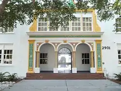 Bay Haven School |
April 23, 1984 (#84003832) |
2901 West Tamiami Circle 27°21′42″N 82°33′06″W |
Sarasota | Part of the Sarasota MRA |
| 8 | Bee Ridge Woman's Club | 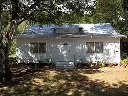 Bee Ridge Woman's Club |
February 10, 1995 (#95000052) |
4919 Andrew Avenue 27°16′53″N 82°29′03″W |
Sarasota | |
| 9 | Frank and Matilda Binz House | 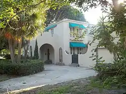 Frank and Matilda Binz House |
August 5, 1994 (#94000736) |
5050 Bay Shore Road 27°22′40″N 82°33′36″W |
Sarasota | |
| 10 | Bispham-Wilson Historic District | 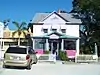 Bispham-Wilson Historic District |
September 14, 2002 (#02001010) |
4613 South Tamiami Trail 27°17′10″N 82°31′54″W |
Sarasota | |
| 11 | Blackburn Point Bridge |  Blackburn Point Bridge |
March 29, 2001 (#01000290) |
Blackburn Point Road at the Gulf Intracoastal Waterway 27°10′46″N 82°29′41″W |
Osprey | |
| 12 | Blalock House | 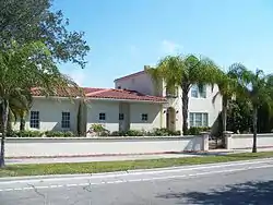 Blalock House |
April 12, 1989 (#89000235) |
241 South Harbor Drive 27°05′49″N 82°26′59″W |
Venice | Part of the Venice MPS |
| 13 | Bryson-Crane House | 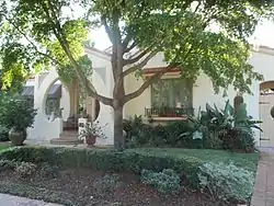 Bryson-Crane House |
June 1, 2005 (#05000501) |
5050 Brywill Circle 27°22′39″N 82°33′34″W |
Sarasota | |
| 14 | Burns Court Historic District | 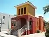 Burns Court Historic District |
March 22, 1984 (#84003830) |
400-446 Burns Court and 418, 426, and 446 South Pineapple Avenue 27°20′03″N 82°32′23″W |
Sarasota | Part of the Sarasota MRA |
| 15 | Burns Realty Company-Karl Bickel House | 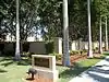 Burns Realty Company-Karl Bickel House |
March 5, 1987 (#87000196) |
101 North Tamiami Trail 27°20′13″N 82°32′50″W |
Sarasota | Part of the Sarasota MRA |
| 16 | William J. Burns House | 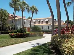 William J. Burns House |
March 21, 1997 (#97000248) |
47 South Washington Drive 27°19′07″N 82°34′27″W |
Sarasota | |
| 17 | Waters and Elsa Burrows Historic District |  Waters and Elsa Burrows Historic District |
February 3, 2012 (#11001077) |
400 Palmetto Avenue 27°12′09″N 82°29′36″W |
Osprey | |
| 18 | Caples'-Ringlings' Estates Historic District | 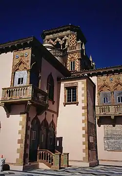 Caples'-Ringlings' Estates Historic District |
December 15, 1982 (#82001039) |
Roughly bounded by Sarasota Bay, U.S. Route 41, Parkview, and North Shore Avenue 27°22′58″N 82°33′40″W |
Sarasota | |
| 19 | Casa Del Mar |  Casa Del Mar |
February 14, 1997 (#97000051) |
25 South Washington Drive 27°19′09″N 82°34′28″W |
Sarasota | |
| 20 | Central-Cocoanut Historic District | 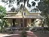 Central-Cocoanut Historic District |
June 17, 2005 (#05000599) |
11th Street, Tamiami Trail, 22nd Street, and railroad tracks 27°21′05″N 82°32′38″W |
Sarasota | |
| 21 | Chidsey Library | 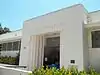 Chidsey Library |
May 4, 2011 (#11000241) |
701 North Tamiami Trail 27°20′32″N 82°32′51″W |
Sarasota | |
| 22 | City Waterworks | 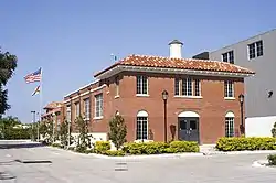 City Waterworks |
April 23, 1984 (#84003831) |
1015 North Orange Avenue 27°20′41″N 82°32′22″W |
Sarasota | Part of the Sarasota MRA |
| 23 | Corrigan House | 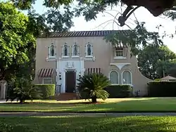 Corrigan House |
May 26, 1994 (#94000528) |
463 Sapphire Drive 27°22′41″N 82°33′46″W |
Sarasota | |
| 24 | Crisp Building | 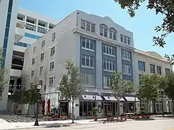 Crisp Building |
April 21, 2000 (#00000388) |
1970 Main Street 27°20′12″N 82°31′52″W |
Sarasota | |
| 25 | F. A. DeCanizares House | 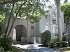 F. A. DeCanizares House |
March 22, 1984 (#84003833) |
1215 North Palm Avenue 27°20′11″N 82°32′46″W |
Sarasota | Part of the Sarasota MRA |
| 26 | DeMarcay Hotel | 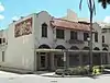 DeMarcay Hotel |
March 22, 1984 (#84003834) |
27 South Palm Avenue 27°20′07″N 82°32′35″W |
Sarasota | Part of the Sarasota MRA |
| 27 | Downtown Sarasota Historic District | 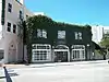 Downtown Sarasota Historic District |
April 9, 2009 (#09000183) |
Bound by 1st Street, Orange Avenue, State Street, Gulf Stream Avenue, and North Pineapple Avenue 27°19′58″N 82°32′14″W |
Sarasota | Boundary decrease (listed October 7, 2010): 1400 block of Main St. |
| 28 | Eagle Point Historic District |  Eagle Point Historic District |
October 3, 1991 (#91001448) |
759 North Tamiami Trail 27°06′31″N 82°26′46″W |
Venice | |
| 29 | Earle House |  Earle House |
September 2, 1993 (#93000908) |
4521 Bayshore Road 27°22′24″N 82°33′44″W |
Sarasota | |
| 30 | Edgewood Historic District |  Edgewood Historic District |
December 18, 1989 (#89002048) |
Roughly bounded by School Street, Myrtle Avenue, the Venice-By-Way, and Groveland Avenue 27°05′46″N 82°25′51″W |
Venice | Part of the Venice MPS |
| 31 | Edwards Theatre |  Edwards Theatre |
March 22, 1984 (#84003835) |
57 North Pineapple Avenue 27°20′12″N 82°32′38″W |
Sarasota | Part of the Sarasota MRA |
| 32 | El Patio Apartments |  El Patio Apartments |
May 6, 1993 (#93000390) |
500 North Audubon Place 27°20′25″N 82°31′37″W |
Sarasota | |
| 33 | El Vernona Apartments-Broadway Apartments | 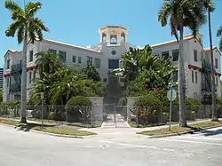 El Vernona Apartments-Broadway Apartments |
March 22, 1984 (#84003836) |
1133 4th Street 27°20′23″N 82°32′54″W |
Sarasota | Part of the Sarasota MRA |
| 34 | El Vernona Hotel-John Ringling Hotel | 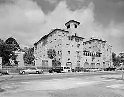 El Vernona Hotel-John Ringling Hotel |
March 5, 1987 (#87000197) |
111 North Tamiami Trail 27°20′13″N 82°32′50″W |
Sarasota | Part of the Sarasota MRA |
| 35 | Field Estate | 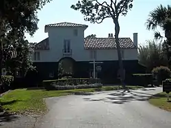 Field Estate |
June 5, 1986 (#86001238) |
Field Road and Camino Real 27°17′11″N 82°32′20″W |
Sarasota | |
| 36 | Frances-Carlton Apartments | 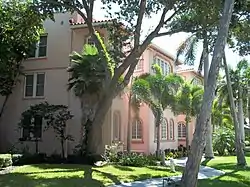 Frances-Carlton Apartments |
March 22, 1984 (#84003837) |
1221-1227 North Palm Avenue 27°20′11″N 82°32′46″W |
Sarasota | Part of the Sarasota MRA |
| 37 | Dr. Joseph Halton House | 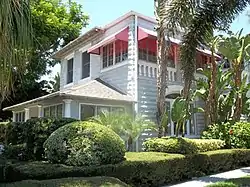 Dr. Joseph Halton House |
March 22, 1984 (#84003838) |
308 Cocoanut Avenue 27°20′19″N 82°32′41″W |
Sarasota | Part of the Sarasota MRA |
| 38 | Harding Circle Historic District |  Harding Circle Historic District |
January 16, 2001 (#00001650) |
Roughly John Ringling Boulevard, St. Armands Circle, and Boulevard of Presidents 27°19′08″N 82°34′37″W |
Sarasota | |
| 39 | Hermitage-Whitney Historic District | 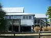 Hermitage-Whitney Historic District |
October 31, 2002 (#02001261) |
6660 Manasota Key Road 26°57′40″N 82°23′03″W |
Englewood | |
| 40 | Hotel Venice | 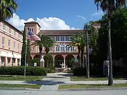 Hotel Venice |
February 6, 1984 (#84000961) |
200 North Nassau Street 27°06′01″N 82°27′11″W |
Venice | |
| 41 | House at 507 Jackson Drive | 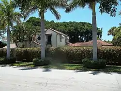 House at 507 Jackson Drive |
February 5, 1998 (#98000060) |
507 Jackson Drive 27°19′00″N 82°34′31″W |
Sarasota | |
| 42 | House at 710 Armada Road South | 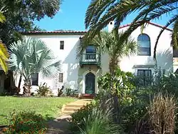 House at 710 Armada Road South |
August 17, 1989 (#89001073) |
710 Armada Road South 27°05′52″N 82°26′49″W |
Venice | Part of the Venice MPS |
| 43 | Johnson Chapel Missionary Baptist Church | 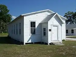 Johnson Chapel Missionary Baptist Church |
October 8, 1997 (#97001218) |
506 Church Street 27°07′49″N 82°26′54″W |
Laurel | |
| 44 | Johnson-Schoolcraft Building |  Johnson-Schoolcraft Building |
December 27, 1996 (#96001522) |
201-203 West Venice Avenue 27°06′16″N 82°27′07″W |
Venice | Part of the Venice MPS |
| 45 | Edson Keith Estate | 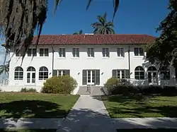 Edson Keith Estate |
March 14, 1991 (#91000282) |
5500 South Tamiami Trail 27°16′13″N 82°31′58″W |
Sarasota | |
| 46 | Dr. Walter Kennedy House | 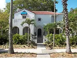 Dr. Walter Kennedy House |
April 14, 1994 (#94000349) |
1876 Oak Street 27°19′53″N 82°31′59″W |
Sarasota | |
| 47 | S. H. Kress Building | 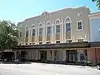 S. H. Kress Building |
March 22, 1984 (#84003839) |
1442 Main Street 27°20′09″N 82°32′31″W |
Sarasota | Part of the Sarasota MRA |
| 48 | Laurel Park Historic District | 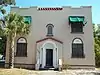 Laurel Park Historic District |
March 11, 2008 (#08000164) |
Bounded by Morrill Street, Orange Avenue, Brother Geenen Way, Julia Place, and Lafayette Court 27°19′52″N 82°32′05″W |
Sarasota | |
| 49 | Hilton Leech House and Amagansett Art School | 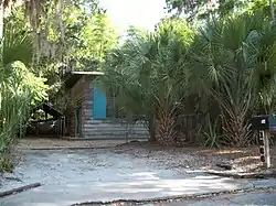 Hilton Leech House and Amagansett Art School |
June 22, 1995 (#95000732) |
1666 Hillview Street 27°18′59″N 82°32′10″W |
Sarasota | Part of the Sarasota School of Architecture MPS |
| 50 | Charles E. Leigh House | 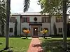 Charles E. Leigh House |
February 4, 2019 (#100003412) |
139 S. Washington Dr. 27°19′01″N 82°34′26″W |
Sarasota | |
| 51 | Lemon Bay Woman's Club | 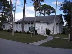 Lemon Bay Woman's Club |
August 11, 1988 (#88001150) |
51 North Maple Street 26°57′47″N 82°21′29″W |
Englewood | |
| 52 | Levillain-Letton House | 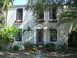 Levillain-Letton House |
April 12, 1989 (#89000234) |
229 South Harbor Drive 27°05′50″N 82°26′59″W |
Venice | Part of the Venice MPS |
| 53 | Little Salt Springs | 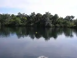 Little Salt Springs |
July 10, 1979 (#79000692) |
Off U.S. Route 41 27°04′29″N 82°14′00″W |
North Port | |
| 54 | Maine Colony Historic District | 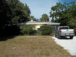 Maine Colony Historic District |
October 5, 2005 (#05001118) |
Bounded by Swift Road Ashton Road, Portland Way and Grafton Street 27°16′47″N 82°31′06″W |
Sarasota | |
| 55 | Miakka School House |  Miakka School House |
July 3, 1986 (#86001458) |
Miakka and Wilson Roads 27°19′10″N 82°16′11″W |
Miakka | |
| 56 | Municipal Auditorium-Recreation Club |  Municipal Auditorium-Recreation Club |
February 24, 1995 (#95000164) |
801 North Tamiami Trail 27°20′35″N 82°32′52″W |
Sarasota | |
| 57 | Lucienne Nielsen House | 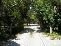 Lucienne Nielsen House |
March 21, 2007 (#07000163) |
3730 Sandspur Lane 27°10′27″N 82°29′39″W |
Nokomis | Part of the Sarasota School of Architecture MPS |
| 58 | Nokomis Beach Pavilion | Nokomis Beach Pavilion |
May 28, 2013 (#13000320) |
100 Casey Key Rd. 27°07′28″N 82°28′13″W |
Nokomis | part of the Sarasota School of Architecture MPS |
| 59 | John Nolen Plan of Venice Historic District | 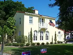 John Nolen Plan of Venice Historic District |
November 8, 2010 (#10000840) |
Laguna Dr on N, Home Park Rd on E, the Corso on S, The Esplanade on W 27°05′46″N 82°26′35″W |
Venice | |
| 60 | Osprey Archeological and Historic Site | 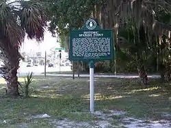 Osprey Archeological and Historic Site |
April 16, 1975 (#75000569) |
Address Restricted 27°12′N 82°29′W |
Osprey | |
| 61 | Osprey School | 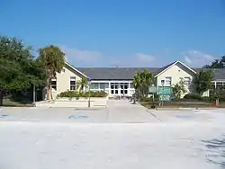 Osprey School |
July 15, 1994 (#94000707) |
337 North Tamiami Trail (U.S. Route 41) 27°12′05″N 82°29′29″W |
Osprey | |
| 62 | Out of Door School |  Out of Door School |
October 28, 1994 (#94001276) |
444 Reid Street 27°17′09″N 82°33′38″W |
Sarasota | |
| 63 | Overtown Historic District |  Overtown Historic District |
July 19, 2002 (#02000781) |
Roughly along Central and Cohen Avenues between 9th and 4th Streets 27°22′13″N 82°32′35″W |
Sarasota | |
| 64 | Christy Payne Mansion |  Christy Payne Mansion |
September 25, 1998 (#98001201) |
800 South Palm Avenue 27°19′40″N 82°32′25″W |
Sarasota | |
| 65 | Capt. W. F. Purdy House |  Capt. W. F. Purdy House |
March 22, 1984 (#84003840) |
3315 Bayshore Road 27°21′52″N 82°33′24″W |
Sarasota | Part of the Sarasota MRA |
| 66 | L. D. Reagin House |  L. D. Reagin House |
October 25, 1984 (#84000111) |
1213 North Palm Avenue 27°20′11″N 82°32′48″W |
Sarasota | Part of the Sarasota MRA |
| 67 | Leonard Reid House |  Leonard Reid House |
October 29, 2002 (#02000780) |
1435 7th Street 27°20′38″N 82°32′30″W |
Sarasota | |
| 68 | Revere Quality Institute House |  Revere Quality Institute House |
March 26, 2008 (#07001200) |
100 Ogden Lane 27°18′03″N 82°33′32″W |
Sarasota | Part of the Sarasota School of Architecture MPS |
| 69 | Rigby's La Plaza Historic District | 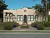 Rigby's La Plaza Historic District |
April 25, 1994 (#94000373) |
1002-1038 South Osprey Avenue, 1744 and 1776 Alta Vista Street, and 1777 Irving Avenue 27°19′27″N 82°32′04″W |
Sarasota | |
| 70 | Rosemary Cemetery | 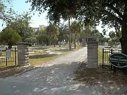 Rosemary Cemetery |
November 16, 2003 (#03001143) |
851 Central Avenue 27°20′42″N 82°32′37″W |
Sarasota | |
| 71 | Roth Cigar Factory | 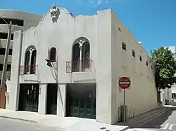 Roth Cigar Factory |
March 22, 1984 (#84003841) |
30 Mira Mar Court 27°20′04″N 82°32′27″W |
Sarasota | Part of the Sarasota MRA |
| 72 | Paul Rudolph Sarasota High School Addition | .jpg.webp) Paul Rudolph Sarasota High School Addition |
June 27, 2012 (#12000365) |
1000 School Ave., S. 27°19′29″N 82°31′33″W |
Sarasota | Part of the Sarasota School of Architecture MPS |
| 73 | Sanderling Beach Club | 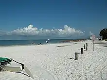 Sanderling Beach Club |
June 29, 1994 (#94000618) |
105 Beach Road 27°14′26″N 82°31′55″W |
Sarasota | Part of the Sarasota School of Architecture MPS |
| 74 | Sarasota County Chamber of Commerce Building | July 28, 2020 (#100005395) |
655 North Tamiami Trail 27°20′31″N 82°32′49″W |
Sarasota | ||
| 75 | Sarasota County Courthouse |  Sarasota County Courthouse |
March 22, 1984 (#84003842) |
2000 Main Street 27°20′08″N 82°31′50″W |
Sarasota | Part of the Sarasota MRA |
| 76 | Sarasota Herald Building | 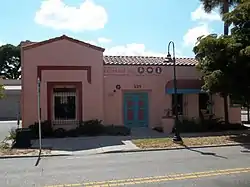 Sarasota Herald Building |
March 22, 1984 (#84003843) |
539 South Orange Avenue 27°19′53″N 82°32′19″W |
Sarasota | Part of the Sarasota MRA |
| 77 | Sarasota High School | 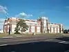 Sarasota High School |
March 22, 1984 (#84003844) |
1001 South Tamiami Trail 27°19′30″N 82°31′46″W |
Sarasota | Part of the Sarasota MRA |
| 78 | Sarasota Times Building | 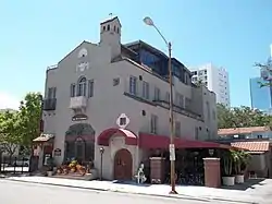 Sarasota Times Building |
March 22, 1984 (#84003845) |
1214-1216 1st Street 27°20′12″N 82°32′46″W |
Sarasota | Part of the Sarasota MRA |
| 79 | Sarasota Woman's Club | 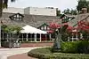 Sarasota Woman's Club |
January 18, 1985 (#85000087) |
1241 North Palm Avenue 27°20′11″N 82°32′44″W |
Sarasota | Part of the Sarasota MRA |
| 80 | George Schueler House | 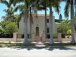 George Schueler House |
September 26, 1997 (#97001170) |
76 South Washington Drive 27°19′04″N 82°34′25″W |
Sarasota | |
| 81 | Scott Commercial Building | 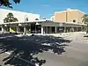 Scott Commercial Building |
June 7, 2016 (#14001116) |
261-265 S. Orange Ave. 27°20′02″N 82°32′19″W |
Sarasota | Part of the Sarasota School of Architecture MPS |
| 82 | South Side School | 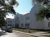 South Side School |
September 14, 1984 (#84003846) |
1901 Webber Street 27°18′29″N 82°31′53″W |
Sarasota | Part of the Sarasota MRA |
| 83 | Southwick-Harmon House | 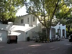 Southwick-Harmon House |
October 28, 2001 (#01001180) |
1830 Lincoln Drive 27°19′39″N 82°31′59″W |
Sarasota | |
| 84 | Thomas House |  Thomas House |
July 1, 1994 (#94000666) |
5030 Bay Shore Road 27°22′38″N 82°33′36″W |
Sarasota | |
| 85 | Triangle Inn | 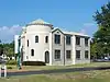 Triangle Inn |
February 23, 1996 (#96000175) |
351 South Nassau Street 27°05′42″N 82°26′52″W |
Venice | Part of the Venice MPS |
| 86 | Umbrella House | .jpg.webp) Umbrella House |
February 4, 2019 (#100003417) |
1300 Westway Dr. 27°19′45″N 82°35′03″W |
Sarasota | Part of the Sarasota School of Architecture MPS |
| 87 | U.S. Post Office-Federal Building | 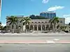 U.S. Post Office-Federal Building |
March 22, 1984 (#84003847) |
111 South Orange Avenue 27°20′09″N 82°32′19″W |
Sarasota | Part of the Sarasota MRA |
| 88 | Valencia Hotel and Arcade | 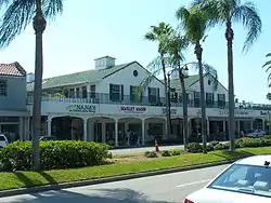 Valencia Hotel and Arcade |
November 10, 1994 (#94001303) |
229 West Venice Avenue 27°05′58″N 82°26′50″W |
Venice | Part of the Venice MPS |
| 89 | Venezia Park Historic District | 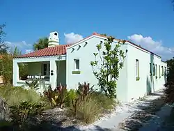 Venezia Park Historic District |
December 18, 1989 (#89002047) |
Roughly bounded by Palermo Street, Sorrento Street, South Harbor Drive, and Salerno Street 27°05′31″N 82°26′53″W |
Venice | Part of the Venice MPS |
| 90 | Venice Depot | 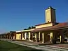 Venice Depot |
August 17, 1989 (#89001072) |
303 East Venice Avenue 27°06′02″N 82°26′25″W |
Venice | Part of the Venice MPS |
| 91 | Warm Mineral Springs | 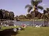 Warm Mineral Springs |
November 28, 1977 (#77000408) |
12200 San Servando Ave. 27°03′35″N 82°15′38″W |
North Port | Part of the Sarasota School of Architecture MPS |
| 92 | Warm Mineral Springs Building Complex | 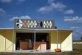 Warm Mineral Springs Building Complex |
November 28, 1977 (#100004352) |
12200 San Servando Ave. 27°03′35″N 82°15′38″W |
North Port | Part of the Sarasota School of Architecture MPS |
| 93 | Warm Mineral Springs Motel | 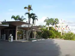 Warm Mineral Springs Motel |
February 5, 2013 (#12001255) |
12597 South Tamiami Trail 27°02′51″N 82°15′43″W |
North Port | Part of the Sarasota School of Architecture MPS |
| 94 | J. G. Whitfield Estate | 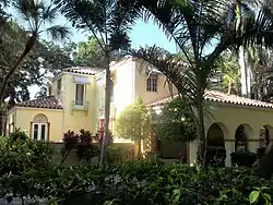 J. G. Whitfield Estate |
September 12, 1985 (#85002177) |
2704 Bayshore Drive 27°21′35″N 82°33′17″W |
Sarasota | |
| 95 | H. B. William House | 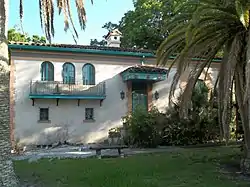 H. B. William House |
March 22, 1984 (#84003848) |
1509 South Orange Avenue 27°19′10″N 82°32′16″W |
Sarasota | Part of the Sarasota MRA |
| 96 | Dr. C. B. Wilson House | 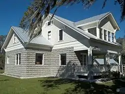 Dr. C. B. Wilson House |
March 22, 1984 (#84003849) |
235 South Orange Avenue 27°20′04″N 82°32′18″W |
Sarasota | Part of the Sarasota MRA |
| 97 | Worth's Block | 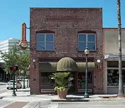 Worth's Block |
June 3, 1998 (#98000651) |
1490 Main Street 27°20′09″N 82°32′27″W |
Sarasota |
Former listings
| [3] | Name on the Register | Image | Date listed | Date removed | Location | City or town | Summary |
|---|---|---|---|---|---|---|---|
| 1 | Atlantic Coast Line Passenger Depot |  Atlantic Coast Line Passenger Depot |
March 22, 1984 (#84000957) | July 25, 2018 | 1 South School Avenue 27°20′08″N 82°31′36″W |
Sarasota | Part of the Sarasota MRA |
See also
| Wikimedia Commons has media related to National Register of Historic Places in Sarasota County, Florida. |
References
- The latitude and longitude information provided in this table was derived originally from the National Register Information System, which has been found to be fairly accurate for about 99% of listings. Some locations in this table may have been corrected to current GPS standards.
- "National Register of Historic Places: Weekly List Actions". National Park Service, United States Department of the Interior. Retrieved on February 5, 2021.
- Numbers represent an alphabetical ordering by significant words. Various colorings, defined here, differentiate National Historic Landmarks and historic districts from other NRHP buildings, structures, sites or objects.
- "National Register Information System". National Register of Historic Places. National Park Service. March 13, 2009.
- The eight-digit number below each date is the number assigned to each location in the National Register Information System database, which can be viewed by clicking the number.
Municipalities and communities of Sarasota County, Florida, United States | ||
|---|---|---|
| Cities | | |
| Town | ||
| CDPs | ||
| Unincorporated communities | ||
| Footnotes | ‡This populated place also has portions in an adjacent county or counties, †This populated place also has portions in the City of North Port | |
| ||
This article is issued from Wikipedia. The text is licensed under Creative Commons - Attribution - Sharealike. Additional terms may apply for the media files.