National Register of Historic Places listings in Hillsborough County, Florida
This is a list of the National Register of Historic Places listings in Hillsborough County, Florida.
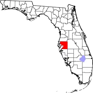
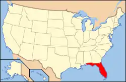
Location of Hillsborough County in Florida
This is intended to be a complete list of the properties and districts on the National Register of Historic Places in Hillsborough County, Florida. The locations of National Register properties and districts for which the latitude and longitude coordinates are included below, may be seen in a map.[1]
There are 99 properties and districts listed on the National Register in the county, including 3 National Historic Landmarks, all three of which are in Tampa. 21 of these properties and districts are listed here, while the others are listed separately in National Register of Historic Places listings in Tampa, Florida.
- This National Park Service list is complete through NPS recent listings posted February 5, 2021.[2]
| Alachua - Baker - Bay - Bradford - Brevard - Broward - Calhoun - Charlotte - Citrus - Clay - Collier - Columbia - DeSoto - Dixie - Duval - Escambia - Flagler - Franklin - Gadsden - Gilchrist - Glades - Gulf - Hamilton - Hardee - Hendry - Hernando - Highlands - Hillsborough (Tampa) - Holmes - Indian River - Jackson - Jefferson - Lafayette - Lake - Lee - Leon - Levy - Liberty - Madison - Manatee - Marion - Martin - Miami-Dade (Miami) - Monroe - Nassau - Okaloosa - Okeechobee - Orange - Osceola - Palm Beach - Pasco - Pinellas - Polk - Putnam - St. Johns - St. Lucie - Santa Rosa - Sarasota - Seminole - Sumter - Suwannee - Taylor - Union - Volusia - Wakulla - Walton - Washington |
Current listings
| [3] | Name on the Register[4] | Image | Date listed[5] | Location | City or town | Description |
|---|---|---|---|---|---|---|
| 1 | Bing Rooming House |  Bing Rooming House |
September 14, 2002 (#02001009) |
205 South Allen Street 28°00′57″N 82°06′58″W |
Plant City | |
| 2 | Cockroach Key |  Cockroach Key |
December 4, 1973 (#73000579) |
Address Restricted |
Ruskin | |
| 3 | A. P. Dickman House | 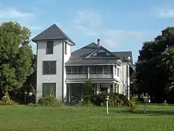 A. P. Dickman House |
July 14, 2000 (#00000786) |
120 Dickman Drive, Southeast 27°43′02″N 82°26′10″W |
Ruskin | |
| 4 | Downtown Plant City Commercial District | 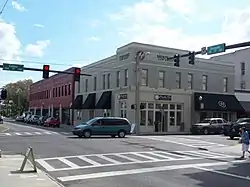 Downtown Plant City Commercial District |
June 8, 1993 (#93000478) |
Bounded by Baker and Wheeler Streets and the former Seaboard Coast Line railroad tracks 28°00′56″N 82°07′25″W |
Plant City | |
| 5 | Downtown Plant City Historic Residential District |  Downtown Plant City Historic Residential District |
August 12, 1998 (#98000965) |
Bounded by North Drane, Thomas, West Tever, Franklin, and Carey Streets 28°01′10″N 82°07′50″W |
Plant City | |
| 6 | Egmont Key |  Egmont Key |
December 11, 1978 (#78000946) |
West of Tampa at the entrance to Tampa Bay 27°35′24″N 82°45′46″W |
Tampa Bay | |
| 7 | Fort Foster | 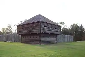 Fort Foster |
June 13, 1972 (#72000324) |
15402 U.S. 301 N. 28°09′01″N 82°13′14″W |
Thonotosassa | |
| 8 | Glover School | 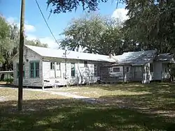 Glover School |
November 29, 2001 (#01001307) |
5110 Horton Road, Bealsville 27°56′33″N 82°04′44″W |
Plant City | |
| 9 | Hillsboro State Bank Building | 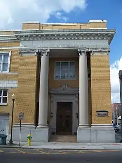 Hillsboro State Bank Building |
August 1, 1984 (#84000868) |
121 North Collins Street 28°00′57″N 82°06′50″W |
Plant City | |
| 10 | Historic Turkey Creek High School | 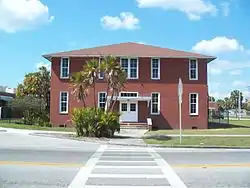 Historic Turkey Creek High School |
March 2, 2001 (#01000177) |
5005 Turkey Creek Road, South 27°56′47″N 82°10′17″W |
Plant City | |
| 11 | A. M. Lamb House | 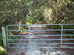 A. M. Lamb House |
October 12, 2007 (#07001049) |
2410 West Shell Road 27°43′15″N 82°27′44″W |
Ruskin | |
| 12 | George McA. Miller House | 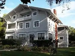 George McA. Miller House |
July 23, 1974 (#74000630) |
508 Tamiami Trail 27°42′49″N 82°26′05″W |
Ruskin | |
| 13 | Moseley Homestead | 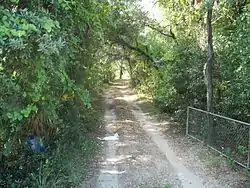 Moseley Homestead |
January 31, 1985 (#85000159) |
1820 West Brandon Boulevard 27°56′20″N 82°18′51″W |
Brandon | |
| 14 | North Plant City Residential District |  North Plant City Residential District |
May 27, 1993 (#93000436) |
Bounded by Herring, Wheeler, Tever, and Palmer Streets 28°01′16″N 82°07′31″W |
Plant City | |
| 15 | Old Lutz Elementary School |  Old Lutz Elementary School |
August 15, 1996 (#96000852) |
18819 U.S. Route 41, North 28°08′51″N 82°27′43″W |
Lutz | |
| 16 | Plant City High School |  Plant City High School |
February 4, 1981 (#81000194) |
North Collins Street 28°01′09″N 82°07′36″W |
Plant City | |
| 17 | Plant City Union Depot | 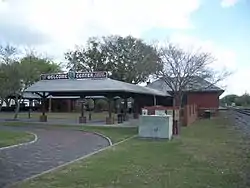 Plant City Union Depot |
April 14, 1975 (#75000558) |
East North Drane Street 28°00′55″N 82°07′18″W |
Plant City | |
| 18 | Standard Oil Service Station |  Standard Oil Service Station |
September 6, 1996 (#96000974) |
1111 North Wheeler Street 28°01′29″N 82°07′35″W |
Plant City | |
| 19 | Temple Terrace Golf Course |  Temple Terrace Golf Course |
October 30, 2012 (#12000888) |
200 Inverness Avenue 28°02′13″N 82°23′07″W |
Temple Terrace | |
| 20 | U.S.S. Narcissus (tugboat) Shipwreck | October 15, 2018 (#100003048) |
2.75 mi. NW of Egmont Key 27°37′28″N 82°48′03″W |
Fort DeSoto vicinity | Florida's twelfth Underwater Archaeological Preserve | |
| 21 | Upper Tampa Bay Archeological District |  Upper Tampa Bay Archeological District |
December 10, 1985 (#85003330) |
Address Restricted 28°00′48″N 82°38′05″W |
Town 'N' Country |
See also
References
- The latitude and longitude information provided in this table was derived originally from the National Register Information System, which has been found to be fairly accurate for about 99% of listings. Some locations in this table may have been corrected to current GPS standards.
- "National Register of Historic Places: Weekly List Actions". National Park Service, United States Department of the Interior. Retrieved on February 5, 2021.
- Numbers represent an alphabetical ordering by significant words. Various colorings, defined here, differentiate National Historic Landmarks and historic districts from other NRHP buildings, structures, sites or objects.
- "National Register Information System". National Register of Historic Places. National Park Service. March 13, 2009.
- The eight-digit number below each date is the number assigned to each location in the National Register Information System database, which can be viewed by clicking the number.
| Wikimedia Commons has media related to National Register of Historic Places in Hillsborough County, Florida. |
This article is issued from Wikipedia. The text is licensed under Creative Commons - Attribution - Sharealike. Additional terms may apply for the media files.