National Register of Historic Places listings in Hendry County, Florida
This is a list of the National Register of Historic Places listings in Hendry County, Florida.
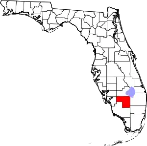
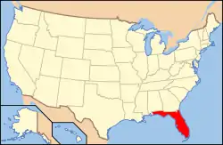
Location of Hendry County in Florida
This is intended to be a complete list of the properties and districts on the National Register of Historic Places in Hendry County, Florida, United States. The locations of National Register properties and districts for which the latitude and longitude coordinates are included below, may be seen in a map.[1]
There are 12 properties and districts listed on the National Register in the county.
- This National Park Service list is complete through NPS recent listings posted January 29, 2021.[2]
| Alachua - Baker - Bay - Bradford - Brevard - Broward - Calhoun - Charlotte - Citrus - Clay - Collier - Columbia - DeSoto - Dixie - Duval - Escambia - Flagler - Franklin - Gadsden - Gilchrist - Glades - Gulf - Hamilton - Hardee - Hendry - Hernando - Highlands - Hillsborough (Tampa) - Holmes - Indian River - Jackson - Jefferson - Lafayette - Lake - Lee - Leon - Levy - Liberty - Madison - Manatee - Marion - Martin - Miami-Dade (Miami) - Monroe - Nassau - Okaloosa - Okeechobee - Orange - Osceola - Palm Beach - Pasco - Pinellas - Polk - Putnam - St. Johns - St. Lucie - Santa Rosa - Sarasota - Seminole - Sumter - Suwannee - Taylor - Union - Volusia - Wakulla - Walton - Washington |
Current listings
| [3] | Name on the Register[4] | Image | Date listed[5] | Location | City or town | Description |
|---|---|---|---|---|---|---|
| 1 | Caldwell Home Place | 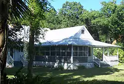 Caldwell Home Place |
February 13, 2003 (#03000009) |
160 Curry Street 26°46′01″N 81°26′29″W |
LaBelle | Part of the LaBelle, FL MPS |
| 2 | Clewiston Historic Schools |  Clewiston Historic Schools |
September 26, 1997 (#97001172) |
325 East Circle Drive and 475 East Osceola Avenue 26°45′21″N 80°55′42″W |
Clewiston | |
| 3 | Clewiston Inn | 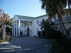 Clewiston Inn |
February 21, 1991 (#91000106) |
U.S. Route 27 west of its junction with State Road 832 26°45′35″N 80°56′20″W |
Clewiston | |
| 4 | Dixie Crystal Theatre |  Dixie Crystal Theatre |
September 25, 1998 (#98001202) |
100 East Sugarland Highway 26°45′14″N 80°56′04″W |
Clewiston | |
| 5 | Downtown LaBelle Historic District | 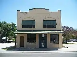 Downtown LaBelle Historic District |
March 25, 1999 (#99000371) |
300 block of North Bridge Street 26°45′59″N 81°26′15″W |
LaBelle | |
| 6 | Capt. F. Deane Duff House |  Capt. F. Deane Duff House |
January 30, 1998 (#98000025) |
151 West Del Monte Avenue 26°45′41″N 80°56′02″W |
Clewiston | |
| 7 | Executive House | 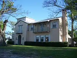 Executive House |
February 5, 1998 (#98000059) |
125 West Del Monte Avenue 26°45′44″N 80°55′58″W |
Clewiston | |
| 8 | First Clewiston Post Office |  First Clewiston Post Office |
March 7, 2017 (#100000710) |
111–113 Bond St. 26°45′13″N 80°56′00″W |
Clewiston | |
| 9 | Forrey Building and Annex | 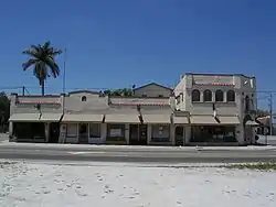 Forrey Building and Annex |
July 28, 1995 (#95000914) |
264-282 Bridge Street 26°45′56″N 81°26′16″W |
LaBelle | |
| 10 | Capt. Francis A. Hendry House |  Capt. Francis A. Hendry House |
February 5, 1998 (#98000061) |
512 Fraser Street 26°45′55″N 81°26′46″W |
LaBelle | |
| 11 | Old Hendry County Courthouse | 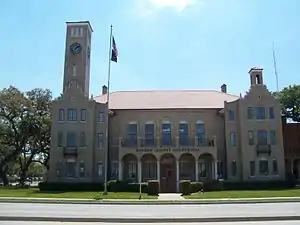 Old Hendry County Courthouse |
November 8, 1990 (#90001744) |
Junction of Bridge Street and Hickpochee Avenue 26°45′40″N 81°26′17″W |
LaBelle | |
| 12 | Scharnberg House |  Scharnberg House |
April 26, 1999 (#99000472) |
325 East Del Monte Avenue 26°45′37″N 80°55′49″W |
Clewiston |
See also
| Wikimedia Commons has media related to National Register of Historic Places in Hendry County, Florida. |
References
- The latitude and longitude information provided in this table was derived originally from the National Register Information System, which has been found to be fairly accurate for about 99% of listings. Some locations in this table may have been corrected to current GPS standards.
- "National Register of Historic Places: Weekly List Actions". National Park Service, United States Department of the Interior. Retrieved on January 29, 2021.
- Numbers represent an alphabetical ordering by significant words. Various colorings, defined here, differentiate National Historic Landmarks and historic districts from other NRHP buildings, structures, sites or objects.
- "National Register Information System". National Register of Historic Places. National Park Service. March 13, 2009.
- The eight-digit number below each date is the number assigned to each location in the National Register Information System database, which can be viewed by clicking the number.
Municipalities and communities of Hendry County, Florida, United States | ||
|---|---|---|
| Cities | | |
| CDPs | ||
| Indian reservation | ||
| Unincorporated community | ||
| Footnotes | ‡This populated place also has portions in an adjacent county or counties | |
| ||
This article is issued from Wikipedia. The text is licensed under Creative Commons - Attribution - Sharealike. Additional terms may apply for the media files.