National Register of Historic Places listings in Okaloosa County, Florida
This is a list of the National Register of Historic Places listings in Okaloosa County, Florida.
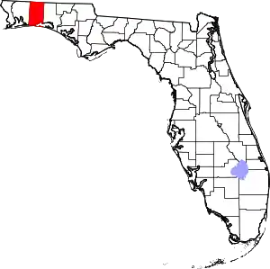
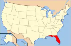
Location of Okaloosa County in Florida
This is intended to be a complete list of the properties and districts on the National Register of Historic Places in Okaloosa County, Florida, United States. The locations of National Register properties and districts for which the latitude and longitude coordinates are included below, may be seen in a map.[1]
There are 9 properties and districts listed on the National Register in the county, including 1 National Historic Landmark. Another property was once listed but has been removed.
- This National Park Service list is complete through NPS recent listings posted January 29, 2021.[2]
| Alachua - Baker - Bay - Bradford - Brevard - Broward - Calhoun - Charlotte - Citrus - Clay - Collier - Columbia - DeSoto - Dixie - Duval - Escambia - Flagler - Franklin - Gadsden - Gilchrist - Glades - Gulf - Hamilton - Hardee - Hendry - Hernando - Highlands - Hillsborough (Tampa) - Holmes - Indian River - Jackson - Jefferson - Lafayette - Lake - Lee - Leon - Levy - Liberty - Madison - Manatee - Marion - Martin - Miami-Dade (Miami) - Monroe - Nassau - Okaloosa - Okeechobee - Orange - Osceola - Palm Beach - Pasco - Pinellas - Polk - Putnam - St. Johns - St. Lucie - Santa Rosa - Sarasota - Seminole - Sumter - Suwannee - Taylor - Union - Volusia - Wakulla - Walton - Washington |
Current listings
| [3] | Name on the Register[4] | Image | Date listed[5] | Location | City or town | Description |
|---|---|---|---|---|---|---|
| 1 | Camp Pinchot Historic District | Camp Pinchot Historic District |
October 22, 1998 (#98001255) |
Eglin Air Force Base, roughly east bank Garnier's Bayou, approximately ½ mile north of Fort Walton Beach 30°28′13″N 86°35′38″W |
Fort Walton Beach | |
| 2 | Crestview Commercial Historic District | 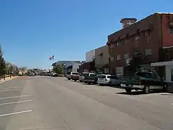 Crestview Commercial Historic District |
July 20, 2006 (#06000620) |
Roughly bounded by Industrial Drive, North Ferdon Boulevard, North Wilson Street, and James Lee Boulevard 30°45′33″N 86°34′15″W |
Crestview | |
| 3 | Eglin Field Historic District |  Eglin Field Historic District |
October 22, 1998 (#98001254) |
Eglin Air Force Base, roughly bounded by Barranca, Choctawhatchee, Fourth, and "F" Avenues 30°28′58″N 86°29′30″W |
Fort Walton Beach | |
| 4 | Fort Walton Mound | 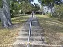 Fort Walton Mound |
October 15, 1966 (#66000268) |
139 Miracle Strip Parkway Southeast 30°24′13″N 86°36′27″W |
Fort Walton Beach | |
| 5 | Gulfview Hotel Historic District |  Gulfview Hotel Historic District |
October 22, 1992 (#92001402) |
12 Miracle Strip Parkway Southeast 30°24′12″N 86°36′45″W |
Fort Walton Beach | |
| 6 | McKinley Climatic Laboratory |  McKinley Climatic Laboratory |
October 6, 1997 (#97001145) |
Building 440 at Eglin Air Force Base 30°28′33″N 86°30′27″W |
Fort Walton Beach | |
| 7 | Operation Crossbow Site | October 22, 1998 (#98001256) |
Address Restricted |
Eglin Air Force Base | ||
| 8 | World War II JB-2 Launch Site | 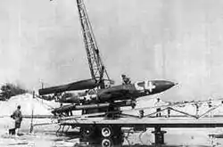 World War II JB-2 Launch Site |
April 19, 1996 (#96000395) |
Address Restricted |
Fort Walton Beach | |
| 9 | World War II JB-2 Mobile Launch Site | 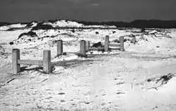 World War II JB-2 Mobile Launch Site |
April 17, 1996 (#96000394) |
Address Restricted |
Fort Walton Beach |
Former listing
| [3] | Name on the Register | Image | Date listed | Date removed | Location | City or town | Summary |
|---|---|---|---|---|---|---|---|
| 1 | Valparaiso Inn | August 1, 1978 (#78000954) | 1981 | 331 Bayshore Dr. 30°30′02″N 86°29′36″W |
Valparaiso | Severely damaged in a fire March 2, 1977. Completely destroyed by a second fire October 25, 1980. |
See also
| Wikimedia Commons has media related to National Register of Historic Places in Okaloosa County, Florida. |
References
- The latitude and longitude information provided in this table was derived originally from the National Register Information System, which has been found to be fairly accurate for about 99% of listings. Some locations in this table may have been corrected to current GPS standards.
- "National Register of Historic Places: Weekly List Actions". National Park Service, United States Department of the Interior. Retrieved on January 29, 2021.
- Numbers represent an alphabetical ordering by significant words. Various colorings, defined here, differentiate National Historic Landmarks and historic districts from other NRHP buildings, structures, sites or objects.
- "National Register Information System". National Register of Historic Places. National Park Service. March 13, 2009.
- The eight-digit number below each date is the number assigned to each location in the National Register Information System database, which can be viewed by clicking the number.
Municipalities and communities of Okaloosa County, Florida, United States | ||
|---|---|---|
| Cities | | |
| Towns | ||
| CDPs | ||
| Unincorporated communities | ||
| Ghost towns | ||
| ||
This article is issued from Wikipedia. The text is licensed under Creative Commons - Attribution - Sharealike. Additional terms may apply for the media files.