National Register of Historic Places listings in Fairbanks North Star Borough, Alaska
This is a list of the National Register of Historic Places listings in Fairbanks North Star Borough, Alaska.
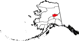
Location of the Fairbanks North Star Borough in Alaska.
This is intended to be a complete list of the properties and districts on the National Register of Historic Places in Fairbanks North Star Borough, Alaska, United States. The locations of National Register properties and districts for which the latitude and longitude coordinates are included below, may be seen in an online map.[1]
There are 31 properties and districts listed on the National Register in the borough, including 3 National Historic Landmarks.
- This National Park Service list is complete through NPS recent listings posted February 5, 2021.[2]
Current listings
| [3] | Name on the Register[4] | Image | Date listed[5] | Location | City or town | Description |
|---|---|---|---|---|---|---|
| 1 | Chatanika Gold Camp | 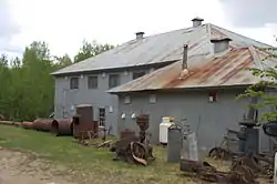 Chatanika Gold Camp |
October 16, 1979 (#79003753) |
Mile 27¾ on the Steese Highway 65°06′42″N 147°28′49″W |
Chatanika | |
| 2 | Chena Pump House | 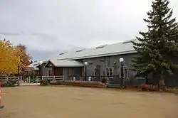 Chena Pump House |
March 17, 1982 (#82004900) |
796 Chena Pump Road 64°49′53″N 147°53′05″W |
Fairbanks | |
| 3 | Chugwater Site | November 23, 1979 (#79003754) |
On Moose Creek Bluff, 35 kilometres (22 mi) southeast of Fairbanks[6] 64°41′30″N 147°13′05″W |
North Pole | ||
| 4 | Old City Hall | 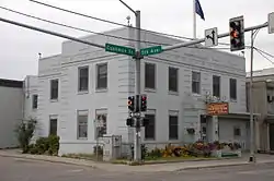 Old City Hall |
May 30, 2002 (#02000561) |
410 Cushman Street 64°50′30″N 147°43′15″W |
Fairbanks | |
| 5 | Clay Street Cemetery | 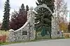 Clay Street Cemetery |
October 25, 1982 (#82001619) |
7th Avenue and Clay Street 64°50′30″N 147°42′27″W |
Fairbanks | |
| 6 | Constitution Hall | 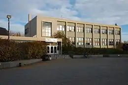 Constitution Hall |
November 3, 2005 (#05001196) |
University of Alaska Fairbanks campus 64°51′27″N 147°49′19″W |
Fairbanks | |
| 7 | Mary Lee Davis House |  Mary Lee Davis House |
September 30, 1982 (#82004901) |
410 Cowles Street 64°50′36″N 147°43′52″W |
Fairbanks | |
| 8 | Discovery Claim on Pedro Creek | .JPG.webp) Discovery Claim on Pedro Creek |
May 13, 1992 (#92000498) |
Mile 16.5 on the Steese Highway 65°00′32″N 147°29′51″W |
Fairbanks | |
| 9 | Ester Camp Historic District | 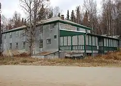 Ester Camp Historic District |
May 6, 1987 (#87000703) |
Off Alaska Route 3 64°50′48″N 148°01′10″W |
Ester | |
| 10 | F.E. Company Housing | 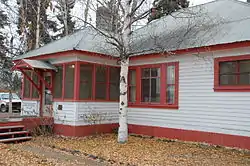 F.E. Company Housing |
May 9, 1997 (#97000400) |
505, 507, 521, and 523 Illinois Street 64°51′02″N 147°43′06″W |
Fairbanks | |
| 11 | F.E. Company Machine Shop | 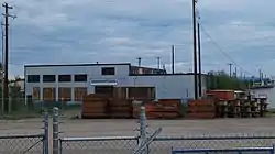 F.E. Company Machine Shop |
October 12, 1995 (#95001164) |
behind 612 Illinois Street 64°51′07″N 147°43′20″W |
Fairbanks | |
| 12 | F.E. Company Manager's House | 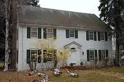 F.E. Company Manager's House |
February 16, 1996 (#96000095) |
757 Illinois Street 64°51′11″N 147°42′58″W |
Fairbanks | |
| 13 | F.E. Company Dredge No. 2 | June 30, 1999 (#99000763) |
Fish Creek 65°02′35″N 147°05′37″W |
Fairbanks | ||
| 14 | F.E. Company Gold Dredge No. 5 | March 18, 2004 (#04000186) |
Upper Dome Creek 65°01′47″N 147°34′35″W |
Fairbanks | Scrapped c. 2012. | |
| 15 | Federal Building | 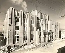 Federal Building |
August 2, 1978 (#78003422) |
250 Cushman Street 64°50′35″N 147°43′17″W |
Fairbanks | |
| 16 | Goldstream Dredge No. 8 | .jpg.webp) Goldstream Dredge No. 8 |
February 28, 1984 (#84000637) |
1755 Old Steese Highway North 64°56′14″N 147°39′28″W |
Fairbanks | |
| 17 | Harding Railroad Car | 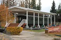 Harding Railroad Car |
April 6, 1978 (#78003423) |
Pioneer Park, 2300 Airport Way 64°50′17″N 147°46′20″W |
Fairbanks | Pullman passenger-observation car Denali (Alaska Railroad No. X-336) |
| 18 | Hinckley-Creamer Dairy |  Hinckley-Creamer Dairy |
April 13, 1977 (#77001572) |
At end of Creamer Lane, in Creamer's Field Migratory Waterfowl Refuge 64°51′51″N 147°44′16″W |
Fairbanks | |
| 19 | Illinois Street Historic District | 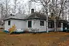 Illinois Street Historic District |
September 14, 2001 (#01000966) |
300-700 Illinois Street 64°50′59″N 147°43′12″W |
Fairbanks | |
| 20 | Immaculate Conception Church | .jpg.webp) Immaculate Conception Church |
April 3, 1976 (#76002278) |
115 North Cushman Street 64°50′43″N 147°43′18″W |
Fairbanks | |
| 21 | Falcon Joslin House | 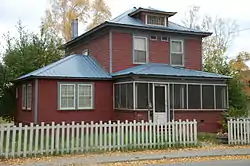 Falcon Joslin House |
April 29, 1980 (#80004567) |
413 Cowles Street 64°50′35″N 147°43′49″W |
Fairbanks | |
| 22 | Lacey Street Theatre | .JPG.webp) Lacey Street Theatre |
June 14, 1990 (#90000878) |
504 Second Avenue 64°50′38″N 147°43′04″W |
Fairbanks | |
| 23 | Ladd Field | 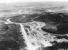 Ladd Field |
February 4, 1985 (#85002730) |
Fort Wainwright 64°49′54″N 147°36′58″W |
Fairbanks | |
| 24 | Main School | 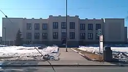 Main School |
September 27, 1990 (#90001472) |
800 Cushman Street 64°50′23″N 147°43′16″W |
Fairbanks | Now Fairbanks City Hall. |
| 25 | Nenana (steamer) | _Fairbanks%252C_Alaska.jpg.webp) Nenana (steamer) |
June 27, 1972 (#72001581) |
Pioneer Park, 2300 Airport Way 64°50′19″N 147°46′20″W |
Fairbanks | |
| 26 | Oddfellows Hall | 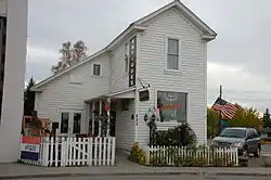 Oddfellows Hall |
June 3, 1980 (#80004569) |
825 First Avenue 64°50′40″N 147°43′39″W |
Fairbanks | |
| 27 | Rainey's Cabin | 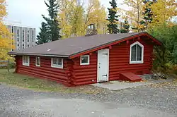 Rainey's Cabin |
November 20, 1975 (#75002158) |
University of Alaska campus 64°51′32″N 147°49′54″W |
College | |
| 28 | Rose Building | 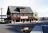 Rose Building |
May 11, 1992 (#92000444) |
Illinois and Church Streets 64°50′47″N 147°43′20″W |
Fairbanks | Building demolished in 1998, before the start of urban improvements to Illinois Street; mitigation for the removal of the building was used to restore other historical properties in Fairbanks.[7][8]
AHRS# FAI-280[9] |
| 29 | St. Matthew's Episcopal Church | 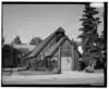 St. Matthew's Episcopal Church |
February 12, 2016 (#16000001) |
1029 First Avenue 64°50′45″N 147°43′51″W |
Fairbanks | AHRS# FAI-00110[10] |
| 30 | George C. Thomas Memorial Library | 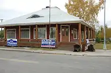 George C. Thomas Memorial Library |
February 23, 1972 (#72001542) |
901 First Avenue 64°50′41″N 147°43′41″W |
Fairbanks | |
| 31 | Wickersham House | 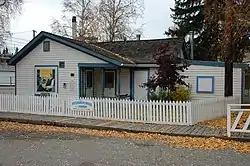 Wickersham House |
April 27, 1979 (#79003757) |
Pioneer Park, 2300 Airport Way 64°50′19″N 147°46′17″W |
Fairbanks |
Former listings
| [3] | Name on the Register | Image | Date listed | Date removed | Location | City or town | Summary |
|---|---|---|---|---|---|---|---|
| 1 | Masonic Temple | .jpg.webp) Masonic Temple |
June 3, 1980 (#80004568) | August 16, 2018 | 809 First Avenue 64°50′39″N 147°43′36″W |
Fairbanks | Roof collapsed on March 17, 2018, and the remainder was demolished the next day. |
See also
| Wikimedia Commons has media related to National Register of Historic Places in Fairbanks North Star Borough, Alaska. |
References
- The latitude and longitude information provided in this table was derived originally from the National Register Information System, which has been found to be fairly accurate for about 99% of listings. Some locations in this table may have been corrected to current GPS standards.
- "National Register of Historic Places: Weekly List Actions". National Park Service, United States Department of the Interior. Retrieved on February 5, 2021.
- Numbers represent an alphabetical ordering by significant words. Various colorings, defined here, differentiate National Historic Landmarks and historic districts from other NRHP buildings, structures, sites or objects.
- "National Register Information System". National Register of Historic Places. National Park Service. April 24, 2008.
- The eight-digit number below each date is the number assigned to each location in the National Register Information System database, which can be viewed by clicking the number.
- Location derived from Lively, Ralph. "Chugwater" in American Beginnings: The Prehistory and Palaeoecology of Beringia, Frank Hadleigh West, ed. Chicago: U of Chicago P, 1996, 308. The NRIS lists the site as "Address Restricted".
- US Department of Transportation, Federal Highway Administration and State of Alaska (April 27, 2005). "Illinois Street Reconstruction Project - Environmental Assessment" (PDF). Retrieved May 16, 2017.
- "Historic Rose building disappears from corner" was published in the Fairbanks Daily News-Miner on September 13, 1998 on page B1.
- "NRHP nomination for Rose Building". National Park Service. Retrieved May 17, 2017.
- "Commission on Historic Preservation - Special Meeting Agenda" (PDF). December 1, 2015. Retrieved May 17, 2017.
| Topics | |
|---|---|
| Lists by state |
|
| Lists by insular areas | |
| Lists by associated state | |
| Other areas | |
| Related | |
| |
Boroughs | .svg.png.webp) | ||
Census areas | |||
There are no sites listed on the National Register of Historic Places in Kusilvak Census Area. | |||
Municipalities and communities of Fairbanks North Star Borough, Alaska, United States | ||
|---|---|---|
| Cities | Fairbanks North Star Borough map | |
| CDPs | ||
| Unincorporated communities | ||
| Ghost town | ||
| ||
This article is issued from Wikipedia. The text is licensed under Creative Commons - Attribution - Sharealike. Additional terms may apply for the media files.