National Register of Historic Places listings in Southeast Fairbanks Census Area, Alaska
This is a list of the National Register of Historic Places listings in Southeast Fairbanks Census Area, Alaska.
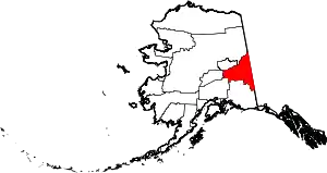
Location of the Southeast Fairbanks Census Area in Alaska
This is intended to be a complete list of the properties and districts on the National Register of Historic Places in Southeast Fairbanks Census Area, Alaska, United States. The locations of National Register properties and districts for which the latitude and longitude coordinates are included below, may be seen in a Google map.[1]
There are 12 properties and districts listed on the National Register in the census area, including 1 National Historic Landmark.
- This National Park Service list is complete through NPS recent listings posted February 5, 2021.[2]
Current listings
| [3] | Name on the Register[4] | Image | Date listed[5] | Location | City or town | Description |
|---|---|---|---|---|---|---|
| 1 | Alaska-Canada Military Highway (Segment) | 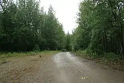 Alaska-Canada Military Highway (Segment) |
July 31, 2013 (#13000543) |
West of Alaska Highway, about 37 miles (60 km) southeast of Delta Junction 63°43′53″N 144°42′02″W |
Delta Junction | Now part of the access road to Craig Lake |
| 2 | Big Delta Historic District | 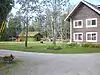 Big Delta Historic District |
March 20, 1991 (#91000252) |
Mile 274.5 of Richardson Highway at the junction of the Delta and Tanana Rivers 64°09′17″N 145°50′24″W |
Big Delta | |
| 3 | Chicken Historic District | 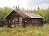 Chicken Historic District |
September 30, 2001 (#01001053) |
Mile 66.5 of Taylor Highway 64°04′29″N 141°55′56″W |
Chicken | |
| 4 | Chisana Historic Mining Landscape | 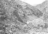 Chisana Historic Mining Landscape |
May 14, 1998 (#98000436) |
Vicinity of Chisana and Gold Hill[6][7] 62°06′10″N 141°53′58″W |
Northway | Also partly comprised in Valdez–Cordova Census Area |
| 5 | Eagle Historic District | 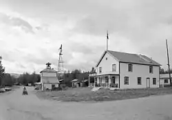 Eagle Historic District |
October 27, 1970 (#70000919) |
Roughly the town of Eagle and the area of Fort Egbert 64°47′28″N 141°12′56″W |
Eagle | |
| 6 | F.E. Company Dredge No. 4 | 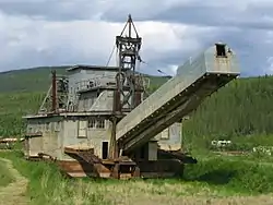 F.E. Company Dredge No. 4 |
May 18, 2006 (#06000435) |
Along Airport Road, south of mile 66.4 of Taylor Highway 64°04′11″N 141°56′19″W |
Chicken | |
| 7 | The Kink | 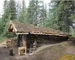 The Kink |
November 20, 1975 (#75002161) |
Along the North Fork Fortymile River, about 21.5 miles (34.6 km) north of Chicken 64°23′08″N 142°01′38″W |
Chicken | |
| 8 | Rapids Roadhouse | 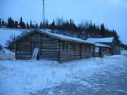 Rapids Roadhouse |
February 2, 2001 (#01000021) |
Mile 227.4 of Richardson Highway, about 35 miles (56 km) south of Delta Junction 63°31′46″N 145°51′31″W |
Delta Junction | |
| 9 | Rika's Landing Roadhouse | 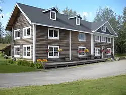 Rika's Landing Roadhouse |
September 1, 1976 (#76000364) |
Mile 274.5 of Richardson Highway near the junction of the Delta and Tanana Rivers 64°09′19″N 145°50′26″W |
Big Delta | |
| 10 | Steele Creek Roadhouse | 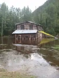 Steele Creek Roadhouse |
April 29, 1980 (#80004576) |
South side of Fortymile River, about 24 miles (39 km) northeast of Chicken, Alaska 64°16′17″N 141°17′14″W |
Chicken | |
| 11 | Sullivan Roadhouse | 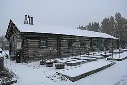 Sullivan Roadhouse |
August 10, 1979 (#79003756) |
266 Richardson Highway 64°02′08″N 145°43′51″W |
Delta Junction | |
| 12 | Swan Point Archaeological Site | 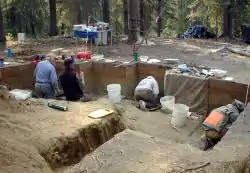 Swan Point Archaeological Site |
September 26, 2008 (#08000929) |
Northern edge of the Shaw Creek Flats, 90 kilometres (56 mi) southeast of Fairbanks[8] 63°18′00″N 146°02′00″W |
Big Delta |
See also
| Wikimedia Commons has media related to National Register of Historic Places in Southeast Fairbanks Census Area, Alaska. |
References
- The latitude and longitude information provided in this table was derived originally from the National Register Information System, which has been found to be fairly accurate for about 99% of listings. Some locations in this table may have been corrected to current GPS standards.
- "National Register of Historic Places: Weekly List Actions". National Park Service, United States Department of the Interior. Retrieved on February 5, 2021.
- Numbers represent an alphabetical ordering by significant words. Various colorings, defined here, differentiate National Historic Landmarks and historic districts from other NRHP buildings, structures, sites or objects.
- "National Register Information System". National Register of Historic Places. National Park Service. April 24, 2008.
- The eight-digit number below each date is the number assigned to each location in the National Register Information System database, which can be viewed by clicking the number.
- Location derived from Fensterman, Greg. Hiking Alaska's Wrangell-St. Elias National Park and Preserve: From Day Hikes to Backcountry Treks. Guilford: Falcon, 2008, 5. The NRIS lists the site as "Address Restricted".
- Coordinates derived from the GNIS feature record for Gold Hill
- Location derived from Holmes, Charles, et al. "Swan Point" in American Beginnings: The Prehistory and Palaeoecology of Beringia, Frank Hadleigh West, ed. Chicago: U of Chicago P, 1996, 319. The NRIS lists the site as "Address Restricted".
| Topics | |
|---|---|
| Lists by state |
|
| Lists by insular areas | |
| Lists by associated state | |
| Other areas | |
| Related | |
| |
Boroughs | .svg.png.webp) | ||
Census areas | |||
There are no sites listed on the National Register of Historic Places in Kusilvak Census Area. | |||
Municipalities and communities of Southeast Fairbanks Census Area, Alaska, United States | ||
|---|---|---|
| Cities | Southeast Fairbanks Census Area map | |
| CDPs | ||
| Unincorporated communities | ||
| ||
This article is issued from Wikipedia. The text is licensed under Creative Commons - Attribution - Sharealike. Additional terms may apply for the media files.