National Register of Historic Places listings in Juneau, Alaska
This is a list of the National Register of Historic Places listings in Juneau, Alaska.
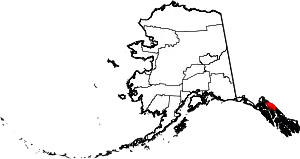
Location of Juneau in Alaska
This is intended to be a complete list of the properties and districts on the National Register of Historic Places in Juneau, Alaska, United States. The locations of National Register properties and districts for which the latitude and longitude coordinates are included below, may be seen in an online map.[1]
There are 23 properties and districts listed on the National Register in the city and borough, including 1 National Historic Landmark.
- This National Park Service list is complete through NPS recent listings posted February 5, 2021.[2]
Current listings
| [3] | Name on the Register[4] | Image | Date listed[5] | Location | Description |
|---|---|---|---|---|---|
| 1 | Alaska Governor's Mansion | 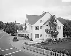 Alaska Governor's Mansion |
November 7, 1976 (#76000359) |
716 Calhoun Avenue 58°22′29″N 134°34′54″W |
|
| 2 | Alaska Steam Laundry | 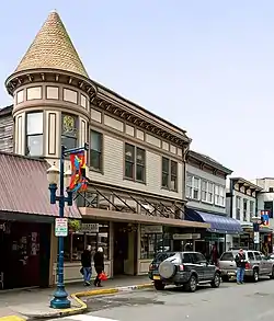 Alaska Steam Laundry |
February 17, 1978 (#78000527) |
174 South Franklin Street 58°18′00″N 134°24′19″W |
Also a contributing property to Juneau Downtown Historic District. |
| 3 | Alaskan Hotel | 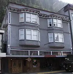 Alaskan Hotel |
October 25, 1978 (#78000526) |
167 South Franklin Street 58°18′01″N 134°24′18″W |
Also a contributing property to Juneau Downtown Historic District. |
| 4 | Bergmann Hotel | 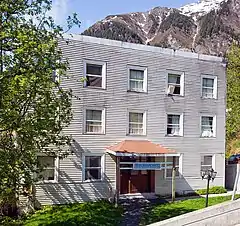 Bergmann Hotel |
July 28, 1977 (#77000217) |
434 3rd Street 58°18′10″N 134°24′22″W |
Condemned by city officials March 10, 2017 due to neglected maintenance and insect infestations.[6] |
| 5 | Chicken Ridge Historic District |  Chicken Ridge Historic District |
October 12, 1995 (#95000420) |
Roughly along Seventh Street, Goldbelt Avenue, Dixon Street, and Basin Road 58°18′14″N 134°24′39″W |
|
| 6 | J. M. Davis House | 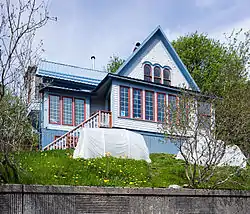 J. M. Davis House |
August 31, 1982 (#82002073) |
202 6th Street 58°18′12″N 134°24′40″W |
|
| 7 | Fort Durham Site | May 5, 1978 (#78000529) |
Near Taku Harbor |
||
| 8 | The Frances House | 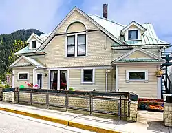 The Frances House |
June 7, 1985 (#85001187) |
137 Sixth Street 58°18′10″N 134°24′41″W |
|
| 9 | Fries Miners' Cabins | 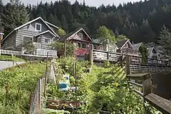 Fries Miners' Cabins |
September 8, 1988 (#88001347) |
501, 511, 517, 523, 525 and 535 Kennedy Street 58°18′16″N 134°24′20″W |
|
| 10 | Ernest Gruening Cabin | 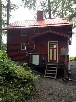 Ernest Gruening Cabin |
June 8, 1992 (#92000633) |
0.5 miles (0.80 km) west of Mile 26 Glacier Highway, northwest of Juneau 58°29′37″N 134°47′12″W |
|
| 11 | Holy Trinity Church | 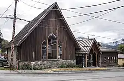 Holy Trinity Church |
October 19, 1978 (#78000528) |
325 Gold Street 58°18′10″N 134°24′25″W |
Destroyed by fire March 12, 2006[7][8] |
| 12 | Jualpa Mining Camp | 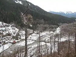 Jualpa Mining Camp |
August 5, 1993 (#93000733) |
1001 Basin Road 58°18′24″N 134°23′07″W |
Site hosting the Last Chance Mining Museum. |
| 13 | Juneau Downtown Historic District | 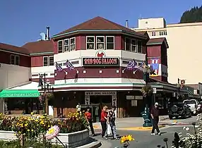 Juneau Downtown Historic District |
June 17, 1994 (#94000603) |
Roughly along South Franklin Street and Front Street 58°17′58″N 134°24′15″W |
|
| 14 | Juneau Memorial Library | 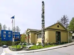 Juneau Memorial Library |
June 7, 2006 (#06000463) |
114 West Fourth Street 58°18′07″N 134°24′41″W |
Building now hosting the Juneau City Museum |
| 15 | MacKinnon Apartments | 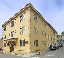 MacKinnon Apartments |
February 24, 2000 (#00000144) |
236 Third Street 58°18′07″N 134°24′30″W |
|
| 16 | Mayflower School | 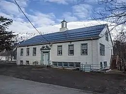 Mayflower School |
November 21, 1988 (#88002534) |
750 St Anns Ave., Douglas townsite, Douglas Island 58°16′31″N 134°23′32″W |
Building now hosting the Juneau Montessori School.[9] |
| 17 | Rudy-Kodzoff House | 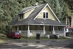 Rudy-Kodzoff House |
March 17, 2015 (#15000070) |
2865 Mendenhall Loop Road, C-0 58°22′29″N 134°34′54″W |
|
| 18 | St. Nicholas Russian Orthodox Church | 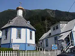 St. Nicholas Russian Orthodox Church |
September 19, 1973 (#73000377) |
326 Fifth Street 58°18′11″N 134°24′33″W |
|
| 19 | Sentinel Island Light Station | 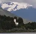 Sentinel Island Light Station |
December 2, 2002 (#02001407) |
Sentinel Island 58°32′47″N 134°55′24″W |
|
| 20 | Twin Glacier Camp | 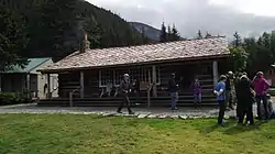 Twin Glacier Camp |
May 20, 1988 (#88000556) |
Along the Taku River 58°29′26″N 133°56′28″W |
Originally a hunting camp, now a tourist destination known as the Taku Glacier Lodge. |
| 21 | Valentine Building | 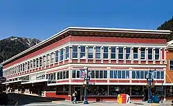 Valentine Building |
May 30, 1985 (#85001275) |
202 Front Street 58°18′03″N 134°24′26″W |
Also a contributing property to Juneau Downtown Historic District. |
| 22 | House of Wickersham | .jpg.webp) House of Wickersham |
November 21, 1976 (#76000360) |
213 Seventh Street 58°18′13″N 134°24′41″W |
Also a contributing property to Chicken Ridge Historic District |
| 23 | X'unaxi |  X'unaxi |
July 7, 2016 (#16000401) |
Indian Point 58°22′38″N 134°41′42″W |
AKA Auke Cape and Indian Point[10] |
See also
| Wikimedia Commons has media related to National Register of Historic Places in Juneau, Alaska. |
References
- The latitude and longitude information provided in this table was derived originally from the National Register Information System, which has been found to be fairly accurate for about 99% of listings. Some locations in this table may have been corrected to current GPS standards.
- "National Register of Historic Places: Weekly List Actions". National Park Service, United States Department of the Interior. Retrieved on February 5, 2021.
- Numbers represent an alphabetical ordering by significant words. Various colorings, defined here, differentiate National Historic Landmarks and historic districts from other NRHP buildings, structures, sites or objects.
- "National Register Information System". National Register of Historic Places. National Park Service. April 24, 2008.
- The eight-digit number below each date is the number assigned to each location in the National Register Information System database, which can be viewed by clicking the number.
- Hsieh, Jeremy (March 9, 2017). "CBJ: Bergmann Hotel shutdown and evictions imminent due to health and safety problems". Retrieved March 12, 2012.
- "Holy Trinity: A Brief History". Juneau, Alaska: Church of the Holy Trinity. Retrieved January 30, 2012.
- "On The Job: Alaska - Arson Fire Set in Boat Destroys Juneau Church". December 31, 2006. Retrieved May 19, 2017.
- "A History of Montessori in Juneau". Juneau Montessori School. Retrieved April 16, 2016.
- "X'unaxi". United States Forest Service. Retrieved 2018-06-30.
This article is issued from Wikipedia. The text is licensed under Creative Commons - Attribution - Sharealike. Additional terms may apply for the media files.

.svg.png.webp)
