Noklak district
Noklak is the youngest and the 12th district of Nagaland state in India, It was established on January 20, 2021. The district headquarter is in the town of Noklak.[3]
Noklak district | |
|---|---|
District | |
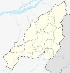 Noklak district  Noklak district | |
| Coordinates (Noklak): 26.2167°N 94.9919°E | |
| State | Nagaland |
| Country | India |
| Seat | Noklak |
| Area | |
| • Total | 1,152 km2 (445 sq mi) |
| Population (2011)[4] | |
| • Total | 59,300 |
| • Density | 51/km2 (130/sq mi) |
| Time zone | UTC+05:30 (IST) |
Geography
Noklak district covers an area of 1,152 km2.[5] Noklak district is a hilly region, with broad leaved forests.[3]
The climate is sub-tropical with a monsoon season.[3]
History
Noklak district was created on 21 December 2017 as the 12th district of Nagaland. The new district has the same boundaries as the former Noklak sub-division of Tuensang district.[6] Noklak sub-division contained the five admin circles of Noklak, Thonoknyu, Nokhu, Panso and Chingmei.[7][8]
Demands for upgrading the ADC office in Noklak town had been made by the Eastern Nagaland Peoples' Organisation in 2008.[9]
Administration
The district covers five taluks (administrative circles), which are Noklak, Thonoknyu, Nokhu, Panso and Chingmei.[8] While a subdivision of Tuensang an Additional Deputy Commissioner (ADC) office was located in Noklak circle, a Sub-Divisional Officer (SDO) was located in Thonoknyu circle, and Extra Assistant Commissioner EAC headquarters were located in Nokhu, Panso and Chingmei circles.[10]
There are also police stations in Noklak and Panso Headquarters and a police outpost at Thonoknyu. [11]
Noklak district contains two rural development blocks (RD blocks), which are Noklak, covering Noklak, Nokhu, Panso and Chingmei taluks, and Thonoknyu RDB covering just Thonoknyu taluk.[3]:68
The district will have two seats in the state legislature.[12][13]
Demographics
As of 2011 the 2011 census Noklak circle of Tuensang district had an entirely rural population of 19,507.[3]
Of the whole population approximately 52% were male, 48% female; 20% were children. 98% were from scheduled tribes, none were of any scheduled caste. The literacy rate across the Noklak district was 77% overall: 79% among males and 74% among females.[5] The majority of the inhabitants are from the Khiamniungan tribe.[14]
Religion
Christianity is the religion of 98.5% of the inhabitants. Other religions followed are Hinduism by 0.7% of the population, Islam by 0.5%, Buddhism by 0.2%, and a few Sikhs.
Towns and villages
As of 2011 the 2011 census the erstwhile sub-division held 39 villages, spread over four admin circles as follows:
| circle | population[3]:24 | area km2[1] | villages | source |
|---|---|---|---|---|
| Noklak | 19,507 | 164.92 | Noklak HQ (7,674), Noklak Village (4,205), New Pangsha (2,575), Nokyan (1,542), Old Pangsha (1,121), Wansoi (924), Dan (636), Kusong (467), Nokyan B (363). | |
| Thonoknyu | 18,600 | 491.36 | Sanglao (3,881), Peshu (3,447), Chipur (2,973), Thonoknyu Hq (1,485), Pang (1,174), Kenjong (1,035), Thonoknyu Vill. (923), Chilliso (839), Thoktsur (757), Wui (756), New Sanglao (331), Thongsonyu (296), Thongtsou (239), Jejeiking (238), Peshu Nokya (226). | |
| Nokhu | 6,291 | 218.94 | Choklangan (2,027), Nokhu (1,875), Langnok (1,307), Aniashu (568), Nokhu Hq. (306), Kingpao (148), Kenking (60). | |
| Panso | 11,036 | 148.33 | Pathso Nokeng (2,880), Pathso (2,117), Lengnyu (1,255), Yokao (1,083), Panso Hq (1,063), Kingniu (1,026), Tsuwao (901), Ekhao (390), Tsangkoi (213), Lumoking (108). | |
| Chingmei | 3,866 | 128.79 | Chingmei (1,685), Chendang Saddle (801), Waoshu (512), Yimpang (387), Taknyu (309), Chingmei Hq. (172) | |
| total | 59,300 | 1,152 |
References
- "Tuensang District Population, Nagaland, List of Taluks in Tuensang". Censusindia2011.com.
- total area of the 5 circles.[1]
- "District Census Handbook, Tuensang" (PDF). Census of India. 16 June 2014. p. 25.
- total population of the 5 circles.[3]
- "Noklak Taluk Population Tuensang, Nagaland, List of Villages & Towns in Noklak Taluk". Census of India. 2017. Retrieved 22 December 2017.
- "Noklak is Nagaland's youngest district". Eastern Mirror. 21 December 2017.
- "News Press Releases 06 08 2012". Government of Nagaland. 6 August 2012.
Noklak Sub-Division which comprises of 37 recognized villages and 8 un-recognized villages and 5 Administrative headquarters namely Noklak ADC, Thonoknyu SDO, EAC Hqs are Panso, Nokhu and Chengmei
- "District Disaster Management Plan, Tuensang" (PDF). Nagaland State Disaster Management Authority. November 2011. p. 17.
- "ENPO supports demand for Noklak district headquarter". Nagaland Post News. 27 December 2008.
- "Profile of Tuensang District (Land of Culture)". Department of Information & Public Relations, Nagaland Official Website. 2016.
- "Tuensang District Profile". tuensang.nic.in.
- "Noklak sub-div is now a district". Nagaland Page. 22 December 2017.
- "List of Polling Stations" (PDF). Government of Nagaland. pp. 19, 23.
- "Nagaland upgrades Noklak sub-division into district". India Today. 21 December 2017.
External links
| State symbols | |
|---|---|
| Governance | |
| Topics | |
| Divisions |
|
| Districts | |
| Main cities and towns | |