Wokha district
Wokha (Pron:/ˈwəʊkə/) is a district of Nagaland state in India. Gastronomically, it known for its variety of fermented bamboo shoots (bastenga). It holds an important place as the roosting site of the migratory Amur Falcon.[2] Geologically, it has known oil deposits.
Wokha district | |
|---|---|
District | |
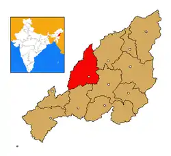 Wokha district's location in Nagaland | |
| Coordinates: 26°06′N 94°16′E | |
| Country | |
| State | Nagaland |
| Seat | Wokha |
| Area | |
| • Total | 1,628 km2 (629 sq mi) |
| Population (2011) | |
| • Total | 166,343 |
| • Density | 100/km2 (260/sq mi) |
| Time zone | UTC+05:30 (IST) |
| ISO 3166 code | IN-NL-WO |
| Website | http://wokha.nic.in/ |
Geography
Wokha district is located in the midwest part of present state of Nagaland. It is surrounded by Mokokchung district to its northeast, Zunheboto district to its southeast, Kohima district to its south and connected to Dimapur district on its southwest. It borders the Golaghat plain of Assam on the west.
It covers an area of 1,628 sq. km. which equals around 9.82% of the total area of Nagaland. Of the total area, 35.74% comes under subtropical hill zone, 23.64% under subtropical plain zone and 40.59% in the mild tropical hill zone.[3] The average altitude of the Wokha (Upper Range) is 1000-1500m above sea level; Bhandari (Lower Range) is 400-1000m above sea level.[4] While Baghty town is at an altitude of 304.30m above sealevel, Wokha town is the highest town at 1313.69m.[5]
Mount Tiyi is the highest peak in the district at an altitude of 1970 metres above sea-level.[6] It has a rich biodiversity. Mount Tiyi is of great cultural significance to the Lotha tribe with many legends and myth embedded into the cultural history. Mount Totsu is the second highest peak with an altitude of 1250 metres above the sea-level. Both these places are earmarked by the district administration for ecotourism.[7]
Doyang (also known as Dzu and Dzulu by the Angamis) is the biggest river in the state, and the district, and flows through the three hill ranges, namely, Bhandari range, Sanis range and Wokha range. It goes further to join the Dhansari river in the Assam valley.[8] The other three important rivers flowing down its mountains are, Chubi, Nzhu and Nruk.[6] Chubi flows southwards from Mokokchung district and joins Doyang in the Pangti area. Nzhu rises from Kohima district, flows through Miphong and joins the Doyang in the Lotsu area.[9] The river Nruk comes from Kohima, crosses through Moilan and joins the Doyang.[6] Other waterbodies in the district include small lakes across the ranges. The Totsu Wozhu which is situated in the southern part of the Phiru-shaki area is the largest amongst these but occupies merely around an acre of land.[10] Other similar natural lakes are situated in the Sanis and Mekokla areas. The lake created by the Doyang dam is the biggest manmade waterbody in the district. There are no permanent waterfalls in the district though several are formed during the monsoons.
The migratory Amur Falcon (Falcon Amurensis) use the area around Doyang reservoir as a feeding and resting place and around a million gather during the season.[11] The best time to view roosting of the birds is from second week of October to the first week of November.[2]
Climate
Due to its subtropical topography, the district receives warm rainy summer and cold dry winter. In winter, the average night temperature falls between 4 °C to 2 °C. December and January are the coldest months. The average temperature in the summer months in approximately 27 °C.[12] The district receives an average annual rainfall of 2000mm to 2500mm and rains for around six months in a year with greater intensity in the months of July and August. Although the district receives moderate rainfall, villages at higher elevation face acute scarcity of water due to the high surface runoff leading to less recharge of ground water.[13]
During summer, the average humidity is 85%, which can go uptown 95% to 100%, which makes the monsoon season very damp.[14]
The climate in the Bhandari range is slightly warmer with little lesser compared to the middle and upper ranges.[15]
History
British Colonial Administration
In the Lotha Naga areas, Captain Brodie was the first official to carry out colonial exploration in 1844. The first recorded meeting between a European and the Lothas was with Lieutenant Biggs in the year 1841.[16] During the British colonial expansion into the Naga Hills, Wokha was designated the district headquarters initially. Two years later, it was shifted to Kohima in 1878, and Wokha was reduced to a sub-division in the colonial administration. The sub-divisional administration shifted its headquarters to Mokokchung further relegating Wokha in the colonial administration.[17]
Indian state
In 1957, when the Naga Hills Tuensang Area (NHTA) was formed, Wokha became a sub-division under the Mokokchung district.[18]
The currently defined Wokha district was created in 1973 when the sub-division separated from Mokokchung district[19] along with six administrative circles.[20] The first census of the new district in 1981 counted the population to be 57,583.
Economy
It is one of the three districts in Nagaland currently receiving funds from the Backward Regions Grant Fund Programme (BRGF).[21]
Demographics
According to the 2011 census Wokha district has a population of 166,343, [22] roughly equal to the nation of Saint Lucia.[23] This gives it a ranking of 595th in India (out of a total of 640).[22] Wokha has a sex ratio of 968 females for every 1000 males, and a literacy rate of 87.7%.[1]
References
- "Wokha District Population Census 2011, Nagaland literacy sex ratio and density". www.census2011.co.in.
- "Places of Interest". District Administration, Wokha District. Retrieved 9 June 2020.
- Ray, Sanjay Kumar; Chatterjee2, Dibyendu; Saha, Saurav; Kamble, Kalpana H.; Deka, Bidyut C. A Guide for Soil Nutrient Management with special reference to Wokha. Jharnapani: ICAR Research Complex for NEH Region. p. 3. ISBN 978-81-931382-1-2. Retrieved 9 June 2020.
- Ground Water Information Booklet: Wokha District, Nagaland (PDF). Guwahati: Central Ground Water Board (North Eastern Region). 2013. Retrieved 11 June 2020.
- Jamir, N. S.; Takatemjen; Limasemba (2010). "Traditional knowledge of Lotha-Naga tribes in Wokha district, Nagaland". Indian Journal of Traditional Knowledge. 9 (1): 45–48. Retrieved 11 June 2020.
- Ezung, T. Zarenthung (19 October 2012). "Rural Tourism in Nagaland, India: Exploring the Potential". International Journal of Rural Management. 7 (1–2): 133–147. doi:10.1177/0973005212459833. S2CID 154329031.
- Ezung, T. Zarenthung (19 October 2012). "Rural Tourism in Nagaland, India: Exploring the Potential". International Journal of Rural Management. 7 (1–2): 133–147. doi:10.1177/0973005212459833. S2CID 154329031.
- District Census Handbook, Wokha (PDF). Kohima: Directorate of Census Operations, Nagaland. 2011. pp. 10–11. Retrieved 9 June 2020.
- District Census Handbook, Wokha (PDF). Kohima: Directorate of Census Operations, Nagaland. 2011. p. 11. Retrieved 9 June 2020.
- District Census Handbook, Wokha (PDF). Kohima: Directorate of Census Operations, Nagaland. 2011. p. 11. Retrieved 9 June 2020.
- Kasambe, Raju (2014). "Doyang Reservoir: A potential IBA in Nagaland". Mistnet. 15 (2): 24–28. Retrieved 10 June 2020.
- District Census Handbook, Wokha (PDF). Kohima: Directorate of Census Operations, Nagaland. 2011. p. 11. Retrieved 9 June 2020.
- Ground Water Information Booklet: Wokha District, Nagaland (PDF). Guwahati: Central Ground Water Board (North Eastern Region). 2013. Retrieved 11 June 2020.
- District Census Handbook, Wokha (PDF). Kohima: Directorate of Census Operations, Nagaland. 2011. p. 11. Retrieved 9 June 2020.
- District Census Handbook, Wokha (PDF). Kohima: Directorate of Census Operations, Nagaland. 2011. p. 11. Retrieved 9 June 2020.
- Ao, Moatoshi (2019). A Treatise on Customary and Fundamental Laws of the Nagas in Nagaland. Chennai: Notion Press. ISBN 9781645464778.
- District Census Handbook, Wokha (PDF). Kohima: Directorate of Census Operations, Nagaland. 2011. p. 8. Retrieved 9 June 2020.
- District Census Handbook, Wokha (PDF). Kohima: Directorate of Census Operations, Nagaland. 2011. p. 18. Retrieved 9 June 2020.
- "District industrial profile report of Wokha district" (PDF). gov.in. Dimapur: Development Commissioner Ministry of Micro, Small & Medium Enterprises. 2012.
- District Census Handbook, Wokha (PDF). Kohima: Directorate of Census Operations, Nagaland. 2011. p. 8. Retrieved 9 June 2020.
- Ministry of Panchayati Raj (8 September 2009). "A Note on the Backward Regions Grant Fund Programme" (PDF). National Institute of Rural Development. Retrieved 27 September 2011.
- "District Census 2011". Census2011.co.in. 2011. Retrieved 30 September 2011.
- US Directorate of Intelligence. "Country Comparison:Population". Retrieved 1 October 2011.
Saint Lucia 161,557 July 2011 est.
External links
Places adjacent to Wokha district | ||||||||||
|---|---|---|---|---|---|---|---|---|---|---|
| ||||||||||
| State symbols | |
|---|---|
| Governance | |
| Topics | |
| Divisions |
|
| Districts | |
| Main cities and towns | |