Phek district
Phek (pron:/ˈfɛk/) is a district of Nagaland state, India. It was established in 1973. The district headquarters are in the town of Phek.[1]
Phek district | |
|---|---|
District | |
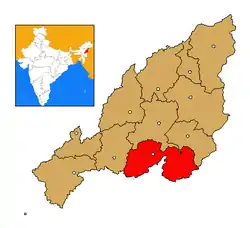 Phek district's location in Nagaland | |
| Coordinates: 25°40′N 94°28′E | |
| State | Nagaland |
| Country | India |
| Seat | Phek |
| Area | |
| • Total | 2,026 km2 (782 sq mi) |
| Population (2011) | |
| • Total | 163,418 |
| • Density | 81/km2 (210/sq mi) |
| Time zone | UTC+05:30 (IST) |
| ISO 3166 code | IN-NL-PH |
| Website | http://phek.nic.in/ |
Geography
Phek district is a mountainous region, 70% evergreen forest. The highest mountain is Zanibu, with the summit over 2,400 m (7,900 ft) above mean sea level (AMSL). The district HQ town of Phek lies at the lowest altitude of the district at 1,524m above sea level, with the town of Pfutsero at the highest point 2,136m above.[2][3]
The largest rivers of the district are the Tizu, Lanyi, Arachu, and three most important lakes are the Shilloi, Chida and Dzudu.[1] As of 2002, of its 89 recognized villages, twelve were not accessible by road at all, and of the rest only 24 were accessible by "all-weather roads". Only 9 of the 89 villages were still to be connected to the water supply.[2]
Avakhung International Border Checkpost, also known as Avankhu in Phek district of Nagaland, is an International Border Checkpost on India–Myanmar barrier and a highway is being developed as part of the Bharatmala project (2017-2022).[4]
Climate
The summers are moderately warm with the average temperature being 27 °C without exceeding 32 °C. Monsoon starts towards the end of May, and is over by the end of September. Winters are cold, in comparison to the nearby plains of Assam, with the temperature dropping to 0 °C in the coldest months of January and February.[5]
The average annual rainfall is 1,527mm.[5]
History
The name Phek comes from the word Phekrekedze, meaning watch tower.[1]
Phek district was established in 1973 when it was by Nagaland state notification notification no. APA.15/12/71 dated 19 December 73
Administration
The Deputy Commissioner's office is located in Phek. The district is split into 14 administrative circles, which are Pfutsero, Phek Sadar, Chetheba, Chozuba, Meluri, Sekruzu, Chizami, Sakraba, Razieba, Zuketsa, Phor, Khuza, Khezhakeno, and Phokhungri.
Additional Deputy Commissioner (ADC) offices are located in Pfutsero, Meluri and Chozuba. A Sub-Divisional Officer is located in Chizami, and Extra Assistant Commissioner EAC headquarters are located in Sakraba, Sekruzu, Phokhungri, Khezhakeno, Chetheba, Khuza, Zuketsa, and Phor.[3]
Demographics
As of 2011 the 2011 census Phek district has a population of 163,418, roughly equal to the nation of Saint Lucia.[6] This gives it a ranking of 596th in India (out of a total of 640). Phek has a sex ratio of 951 females for every 1000 males, and a literacy rate of 79.13%.
85% of the population lives in rural areas of the district.
The district is the home of the Chakhesang and Pochury tribes.[1]
Languages
The following Angami–Pochuri languages are spoken in Phek district.
Religion
Christianity is the religion of 97% of the inhabitants. Other religions followed are Hinduism by 2% of the population, Islam by 0.6%, Buddhism by 0.2%, and a few Jains and Sikhs.
Towns and villages
As of 2011 the 2011 census, the district holds two towns, Phek and Pfutsero, and 117 villages, divided into fourteen admin circles as follows:
| Circle | Towns | Villages |
|---|---|---|
| Chetheba | Chesezumi (3,470), Thenyizumi (3,275), Thipuzu (3,249), Chetheba Hq (1,915), Khulazu Basa (1,839), Khulazu Bawe (1,669), Rihuba (949), Chesezu Nasa (275), Phuyoba (240). | |
| Chizami | Chizami Vill.(2,954), Thetsumi (2,840), Mesulumi (2,037), Chizami Hq (1,283), Enhulumi (1,014), Sumi (508). | |
| Chozuba | Chozuba Hq (3,543), Chozuba Vill. (3,419), Yoruba (3,353), Thevopisu (2,624), Runguzumi Nawe (1,193), Runguzumi Nasa (335), Khesomi (265), Chozubasa (104). | |
| Khezhakeno | Khezakeno Village (3,281), Khezakeno Hq (529). | |
| Khuza | Chiepoketa (1,007), Khuza Village (743), Metsale (663), Tehephu (534), Khutsokhuno (501), Suthotsu (402), Khuza Hq (157). | |
| Meluri | Meluri Hq (5,191), Meluri Village (2,723), Lephori (1,355), Akhegwo (1,196), Matikhru (623), Reguri (592), Kanjang (539), Mollen (430), Khumiasu (407), New Akhegwo (305), Kukhegwo (288), Akhen (128), Akhegwo Junction (113). | |
| Pfutsero | Pfutsero Town Committee (10,371) | Kikruma (7,298), Phusachodu (7,275), Pfutseromi (3,378), Kami (1,239), Lekromi (950), R.D Block Kikruma (571), Kade (147). |
| Phek Sadar | Phek Town Committee (14,204) | Phek Village (2,744), Losami (2,246), Lozaphuhu (2,077), Ketsapo (2,050), Phek Old Town (924), Sohomi (558), Kizari (490), Kotisu (455), Phek Basa (434), Lanyezho (319), Tezatse (252), Chosaba (210), Satheri (194), Losami Junction (132), Surhoba (118). |
| Phokhungri | Phokhungri Vill. (629), Sutsu (485), Laruri (472), New Thewati (457), Zipu (387), Phokhungri Hq (259), Mokie (214), Washelo (200), Old Thewati (187), Avankhu (186), Letsam (135). | |
| Phor | Hutsu (1,007), Weziho Town (783), Phor (732), Weziho (699), Satuza (431), Yesisotha Centre (331), Wuzu (314), Kuzatu (195), Yesi (102), New (Phor 523). | |
| Razieba | Zhavame (3,208), Zelume (1,076), Tsupfume (1,070), Razieba Hq (780), Zavachu (371). | |
| Sakraba | Porba (2,764), Middle Khomi (1,206), Pholami (1,159), Pholami (873), Sakraba (754), Sakraba Hq (735), Upper Khomi (730), Wibo (538), Gidemi (246), Lower Khomi (236). | |
| Sekruzu | Ruzazho (2,848), Dzulhami (2,823), Phugwi (1,527), Suthazu Nawe (1,478), Therhutsesemi (1,010), Khutsami (621), Suthazu Nasa (462), Sekrezu (394), New Ruzazho (203). | |
| Zuketsa | Leshemi (1,877), Zapami (1,308), Lasumi (1,048), Zuketsa (555), Lowuza (456). |
Economy
Agriculture is the main occupation with Terrace Rice Cultivation (TRC) as the most predominant.[1] Jhum cultivation is also a common practice.[7]
Important crops produced in the district include rice, maize and millet.[3]
Manufacturing here includes production of salt in Meluri, fruit juice production, weaving, bamboo and wood carving.[1]
The healthcare sector comprises one hospital, two community health centres and eight primary health centres.[2]
The education sector comprises 116 primary schools, 46 middle schools, 18 high schools plus one higher secondary school, and three colleges.[2]
Culture
The festivals of Shükhrünyie, Yemshe, Tsükhrünyie, and Nazhü are celebrated in Phek district.[3]
References
- "District Census Handbook" (PDF). Government of India.
- "Phek profile". phek.nic.in. 2003.
- "District Profile". Department of Information & Public Relations. Government of Nagaland. Retrieved 6 November 2017.
- "Bharatmala presentation" (PDF). pp. 21, 22.
- Ministry of Water Resources (September 2013). "Ground Water Information Booklet Phek District, Nagaland" (PDF). Central Ground Water Board, North Eastern Region. Archived from the original (PDF) on 8 November 2017. Retrieved 8 November 2017.
- US Directorate of Intelligence. "Country Comparison:Population". Retrieved 1 October 2011.
Saint Lucia 161,557 July 2011 est.
- Lohe, Sakhoveyi (2014). "Environmental Management of Degraded Ecosystems in Phek District, Nagaland (PhD thesis)". Shodhganga. p. 30, ch2.
External links
Places adjacent to Phek district | ||||||||||
|---|---|---|---|---|---|---|---|---|---|---|
| ||||||||||
| State symbols | |
|---|---|
| Governance | |
| Topics | |
| Divisions |
|
| Districts | |
| Main cities and towns | |