Kohima district
Kohima district (pron:/ˈkəʊhɪˌmɑː or kəʊˈhiːmə/) is a district of Nagaland state in India. It is the home of the Angami Naga tribe. As of 2011, it is the second most populous district of Nagaland (out of 11), after Dimapur with a population of 267,988, 45% of which is urban.
Kohima district | |
|---|---|
District | |
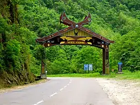 Entrance to Kohima district | |
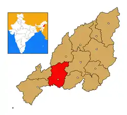 Kohima district's location in Nagaland | |
| Coordinates: 25°40′N 94°07′E | |
| State | Nagaland |
| Country | India |
| Seat | Kohima |
| Elevation | 1,444 m (4,738 ft) |
| Population (2011) | |
| • Total | 267,988 |
| Time zone | UTC+05:30 (IST) |
| ISO 3166 code | IN-NL-KO |
| Website | http://kohima.nic.in/ |
History
Prior to India's independence, the area was part of Naga Hills District, with Kohima as the district headquarters.[1]
Kohima district was created as one of the three districts of the newly inaugurated of Nagaland state on 1 December 1961.[2] In 1973 the new districts of Phek, Wokha were created out of Kohima district, as in 1997 Dimapur district was similarly carved.[3][4] The 2003 creation of Peren district left Kohima in its current form.[5]
Administration
Kohima district is administered by a deputy commissioner, who has a number of additional deputy commissioners and sub-division officers (SDOs) with responsibilities for each of the administrative circles.[6] There exists also a District Urban Development Agency for Kohima.[7]
Kohima district is subdivided into the eight administrative circles of Tseminyu, Tsogin, Chiephobozou, Botsa, Kezocha, Jakhama, Kohima Sadar and Sechu-Zubza. These administrative circles are grouped four Rural Development Blocks, which are Kohima (for Kohima Sadar and Sechu-Zubza), Chiephobozou (for Chiephobozou, Botsa and some of Kezocha), Jakhama (for Jakhama and the rest of Kezocha) and Tseminyu (Tseminyu and Tsogin).[2]
Demographics
According to the 2011 census Kohima district has a population of 267,988, of which 121,088 or 45% lived in urban areas. This gives it a ranking of 576th in India (out of a total of 640). Kohima has a sex ratio of 928 females for every 1000 males, and a literacy rate of 85%.
The main indigenous inhabitants of Kohima district are the Angami Nagas and the Rengma Nagas.
Kohima Sadar circle comprises two towns:
- Kohima (99,039), Kohima Village Census Town (15,734), and the two villages of Chiedema (1,820), Chiede Model Village (277).
Tseminyu circle comprises the one town of Tseminyu (6,315), and the thirty-two villages of :
- Tesophenyu (11,116), Kandinu (3,938), Nsunyu (2,868), Tseminyu Vill. (2,863), Zisunyu (2,840), Phenshunyu (2,675), Sishunu (2,236), K. Station (2,169), Chunlikha (1,604), Terogunyu (1,559), Ziphenyu (1,495), Ehunnu (1,139), Kashanyu (833), Tseminyu South (765), Phenwhenyu (729), Rumensinyu (712), Khenyu (569), Sewanu (540), New Tesophenyu (516), Kashanyishi (428), Tsonsa (417), Ngvuphen (379), Gukhanyu (340), Yikhanu (331), Tseminyu Old Town (329), Henbenji (278), New Terogunyu (269), Khonibenzun (242), Likhwenchu (241), Guzinyu (222), Phenda (207), Zunpha Mission Centre (150).
Jakhama circle comprises ten towns and villages :
- Viswema (7,417), Jakhama Hq (5,216), Khuzama (5,160), Jakhama Vill. (4,695), Kigwema (3,872), Phesama (3,061), Mima (2,149), Kigwe Town (1,228), Pfuchama (870), Sweba (388).
Chiephobozou circle comprises eighteen villages :
- Zhadima (3,184), Ciechama (3,172), Rusoma (1,903), Chiephobozou (1,841), Nerhema (1,678), Tsiese Basa (1,563), 4Th NAP Batt. Thiza (1,505), Meriema (1,233), Thizama (803), Tsiese Bawe (620), Viphoma (456), Nachama (422), Phekerkrie Bawe (301), Nerhe Model (301), Phezha (285), Ziezou (245), Phekerkrie Basa (147), Viphoma Basa (33).
Sechu-Zubza circle comprises sixteen villages :
- Sechu (4,460), Jotsoma (2,458), Phezhu (2,391), Mezoma (2,177), Khonoma (1,943), Peducha (1,087), Mengujuma (537), Kiruphema Basa (462), Sechuma (419), Thekrejuma (316), Sirhi Angami (286), Mezo Basa (285), Kiruphema Bawe (237), Dzuleke (156), Khonoma Basa (96), Hydro Project Station (59).
Kezocha circle comprises ten villages :
- Kidima (7,160), Sakhabama (2,857), Kezoma (2,117), Dihoma (1,550), Kezo Town (1,122), Kijumetouma (638), Kezo Basa (490), Mitelephe (245), Kijumetou Basa (149), Kezocha Hq (139).
Botsa circle comprises ten villages :
- Tuophema (2,236), Botsa (1,063), Gareiphema (952), Seiyhama (903), Teichuma (610), Tsiemekhuma Bawe (288), Tsiemekhuma Basa (283), Tuophe Phezou (132), Gareiphe Basa (122), Seiyha Phesa (106).
Tsogin circle comprises seven villages :
- Sendenyu (2,548), New Sendenyu (730), Tsosinyu (696), Rengmapani (627), Thongsunyu (464), Longwesunyu (429), Tsogin Hq (31).
Geography
Kohima district has a hilly landscape - Kohima town, typical of the area, is stretched along the top of a mountain.[2]
Climate
| Climate data for Kohima | |||||||||||||
|---|---|---|---|---|---|---|---|---|---|---|---|---|---|
| Month | Jan | Feb | Mar | Apr | May | Jun | Jul | Aug | Sep | Oct | Nov | Dec | Year |
| Average high °C (°F) | 16.6 (61.9) |
17.9 (64.2) |
22.1 (71.8) |
24.1 (75.4) |
24.4 (75.9) |
24.9 (76.8) |
25.0 (77.0) |
25.4 (77.7) |
25.0 (77.0) |
23.4 (74.1) |
20.6 (69.1) |
17.7 (63.9) |
22.2 (72.0) |
| Average low °C (°F) | 8.1 (46.6) |
9.3 (48.7) |
12.7 (54.9) |
15.6 (60.1) |
16.9 (62.4) |
18.1 (64.6) |
18.8 (65.8) |
18.9 (66.0) |
18.1 (64.6) |
16.6 (61.9) |
13.1 (55.6) |
9.4 (48.9) |
14.6 (58.3) |
| Average rainfall mm (inches) | 11.7 (0.46) |
35.4 (1.39) |
47.6 (1.87) |
88.7 (3.49) |
159.2 (6.27) |
333.8 (13.14) |
371.8 (14.64) |
364.0 (14.33) |
250.1 (9.85) |
126.0 (4.96) |
35.2 (1.39) |
7.8 (0.31) |
1,831.3 (72.1) |
| Average rainy days | 2 | 3.9 | 5.8 | 12.2 | 16.9 | 23.1 | 24.6 | 22.9 | 19.1 | 10.7 | 3.6 | 1.4 | 146.2 |
| Source: WMO [8] | |||||||||||||
Flora and fauna
In 1980 Kohima district became home to the Puliebadze Wildlife Sanctuary, which has an area of 9.2 km2 (3.6 sq mi).[9] It is a natural habitat for Blyth’s Tragopan.[10]
Sports
Kohima is also home to Kohima Komets a soccer club which plays in Nagaland Premier League.
References
- "Brief industrial profile of Kohima district, Nagaland state" (PDF). Government of India Ministry of MSME. 18 February 2015.
- "District Census Handbook" (PDF). Census of India 2011. 16 June 2014.
- "Know Your Districts: Phek - The Morung Express". The Morung Express. 8 June 2016. Archived from the original on 6 June 2019. Retrieved 3 November 2017.
- "About Wokha". Wokha Dist Administration. 2010.
- "Nagaland: Know Your Districts - An overview -III - The Morung Express". The Morung Express. 17 October 2017. Archived from the original on 20 May 2019. Retrieved 3 November 2017.
- "Hierarchy of administrative officers at deputy commissioner's office, Kohima". National Informatics Centre, Kohima District Centre. July 2017. Archived from the original on 9 August 2018. Retrieved 3 November 2017.
- "Kohima CDP Revised" (PDF). Government of Nagaland. July 2006. p. 67. Archived from the original (PDF) on 7 January 2012. Retrieved 3 November 2017.
- "Kohima". World Meteorological Organisation. Retrieved 1 December 2011.
- Indian Ministry of Forests and Environment. "Protected areas: Nagaland". Archived from the original on 23 August 2011. Retrieved 25 September 2011.
- "Wildlife". Archived from the original on 14 October 2018. Retrieved 22 October 2011.
External links
Places adjacent to Kohima district | ||||||||||
|---|---|---|---|---|---|---|---|---|---|---|
| ||||||||||
| State symbols | |
|---|---|
| Governance | |
| Topics | |
| Divisions |
|
| Districts | |
| Main cities and towns | |