Peck Mounds
Peck Mounds (16 CT 1) is an archaeological site of the Late Troyville-Early Coles Creek culture (650 to 860 CE) in Catahoula Parish, Louisiana.
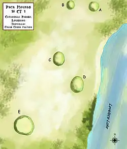 Arrangement of the mounds at the Peck site | |
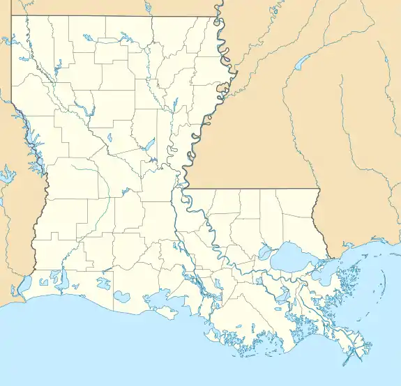 Location within Louisiana today | |
| Location | Sicily Island, Louisiana, Catahoula Parish, Louisiana, |
|---|---|
| Region | Catahoula Parish, Louisiana |
| Coordinates | 31°49′30.98″N 91°39′4.05″W |
| History | |
| Founded | 650 CE |
| Abandoned | 860 |
| Cultures | Troyville culture, Coles Creek culture |
| Site notes | |
| Responsible body: private | |
Description
The mounds are located in the vicinity of the Ferry Place Plantation house. It consists of five mounds, of which one is no longer visible. Three of the remaining mounds are low dome-shaped bumps measuring roughly 4 feet (1.2 m) in height, with their bases being about 100 feet (30 m) by 130 feet (40 m). Mound E, the largest and most southernmost mound, is a platform mound measuring 18 feet (5.5 m) in height, with the base being 165 feet (50 m) by 180 feet (55 m) and a summit area measuring 65 feet (20 m) by 55 feet (17 m). The site is situated on Maçon Ridge and overlooks Lake Lovelace.[1] It was added to the NRHP on August 29, 1980 as part of the Ferry Place National Register District, NRIS number 80001711.[2] The site is first mentioned by James A. Ford in 1933 when he conducted investigations at the nearby Peck Village Site, which is also located next to the lake .75 miles (1.21 km) south of the mound site.[3]
References
- "Indian Mounds of Northeast Louisiana:Peck Mounds". Archived from the original on 2012-12-24. Retrieved 2011-10-20.
- "National Register of Historic Places". Retrieved 2011-10-17.
- "Ferry Place" (PDF). Retrieved 2011-10-27.
External links
| Coles Creek sites |
|  |
|---|---|---|
| Coastal Coles Creek sites |
| |
| Plum Bayou sites |
| |
| Topics | |
|---|---|
| Lists by state |
|
| Lists by insular areas | |
| Lists by associated state | |
| Other areas | |
| Related | |
| |
| Baytown sites |  | |
|---|---|---|
| Troyville sites | ||