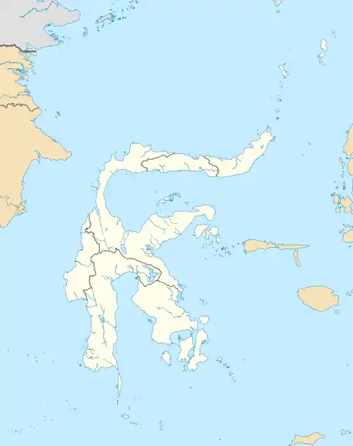
Kendari
Kendari is the capital of the Indonesian province of Southeast Sulawesi. The city lies along Kendari Bay. Moramo Waterfall is located 65 km east of Kendari. The city has a population of 359,371 at 2017, making it the fourth-largest city in Sulawesi, behind Makassar, Manado, and Palu.
Kendari | |
|---|---|
.jpg.webp) Al-Alam Mosque | |
 Seal | |
 Location within Southeast Sulawesi | |
| Coordinates: 3°58′2.96″S 122°35′40.92″E | |
| Country | |
| Province | |
| Founded | 9 May 1831 |
| Incorporated | 1 July 1978 |
| City Status | 27 September 1995 |
| Government | |
| • Mayor | Sulkarnain Kadir |
| • Vice Mayor | - |
| Area | |
| • Total | 297 km2 (115 sq mi) |
| Elevation | 5−55 m (−180 ft) |
| Population (2017) | |
| • Total | 359,371 |
| Time zone | UTC+8 (Indonesia Central Time) |
| Area code | (+62) 401 |
| HDI | |
| Website | kendarikota.go.id |
History
In 1831, a Dutch cartographer named Vosmaer was tasked with mapping the area of Kendari. While performing this task, he is said to have met with the indigenous tribe, the Tolakis, and to have built their king a palace in the harbor of Kendari. The palace was completed on 9 May 1832, and now 9 May is celebrated as the date of Kendari's founding.[1]
Over time, the city became an important center of Sulawesi in the Dutch East Indies, first becoming the capital of the Kewedanan District and later the Laiwoi Onder Afdeling District.[1]
World War II
Kendari was an important objective of the Japanese in World War II because of the nearby airfield, (now Haluoleo Airport) which could be used to interdict the sea lanes between Australia and the Dutch East Indies and to bomb Dutch bases on Java and other Islands. The garrison of Kendari was surprised by a Japanese landing on the night of 23–24 January 1942 and put up little resistance before Kendari and the intact airfield were captured.[2]
During the Japanese occupation the airbase was used by the Imperial Japanese Navy Air Service. In the second of the two raids on Darwin in Australia on February 19th 1942, 27 Mitsubishi G4M "Betty" medium bombers joined 27 Mitsubishi G3M "Nell" bombers flying from Ambon.[3]
_(14768106072).jpg.webp) Map by J. N. Vosmaer
Map by J. N. Vosmaer
Administration
The city, originally composed of four districts (kecamatan) - Mandonga, Baruga, Poasia and Kendari - is now divided into ten districts, tabulated below with their 2010 Census population.[4]
| Name | Population Census 2010[5] |
|---|---|
| Mandonga | 36,163 |
| Baruga | 19,368 |
| Puuwatu | 27,749 |
| Kadia | 39,244 |
| Wua-Wua | 24,407 |
| Poasia | 24,977 |
| Abeli | 22,438 |
| Kambu | 27,135 |
| Kendari | 25,557 |
| Kendari Barat (West Kendari) | 42,928 |
Economy
Kendari's economy is mostly agricultural with some industrial centers near the city.[1] The city is connected to other parts of Indonesia by Haluoleo Airport.
Kendari Botanical Garden
In 2014, the Civil Works Ministry decided to build the Kendari Botanical Garden in a 113 hectare area, as one of twelve priority developments of botanical gardens.[6]
Tourism
Some of Kendari's main attractions are its bay, nearby Bungkutoko Island, Bokori Island, and the city's many beaches. Another draw is the selling of local handicrafts and souvenirs.[1] Handicrafts include gold and silver ornament making, filigree work, weaving, and woodworking. The silver jewelry industry is carried on mostly by the Chinese.[7]
Climate
Kendari has a tropical rainforest climate (Af) with heavy rainfall from December to July and moderate rainfall from August to November.
| Climate data for Kendari | |||||||||||||
|---|---|---|---|---|---|---|---|---|---|---|---|---|---|
| Month | Jan | Feb | Mar | Apr | May | Jun | Jul | Aug | Sep | Oct | Nov | Dec | Year |
| Average high °C (°F) | 31.5 (88.7) |
31.4 (88.5) |
31.4 (88.5) |
31.2 (88.2) |
30.6 (87.1) |
29.8 (85.6) |
29.4 (84.9) |
30.2 (86.4) |
31.2 (88.2) |
32.4 (90.3) |
32.6 (90.7) |
31.9 (89.4) |
31.1 (88.0) |
| Daily mean °C (°F) | 27.5 (81.5) |
27.5 (81.5) |
27.5 (81.5) |
27.4 (81.3) |
27.2 (81.0) |
26.5 (79.7) |
25.9 (78.6) |
26.2 (79.2) |
26.8 (80.2) |
27.6 (81.7) |
28.2 (82.8) |
27.8 (82.0) |
27.2 (80.9) |
| Average low °C (°F) | 23.6 (74.5) |
23.6 (74.5) |
23.6 (74.5) |
23.7 (74.7) |
23.8 (74.8) |
23.2 (73.8) |
22.5 (72.5) |
22.3 (72.1) |
22.5 (72.5) |
22.9 (73.2) |
23.8 (74.8) |
23.8 (74.8) |
23.3 (73.9) |
| Average precipitation mm (inches) | 196 (7.7) |
207 (8.1) |
242 (9.5) |
225 (8.9) |
241 (9.5) |
224 (8.8) |
144 (5.7) |
91 (3.6) |
103 (4.1) |
80 (3.1) |
98 (3.9) |
181 (7.1) |
2,032 (80) |
| Source: [8] | |||||||||||||
Sister cities
Notes
- "The City Of Kendari". indonesia-tourism.com.
- L, Klemen (1999–2000). "The Fall of Kendari, January 1942". Forgotten Campaign: The Dutch East Indies Campaign 1941-1942.
- Alford 2017, p. 20
- Biro Pusat Statistik, Jakarta, 2011.
- Biro Pusat Statistik, Jakarta, 2011
- Ali Hidayat. "Selain Batam, PU Bangun Kebun Raya di KendariYYY". Retrieved 20 February 2017.
- "Kendari". Encyclopædia Britannica.
- https://en.climate-data.org/location/984253
References
- L, Klemen (1999–2000). "Forgotten Campaign: The Dutch East Indies Campaign 1941-1942". Archived from the original on 26 July 2011.
Bibliography
- Alford, Bob. Darwin 1942, The Japanese Attack on Australia. Oxford: Osprey Publishing, 2017. ISBN 1472816870.

