Subachoque Formation
The Subachoque Formation (Spanish: Formación Subachoque, Q1su) is a geological formation of the Bogotá savanna, Altiplano Cundiboyacense, Eastern Ranges of the Colombian Andes. The formation consists mainly of sandy shales and lignite with sandstone beds. The Subachoque Formation dates to the Quaternary period; Early to Middle Pleistocene epoch (from approximately 2.5 to 1 Ma), and has a maximum thickness of 150 metres (490 ft). It is the lowermost formation of the lacustrine and fluvio-glacial sediments of Lake Humboldt.
| Subachoque Formation Stratigraphic range: Early to Mid Pleistocene ~2.5–1 Ma | |
|---|---|
| Type | Geological formation |
| Underlies | Sabana Formation |
| Overlies | Tilatá Formation Guadalupe Gp. Guaduas Fm., Cacho Fm., Bogotá Fm., Regadera Fm. |
| Thickness | up to 150 metres (490 ft) |
| Lithology | |
| Primary | Shale, lignite |
| Other | Sandstone |
| Location | |
| Coordinates | 4°57′17.3″N 74°13′07.5″W |
| Region | Bogotá savanna, Altiplano Cundiboyacense Eastern Ranges, Andes |
| Country | |
| Type section | |
| Named for | Subachoque |
| Named by | Helmens & Hammen |
| Location | Subachoque Synclinal |
| Year defined | 1995 |
| Coordinates | 4°57′17.3″N 74°13′07.5″W |
| Region | Cundinamarca |
| Country | |
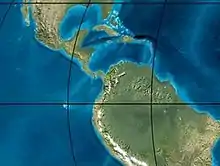 Paleogeography of the Pleistocene by Ron Blakey | |
Etymology
The formation was first defined and named by Helmens and Van der Hammen in 1995 after Subachoque, Cundinamarca.[1]
Description
Lithologies
The Subachoque Formation consists mainly of sandy shales, some organic, with lignite and sandstone beds.[1]
Stratigraphy and depositional environment
The Subachoque Formation is the lowermost of the lagunal and alluvial sequence of the Bogotá savanna. In parts, it conformably overlies the Tilatá Formation and other parts unconformably the Cretaceous Guadalupe Group and the Paleogene Guaduas, Cacho, Bogotá, and Regadera Formations. The Subachoque Formation is overlain by other Quaternary deposits of Lake Humboldt. The age has been estimated to be Early to Middle Pleistocene based on fission track analysis, with reported ages between 2.5 and 1 Ma.[2] The depositional environment has been interpreted as lacustrine and fluvio-glacial with alluvial fans.[1]
Outcrops
The Subachoque Formation is found at its type locality in the western flank of the synclinal of Subachoque and in the western flank of the synclinal of Guasca.[1] The deposition of the Subachoque Formation postdates the main reverse movement of the Bogotá Fault.[3]
Regional correlations
| Ma | Age | Paleomap | Regional events | Catatumbo | Cordillera | proximal Llanos | distal Llanos | Putumayo | VSM | Environments | Maximum thickness | Petroleum geology | Notes |
|---|---|---|---|---|---|---|---|---|---|---|---|---|---|
| 0.01 | Holocene |  | Holocene volcanism Seismic activity | alluvium | Overburden | ||||||||
| 1 | Pleistocene | | Pleistocene volcanism Andean orogeny 3 Glaciations | Guayabo | Soatá Sabana | Necesidad | Guayabo | Gigante Neiva | Alluvial to fluvial (Guayabo) | 550 m (1,800 ft) (Guayabo) | [4][5][6][7] | ||
| 2.6 | Pliocene |  | Pliocene volcanism Andean orogeny 3 GABI | Subachoque | |||||||||
| 5.3 | Messinian | Andean orogeny 3 Foreland | Marichuela | Caimán | Honda | [6][8] | |||||||
| 13.5 | Langhian | Regional flooding | León | hiatus | Caja | León | Lacustrine (León) | 400 m (1,300 ft) (León) | Seal | [7][9] | |||
| 16.2 | Burdigalian | Miocene inundations Andean orogeny 2 | C1 | Carbonera C1 | Ospina | Proximal fluvio-deltaic (C1) | 850 m (2,790 ft) (Carbonera) | Reservoir | [8][7] | ||||
| 17.3 | C2 | Carbonera C2 | Distal lacustrine-deltaic (C2) | Seal | |||||||||
| 19 | C3 | Carbonera C3 | Proximal fluvio-deltaic (C3) | Reservoir | |||||||||
| 21 | Early Miocene | Pebas wetlands | C4 | Carbonera C4 | Barzalosa | Distal fluvio-deltaic (C4) | Seal | ||||||
| 23 | Late Oligocene | 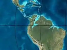 | Andean orogeny 1 Foredeep | C5 | Carbonera C5 | Orito | Proximal fluvio-deltaic (C5) | Reservoir | [5][8] | ||||
| 25 | C6 | Carbonera C6 | Distal fluvio-lacustrine (C6) | Seal | |||||||||
| 28 | Early Oligocene | C7 | C7 | Pepino | Gualanday | Proximal deltaic-marine (C7) | Reservoir | [5][8][10] | |||||
| 32 | Oligo-Eocene | C8 | Usme | C8 | onlap | Marine-deltaic (C8) | Seal Source | [10] | |||||
| 35 | Late Eocene | 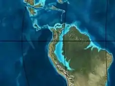 | Mirador | Mirador | Coastal (Mirador) | 240 m (790 ft) (Mirador) | Reservoir | [7][11] | |||||
| 40 | Middle Eocene | Regadera | hiatus | ||||||||||
| 45 | |||||||||||||
| 50 | Early Eocene | 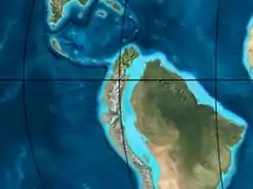 | Socha | Los Cuervos | Deltaic (Los Cuervos) | 260 m (850 ft) (Los Cuervos) | Seal Source | [7][11] | |||||
| 55 | Late Paleocene | PETM 2000 ppm CO2 | Los Cuervos | Bogotá | Gualanday | ||||||||
| 60 | Early Paleocene | SALMA | Barco | Guaduas | Barco | Rumiyaco | Fluvial (Barco) | 225 m (738 ft) (Barco) | Reservoir | [4][5][8][7][12] | |||
| 65 | Maastrichtian | 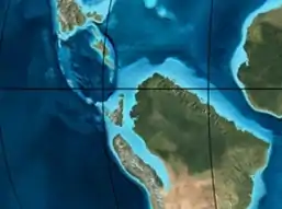 | KT extinction | Catatumbo | Guadalupe | Monserrate | Deltaic-fluvial (Guadalupe) | 750 m (2,460 ft) (Guadalupe) | Reservoir | [4][7] | |||
| 72 | Campanian | End of rifting | Colón-Mito Juan | [7][13] | |||||||||
| 83 | Santonian | Villeta/Güagüaquí | |||||||||||
| 86 | Coniacian | ||||||||||||
| 89 | Turonian | Cenomanian-Turonian anoxic event | La Luna | Chipaque | Gachetá | hiatus | Restricted marine (all) | 500 m (1,600 ft) (Gachetá) | Source | [4][7][14] | |||
| 93 | Cenomanian | 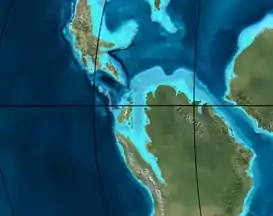 | Rift 2 | ||||||||||
| 100 | Albian | Une | Une | Caballos | Deltaic (Une) | 500 m (1,600 ft) (Une) | Reservoir | [8][14] | |||||
| 113 | Aptian | 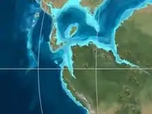 | Capacho | Fómeque | Motema | Yaví | Open marine (Fómeque) | 800 m (2,600 ft) (Fómeque) | Source (Fóm) | [5][7][15] | |||
| 125 | Barremian | High biodiversity | Aguardiente | Paja | Shallow to open marine (Paja) | 940 m (3,080 ft) (Paja) | Reservoir | [4] | |||||
| 129 | Hauterivian | 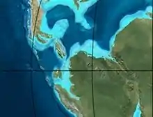 | Rift 1 | Tibú- Mercedes | Las Juntas | hiatus | Deltaic (Las Juntas) | 910 m (2,990 ft) (Las Juntas) | Reservoir (LJun) | [4] | |||
| 133 | Valanginian | Río Negro | Cáqueza Macanal Rosablanca | Restricted marine (Macanal) | 2,935 m (9,629 ft) (Macanal) | Source (Mac) | [5][16] | ||||||
| 140 | Berriasian | Girón | |||||||||||
| 145 | Tithonian | Break-up of Pangea | Jordán | Arcabuco | Buenavista Batá | Saldaña | Alluvial, fluvial (Buenavista) | 110 m (360 ft) (Buenavista) | "Jurassic" | [8][17] | |||
| 150 | Early-Mid Jurassic | 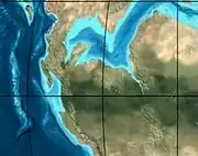 | Passive margin 2 | La Quinta | Montebel Noreán | hiatus | Coastal tuff (La Quinta) | 100 m (330 ft) (La Quinta) | [18] | ||||
| 201 | Late Triassic |  | Mucuchachi | Payandé | [8] | ||||||||
| 235 | Early Triassic |  | Pangea | hiatus | "Paleozoic" | ||||||||
| 250 | Permian |  | |||||||||||
| 300 | Late Carboniferous |  | Famatinian orogeny | Cerro Neiva () | [19] | ||||||||
| 340 | Early Carboniferous | Fossil fish Romer's gap | Cuche (355-385) | Farallones () | Deltaic, estuarine (Cuche) | 900 m (3,000 ft) (Cuche) | |||||||
| 360 | Late Devonian |  | Passive margin 1 | Río Cachirí (360-419) | Ambicá () | Alluvial-fluvial-reef (Farallones) | 2,400 m (7,900 ft) (Farallones) | [16][20][21][22][23] | |||||
| 390 | Early Devonian |  | High biodiversity | Floresta (387-400) El Tíbet | Shallow marine (Floresta) | 600 m (2,000 ft) (Floresta) | |||||||
| 410 | Late Silurian | Silurian mystery | |||||||||||
| 425 | Early Silurian | hiatus | |||||||||||
| 440 | Late Ordovician |  | Rich fauna in Bolivia | San Pedro (450-490) | Duda () | ||||||||
| 470 | Early Ordovician | First fossils | Busbanzá (>470±22) Chuscales Otengá | Guape () | Río Nevado () | Hígado () | [24][25][26] | ||||||
| 488 | Late Cambrian |  | Regional intrusions | Chicamocha (490-515) | Quetame () | Ariarí () | SJ del Guaviare (490-590) | San Isidro () | [27][28] | ||||
| 515 | Early Cambrian | Cambrian explosion | [26][29] | ||||||||||
| 542 | Ediacaran |  | Break-up of Rodinia | pre-Quetame | post-Parguaza | El Barro () | Yellow: allochthonous basement (Chibcha Terrane) Green: autochthonous basement (Río Negro-Juruena Province) | Basement | [30][31] | ||||
| 600 | Neoproterozoic | 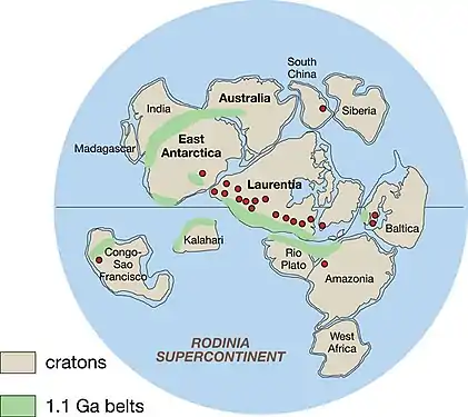 | Cariri Velhos orogeny | Bucaramanga (600-1400) | pre-Guaviare | [27] | |||||||
| 800 |  | Snowball Earth | [32] | ||||||||||
| 1000 | Mesoproterozoic | 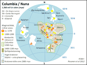 | Sunsás orogeny | Ariarí (1000) | La Urraca (1030-1100) | [33][34][35][36] | |||||||
| 1300 | Rondônia-Juruá orogeny | pre-Ariarí | Parguaza (1300-1400) | Garzón (1180-1550) | [37] | ||||||||
| 1400 | 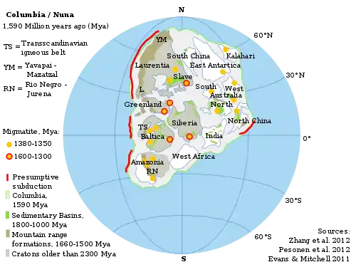 | pre-Bucaramanga | [38] | ||||||||||
| 1600 | Paleoproterozoic | Maimachi (1500-1700) | pre-Garzón | [39] | |||||||||
| 1800 |  | Tapajós orogeny | Mitú (1800) | [37][39] | |||||||||
| 1950 | Transamazonic orogeny | pre-Mitú | [37] | ||||||||||
| 2200 | Columbia | ||||||||||||
| 2530 | Archean | 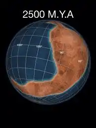 | Carajas-Imataca orogeny | [37] | |||||||||
| 3100 | Kenorland | ||||||||||||
| Sources | |||||||||||||
- Legend
- group
- important formation
- fossiliferous formation
- minor formation
- (age in Ma)
- proximal Llanos (Medina)[note 1]
- distal Llanos (Saltarin 1A well)[note 2]
See also
Notes
References
- Montoya & Reyes, 2005, p.69
- Montoya & Reyes, 2005, p.71
- Geological Map Bogotá, 1997
- García González et al., 2009, p.27
- García González et al., 2009, p.50
- García González et al., 2009, p.85
- Barrero et al., 2007, p.60
- Barrero et al., 2007, p.58
- Plancha 111, 2001, p.29
- Plancha 177, 2015, p.39
- Plancha 111, 2001, p.26
- Plancha 111, 2001, p.24
- Plancha 111, 2001, p.23
- Pulido & Gómez, 2001, p.32
- Pulido & Gómez, 2001, p.30
- Pulido & Gómez, 2001, pp.21-26
- Pulido & Gómez, 2001, p.28
- Correa Martínez et al., 2019, p.49
- Plancha 303, 2002, p.27
- Terraza et al., 2008, p.22
- Plancha 229, 2015, pp.46-55
- Plancha 303, 2002, p.26
- Moreno Sánchez et al., 2009, p.53
- Mantilla Figueroa et al., 2015, p.43
- Manosalva Sánchez et al., 2017, p.84
- Plancha 303, 2002, p.24
- Mantilla Figueroa et al., 2015, p.42
- Arango Mejía et al., 2012, p.25
- Plancha 350, 2011, p.49
- Pulido & Gómez, 2001, pp.17-21
- Plancha 111, 2001, p.13
- Plancha 303, 2002, p.23
- Plancha 348, 2015, p.38
- Planchas 367-414, 2003, p.35
- Toro Toro et al., 2014, p.22
- Plancha 303, 2002, p.21
- Bonilla et al., 2016, p.19
- Gómez Tapias et al., 2015, p.209
- Bonilla et al., 2016, p.22
- Duarte et al., 2019
- García González et al., 2009
- Pulido & Gómez, 2001
- García González et al., 2009, p.60
Bibliography
- Montoya Arenas, Diana María, and Germán Alfonso Reyes Torres. 2005. Geología de la Sabana de Bogotá, 1–104. INGEOMINAS.
Maps
- Buitrago, José Alberto; Roberto Terraza M., and Fernando Etayo. 1998. Plancha 228 - Santafé de Bogotá Noreste - 1:100,000, 1. INGEOMINAS. Accessed 2017-06-06.
- Various, Authors. 1997. Mapa geológico de Santa Fe de Bogotá – Geological Map Bogotá – 1:50,000, 1. INGEOMINAS. Accessed 2017-03-16.
Further reading
- Guerrero Uscátegui, Alberto Lobo. 1992. Geología e Hidrogeología de Santafé de Bogotá y su Sabana, 1–20. Sociedad Colombiana de Ingenieros.
External links
- Gómez, J.; N.E. Montes; Á. Nivia, and H. Diederix. 2015. Plancha 5-09 del Atlas Geológico de Colombia 2015 – escala 1:500,000, 1. Servicio Geológico Colombiano. Accessed 2017-03-16.
