Soatá Formation
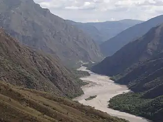
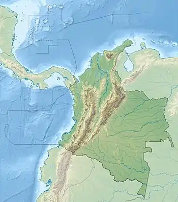
The Soatá Formation (Spanish: Formación Soatá) is a geological formation of the northern Altiplano Cundiboyacense, Eastern Ranges of the Colombian Andes. The formation consists mainly of shales with conglomerates and dates to the Quaternary period; Late Pleistocene epoch. The heavily eroded formation has a maximum measured thickness of 30.8 metres (101 ft). It contains the lacustrine and fluvio-glacial sediments of elongated paleolake Soatá, that existed on the Altiplano in the valley of the Chicamocha River.
| Soatá Formation Stratigraphic range: Late Pleistocene ~0.0475–0.0388 Ma | |
|---|---|
| Type | Geological formation |
| Underlies | Holocene sediments of the Chicamocha River |
| Overlies | Capacho Formation |
| Area | ~130 km2 (50 sq mi) |
| Thickness | up to 30.8 m (101 ft) |
| Lithology | |
| Primary | Shale |
| Other | Conglomerate, siltstone |
| Location | |
| Coordinates | 6°18′00″N 72°39′46″W |
| Region | Altiplano Cundiboyacense Eastern Ranges, Andes |
| Country | |
| Extent | ~30 km × 7 km (18.6 mi × 4.3 mi) |
| Type section | |
| Named for | Soatá |
| Named by | Villarroel et al. |
| Location | Portugalete, Soatá |
| Year defined | 2001 |
| Coordinates | 6°18′00″N 72°39′46″W |
| Approximate paleocoordinates | 6.3°N 72.5°W |
| Region | Boyacá |
| Country | |
| Thickness at type section | 30.8 m (101 ft) |
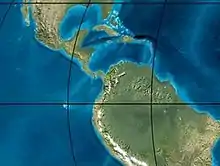 Paleogeography of the Pleistocene | |
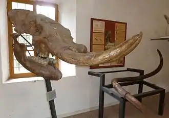
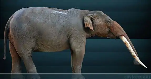
Fossils of the gomphothere Haplomastodon waringi, the capibara Neochoerus sp. and the deer species Odocoileus cf. salinae have been found in the Soatá Formation.
Knowledge about the formation has been provided by Colombian geologists Carlos Villarroel, Jorge Brieva and others.
Etymology
The formation was first proposed and named after Soatá by Villarroel et al. in 2001. The type locality is defined near Portugalete, Soatá.[1]
Regional setting
The Altiplano Cundiboyacense, in the Eastern Ranges of the Colombian Andes, was formed late in the regional uplift of the Andean orogeny. It is estimated that the main stage of uplift happened during the Plio-Pleistocene. The Western and Central Ranges were submerged much earlier, leaving a corridor to the Caribbean in the Neogene.
The compression in the Andean orogenic belt caused the formation of fold and thrust belts in the Eastern Ranges, where Cretaceous and Jurassic normal faults were inverted as thrust faults lifting up the Paleozoic (Floresta and Cuche Formations), Mesozoic and Paleogene strata. A hiatus existed on the Altiplano between the Late Eocene and Late Miocene, in several parts of the Altiplano continuing until the Pleistocene.
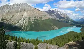
During the glacials and interglacials of the Pleistocene ("ice ages"), several paleolakes formed on the Altiplano Cundiboyacense, of which Lake Humboldt on the Bogotá savanna was the most extensive (approximately 4,500 square kilometres (1,700 sq mi)). Rivers were restricted during the drier glacial periods and the vegetation changed from páramo to Andean forest between the glacials and stadials and interglacials and interstadials.[2]
Description
Lithologies
The Soatá Formation consists of whitish calcareous claystones and sandy siltstones with plagioclase, hematite, zircon, green and reddish biotite, hornblende and crystalline calcite in its upper, older terrace. This unit also contains foraminifera and fragments of shells.[1]
The middle, younger unit is composed of basal greyish claystones with non-uniform matrix-supported conglomerates at the upper section. The uppermost layer contains siltstones, probably of volcaniclastic origin.[3]
The youngest sediments are found deepest in the basin and consist of claystones and greenish matrix-supported conglomerates. Rootlets and mammal fossils are more abundant in this layer.[3]
Stratigraphy
The Soatá Formation unconformably overlies the Cretaceous Capacho Formation, and is overlain by the Holocene infill sediments of the Chicamocha River, the course of which severely eroded and fragmented the Soatá formation.[4] The formation is subdivided into three units of different lithological character and sedimentary dip in a terrace setting. The Soatá Formation is time-equivalent with the upper part of the Sabana Formation on the Bogotá savanna and the Chinauta deposits near Fusagasugá in the southwest of the Altiplano.[5][6] Two samples were analysed for radiometric dating and provided ages of 45,900 ± 1,600 and 39,600 ± 800 years BP.[7] This corresponds to the Chicagota interstadial and the Tagua stadial, when the glaciations were at their maximum extent.[8][9]
Depositional environment
The depositional environment has been interpreted as lacustrine (Lake Soatá) and fluvio-deltaic. Contrasting with the wide and shallow Lake Humboldt on the Bogotá savanna, Lake Soatá was probably close to 400 metres (1,300 ft) deep.[10] The paleolake was approximately 30 kilometres (19 mi) long and widest between Soatá and Boavita at 7 kilometres (4.3 mi).[11]
Fossil content
In the Soatá Formation, fossils of Haplomastodon waringi, Neochoerus sp. and Odocoileus cf. salinae have been found.[12] The fossil content is fragmentary.[13]
Outcrops
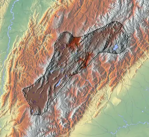
The Soatá Formation is apart from its type locality Portugalete found around Soatá (Jútua), and stretches to the north near the border of Boyacá and Santander, northeast of Tipacoque. To the south, the formation may have reached until Socotá.[10]
Regional correlations
| Ma | Age | Paleomap | Regional events | Catatumbo | Cordillera | proximal Llanos | distal Llanos | Putumayo | VSM | Environments | Maximum thickness | Petroleum geology | Notes |
|---|---|---|---|---|---|---|---|---|---|---|---|---|---|
| 0.01 | Holocene | 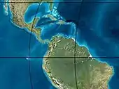 | Holocene volcanism Seismic activity | alluvium | Overburden | ||||||||
| 1 | Pleistocene | | Pleistocene volcanism Andean orogeny 3 Glaciations | Guayabo | Soatá Sabana | Necesidad | Guayabo | Gigante Neiva | Alluvial to fluvial (Guayabo) | 550 m (1,800 ft) (Guayabo) | [14][15][16][17] | ||
| 2.6 | Pliocene |  | Pliocene volcanism Andean orogeny 3 GABI | Subachoque | |||||||||
| 5.3 | Messinian | Andean orogeny 3 Foreland | Marichuela | Caimán | Honda | [16][18] | |||||||
| 13.5 | Langhian | Regional flooding | León | hiatus | Caja | León | Lacustrine (León) | 400 m (1,300 ft) (León) | Seal | [17][19] | |||
| 16.2 | Burdigalian | Miocene inundations Andean orogeny 2 | C1 | Carbonera C1 | Ospina | Proximal fluvio-deltaic (C1) | 850 m (2,790 ft) (Carbonera) | Reservoir | [18][17] | ||||
| 17.3 | C2 | Carbonera C2 | Distal lacustrine-deltaic (C2) | Seal | |||||||||
| 19 | C3 | Carbonera C3 | Proximal fluvio-deltaic (C3) | Reservoir | |||||||||
| 21 | Early Miocene | Pebas wetlands | C4 | Carbonera C4 | Barzalosa | Distal fluvio-deltaic (C4) | Seal | ||||||
| 23 | Late Oligocene |  | Andean orogeny 1 Foredeep | C5 | Carbonera C5 | Orito | Proximal fluvio-deltaic (C5) | Reservoir | [15][18] | ||||
| 25 | C6 | Carbonera C6 | Distal fluvio-lacustrine (C6) | Seal | |||||||||
| 28 | Early Oligocene | C7 | C7 | Pepino | Gualanday | Proximal deltaic-marine (C7) | Reservoir | [15][18][20] | |||||
| 32 | Oligo-Eocene | C8 | Usme | C8 | onlap | Marine-deltaic (C8) | Seal Source | [20] | |||||
| 35 | Late Eocene | 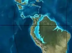 | Mirador | Mirador | Coastal (Mirador) | 240 m (790 ft) (Mirador) | Reservoir | [17][21] | |||||
| 40 | Middle Eocene | Regadera | hiatus | ||||||||||
| 45 | |||||||||||||
| 50 | Early Eocene | 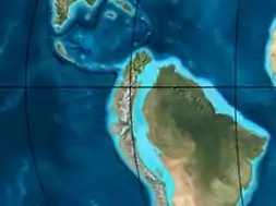 | Socha | Los Cuervos | Deltaic (Los Cuervos) | 260 m (850 ft) (Los Cuervos) | Seal Source | [17][21] | |||||
| 55 | Late Paleocene | PETM 2000 ppm CO2 | Los Cuervos | Bogotá | Gualanday | ||||||||
| 60 | Early Paleocene | SALMA | Barco | Guaduas | Barco | Rumiyaco | Fluvial (Barco) | 225 m (738 ft) (Barco) | Reservoir | [14][15][18][17][22] | |||
| 65 | Maastrichtian | 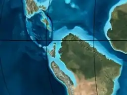 | KT extinction | Catatumbo | Guadalupe | Monserrate | Deltaic-fluvial (Guadalupe) | 750 m (2,460 ft) (Guadalupe) | Reservoir | [14][17] | |||
| 72 | Campanian | End of rifting | Colón-Mito Juan | [17][23] | |||||||||
| 83 | Santonian | Villeta/Güagüaquí | |||||||||||
| 86 | Coniacian | ||||||||||||
| 89 | Turonian | Cenomanian-Turonian anoxic event | La Luna | Chipaque | Gachetá | hiatus | Restricted marine (all) | 500 m (1,600 ft) (Gachetá) | Source | [14][17][24] | |||
| 93 | Cenomanian | 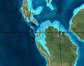 | Rift 2 | ||||||||||
| 100 | Albian | Une | Une | Caballos | Deltaic (Une) | 500 m (1,600 ft) (Une) | Reservoir | [18][24] | |||||
| 113 | Aptian | 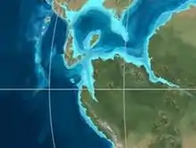 | Capacho | Fómeque | Motema | Yaví | Open marine (Fómeque) | 800 m (2,600 ft) (Fómeque) | Source (Fóm) | [15][17][25] | |||
| 125 | Barremian | High biodiversity | Aguardiente | Paja | Shallow to open marine (Paja) | 940 m (3,080 ft) (Paja) | Reservoir | [14] | |||||
| 129 | Hauterivian | 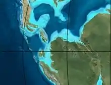 | Rift 1 | Tibú- Mercedes | Las Juntas | hiatus | Deltaic (Las Juntas) | 910 m (2,990 ft) (Las Juntas) | Reservoir (LJun) | [14] | |||
| 133 | Valanginian | Río Negro | Cáqueza Macanal Rosablanca | Restricted marine (Macanal) | 2,935 m (9,629 ft) (Macanal) | Source (Mac) | [15][26] | ||||||
| 140 | Berriasian | Girón | |||||||||||
| 145 | Tithonian | Break-up of Pangea | Jordán | Arcabuco | Buenavista Batá | Saldaña | Alluvial, fluvial (Buenavista) | 110 m (360 ft) (Buenavista) | "Jurassic" | [18][27] | |||
| 150 | Early-Mid Jurassic | 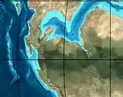 | Passive margin 2 | La Quinta | Montebel Noreán | hiatus | Coastal tuff (La Quinta) | 100 m (330 ft) (La Quinta) | [28] | ||||
| 201 | Late Triassic | 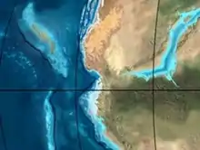 | Mucuchachi | Payandé | [18] | ||||||||
| 235 | Early Triassic |  | Pangea | hiatus | "Paleozoic" | ||||||||
| 250 | Permian |  | |||||||||||
| 300 | Late Carboniferous |  | Famatinian orogeny | Cerro Neiva () | [29] | ||||||||
| 340 | Early Carboniferous | Fossil fish Romer's gap | Cuche (355-385) | Farallones () | Deltaic, estuarine (Cuche) | 900 m (3,000 ft) (Cuche) | |||||||
| 360 | Late Devonian |  | Passive margin 1 | Río Cachirí (360-419) | Ambicá () | Alluvial-fluvial-reef (Farallones) | 2,400 m (7,900 ft) (Farallones) | [26][30][31][32][33] | |||||
| 390 | Early Devonian | 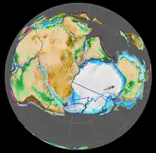 | High biodiversity | Floresta (387-400) El Tíbet | Shallow marine (Floresta) | 600 m (2,000 ft) (Floresta) | |||||||
| 410 | Late Silurian | Silurian mystery | |||||||||||
| 425 | Early Silurian | hiatus | |||||||||||
| 440 | Late Ordovician |  | Rich fauna in Bolivia | San Pedro (450-490) | Duda () | ||||||||
| 470 | Early Ordovician | First fossils | Busbanzá (>470±22) Chuscales Otengá | Guape () | Río Nevado () | Hígado () | [34][35][36] | ||||||
| 488 | Late Cambrian |  | Regional intrusions | Chicamocha (490-515) | Quetame () | Ariarí () | SJ del Guaviare (490-590) | San Isidro () | [37][38] | ||||
| 515 | Early Cambrian | Cambrian explosion | [36][39] | ||||||||||
| 542 | Ediacaran |  | Break-up of Rodinia | pre-Quetame | post-Parguaza | El Barro () | Yellow: allochthonous basement (Chibcha Terrane) Green: autochthonous basement (Río Negro-Juruena Province) | Basement | [40][41] | ||||
| 600 | Neoproterozoic |  | Cariri Velhos orogeny | Bucaramanga (600-1400) | pre-Guaviare | [37] | |||||||
| 800 |  | Snowball Earth | [42] | ||||||||||
| 1000 | Mesoproterozoic | 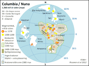 | Sunsás orogeny | Ariarí (1000) | La Urraca (1030-1100) | [43][44][45][46] | |||||||
| 1300 | Rondônia-Juruá orogeny | pre-Ariarí | Parguaza (1300-1400) | Garzón (1180-1550) | [47] | ||||||||
| 1400 | 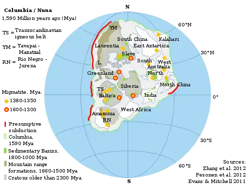 | pre-Bucaramanga | [48] | ||||||||||
| 1600 | Paleoproterozoic | Maimachi (1500-1700) | pre-Garzón | [49] | |||||||||
| 1800 |  | Tapajós orogeny | Mitú (1800) | [47][49] | |||||||||
| 1950 | Transamazonic orogeny | pre-Mitú | [47] | ||||||||||
| 2200 | Columbia | ||||||||||||
| 2530 | Archean |  | Carajas-Imataca orogeny | [47] | |||||||||
| 3100 | Kenorland | ||||||||||||
| Sources | |||||||||||||
- Legend
- group
- important formation
- fossiliferous formation
- minor formation
- (age in Ma)
- proximal Llanos (Medina)[note 1]
- distal Llanos (Saltarin 1A well)[note 2]
See also
Notes
References
- Villarroel et al., 2001, p.80
- Urrego et al., 2016, p.702
- Villarroel et al., 2001, p.82
- IGAC, 2005, p.150
- Villarroel et al., 2001, p.84
- Hoyos et al., 2015, p.263
- Villarroel et al., 2001, p.90
- Hammen, 1986, p.27
- Rutter et al., 2012, p.32
- Villarroel et al., 2001, p.88
- Villarroel et al., 2001, p.81
- Soatá at Fossilworks.org
- Villarroel et al., 1996, p.85
- García González et al., 2009, p.27
- García González et al., 2009, p.50
- García González et al., 2009, p.85
- Barrero et al., 2007, p.60
- Barrero et al., 2007, p.58
- Plancha 111, 2001, p.29
- Plancha 177, 2015, p.39
- Plancha 111, 2001, p.26
- Plancha 111, 2001, p.24
- Plancha 111, 2001, p.23
- Pulido & Gómez, 2001, p.32
- Pulido & Gómez, 2001, p.30
- Pulido & Gómez, 2001, pp.21-26
- Pulido & Gómez, 2001, p.28
- Correa Martínez et al., 2019, p.49
- Plancha 303, 2002, p.27
- Terraza et al., 2008, p.22
- Plancha 229, 2015, pp.46-55
- Plancha 303, 2002, p.26
- Moreno Sánchez et al., 2009, p.53
- Mantilla Figueroa et al., 2015, p.43
- Manosalva Sánchez et al., 2017, p.84
- Plancha 303, 2002, p.24
- Mantilla Figueroa et al., 2015, p.42
- Arango Mejía et al., 2012, p.25
- Plancha 350, 2011, p.49
- Pulido & Gómez, 2001, pp.17-21
- Plancha 111, 2001, p.13
- Plancha 303, 2002, p.23
- Plancha 348, 2015, p.38
- Planchas 367-414, 2003, p.35
- Toro Toro et al., 2014, p.22
- Plancha 303, 2002, p.21
- Bonilla et al., 2016, p.19
- Gómez Tapias et al., 2015, p.209
- Bonilla et al., 2016, p.22
- Duarte et al., 2019
- García González et al., 2009
- Pulido & Gómez, 2001
- García González et al., 2009, p.60
Bibliography
- Van der Hammen, Thomas. 1986. Cambios medioambientales y la extinción del mastodonte en el norte de los Andes. Revista de Antropología, Universidad de los Andes II. 27-34.
- Hoyos, Natalia; O. Monsalve; G.W. Berger; J.L. Antinao; H. Giraldo; C. Silva; G. Ojeda; G. Bayona, and J. Escobar and C. Montes. 2015. A climatic trigger for catastrophic Pleistocene–Holocene debris flows in the Eastern Andean Cordillera of Colombia. Journal of Quaternary Science 30. 258-270.
- Rutter, N.; A. Coronato; K. Helmens; J. Rabassa, and M. Zárate. 2012. Glaciations in North and South America from the Miocene to the Last Glacial Maximum, 1–67. Springer.
- Urrego, Dunia H.; Henry Hooghiemstra; Oscar Rama Corredor; Belén Martrat; Joan O. Grimalt; Lonnie Thompson; Mark B. Bush; Zaire González Carranza, and Jennifer Hanselman, Bryan Valencia and César Velásquez Ruiz. 2016. Millennial-scale vegetation changes in the tropical Andes using ecological grouping and ordination methods. Climate of the Past 12. 697-711.
- Villarroel, Carlos; Ana Elena Concha, and Carlos Macía. 2001. El Lago Pleistoceno de Soatá (Boyacá, Colombia): Consideraciones estratigráficas, paleontológicas y paleoecológicas. Geología Colombiana 26. 79-93.
- Villarroel, Carlos; Jorge Brieva B., and Alberto Cadena. 1996. La Fauna de Mamíferos Fósiles del Pleistoceno de Jútua, Municipio de Soatá (Boyacá, Colombia). Geología Colombiana 21. 81-87.
- Various, Authors. 2005. Estudio General de Suelos y Zonificación de Tierras del Departamento de Boyacá, 1-256. IGAC.
Paleontology in Colombia | |||||||||||||
|---|---|---|---|---|---|---|---|---|---|---|---|---|---|
| Notable researchers |
|   .jpg.webp)  | |||||||||||
| Major fossiliferous stratigraphic units |
| ||||||||||||
| Notable fossils | |||||||||||||