Western Express Highway
'For the metro station named after the highway, see Western Express Highway metro station
| Western Express Highway Ali Yavar Jung Marg | |
|---|---|
 Expressway Map | |
| Route information | |
| Maintained by MMRDA,[1] NHAI | |
| Length | 25.33 km (15.74 mi) |
| Major junctions | |
| North end | NH48 in Dahisar |
| Veer Savarkar Road and General AK Vaidya Marg in Goregaon JVLR in Jogeshwari SCLR in Santacruz Andheri-Kurla Road in Andheri Sahar Road in Andheri SEAR in Vile Parle SV Road in Bandra | |
| South end | Bandra |
| Location | |
| States | Maharashtra |
| Districts | Mumbai Suburban |
| Major cities | Mumbai |
| Highway system | |
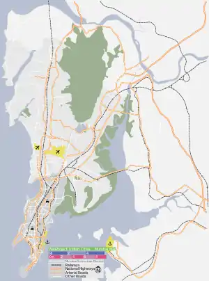
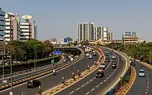
The Western Express Highway, shortened to WEH (officially Ali Yavar Jung Marg after the former Governor of Maharashtra),[2] is a major north-south 8-10 lane arterial road in Mumbai, India, stretching from the suburb of Dahisar to Bandra. The 25.33 km (15.74 mi)[3] highway begins near the Mahim Creek and extends to the Mira-Dahisar toll booth in the northern limit of the city. Beyond the city limits, it continues as the Delhi-Bengaluru National Highway 48. The road serves the city of Mumbai to its suburbs, including the Chhatrapati Shivaji Maharaj International Airport.
Background
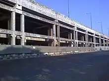
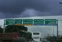
This highway has been instrumental in reducing congestion on SV Road in western Part of the city. There are several flyovers built along sections Western Express Highway. The Andheri Flyover (opened in 2002) was one of the flyovers built over the Western Express Highway to avoid traffic lights for vehicles moving towards Vile Parle, Bandra and so on. Recently another project has been undertaken by the MSRDC to construct a flyover bridge from Vile Parle Onwards to avoid regular traffic jams that occur on the Highway. Other flyovers on the highway are the National Park, Dindoshi, Thakur Complex, Times of India, Pathanwadi, Goregaon, JVLR, Centaur, Vakola, and the newly opened Kherwadi flyovers. Motorists can now travel with no traffic signal from Dahisar till Bandra. New reflectors are installed on the Express highway for better visibility of the road during the night. Signs showing directions have also been set up at major junctions of the highway. Over the past decade, there have been major improvements including installation of better signage, improvements to landscaping and the introduction of marked lanes, painted kerbsides and pedestrian bridges.
The airport flyover, also known as Sahar Elevated Access Road, connects to the WEH using tunnels and bridges. The airport flyover was finished in 2014, and motorists on the WEH are able to access the new terminal with ease. The other alternative to the SEAR, is to turn east on to local streets which are relatively narrow, have poor lighting and have lower speed limits. The statue of The Chhtrapati Shivaji is placed near the entrance of the SEAR; previously this statue was located at the Sahar terminal of the airport.
Link roads connecting WEH and EEH such as the Jogeshwari – Vikhroli Link Road (JVLR) and Santa Cruz – Chembur Link Road (SCLR) are the major arterial roads of the Mumbai suburban road network. Both the WEH and the EEH run along north to south direction and are parallel in certain sections.[4]
References
- "MMRDA - Projects - Mumbai Urban Infrastructure Project". Mmrdamumbai.org. Retrieved 27 July 2010.
- Chacko, Benita (18 September 2017). "Western Express Highway: Few know this arterial road honours a former diplomat". Indian Express. Retrieved 21 March 2019.
- Brihanmumbai Municipal Corporation (BMC). "Urban Transportation" (PDF). BMC. p. 1. Retrieved 7 April 2014.
- MMRDA (30 June 2002). "EA/EMP report of JVLR (Jogeshwari - Vikhroli Road) project under MUTP : Mumbai. Vol. 3 of India - Mumbai Urban Transport Project (MUTP) : environmental impact assessment". India: World Bank. p. 41. Retrieved 7 April 2014.