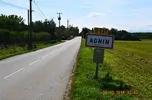
Agnin
Agnin is a commune in the Isère department in the Auvergne-Rhône-Alpes region of south-eastern France.
Agnin | |
|---|---|
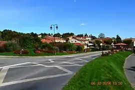 A street in Agnin | |
.svg.png.webp) Coat of arms | |
Location of Agnin 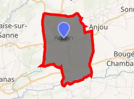
| |
 Agnin  Agnin | |
| Coordinates: 45°20′28″N 4°51′28″E | |
| Country | France |
| Region | Auvergne-Rhône-Alpes |
| Department | Isère |
| Arrondissement | Vienne |
| Canton | Roussillon |
| Intercommunality | Entre Bièvre et Rhône |
| Government | |
| • Mayor (2014-2020) | Christian Monteyremard |
| Area 1 | 7.96 km2 (3.07 sq mi) |
| Population (2017-01-01)[1] | 1,106 |
| • Density | 140/km2 (360/sq mi) |
| Time zone | UTC+01:00 (CET) |
| • Summer (DST) | UTC+02:00 (CEST) |
| INSEE/Postal code | 38003 /38150 |
| Elevation | 167–331 m (548–1,086 ft) |
| 1 French Land Register data, which excludes lakes, ponds, glaciers > 1 km2 (0.386 sq mi or 247 acres) and river estuaries. | |
The inhabitants of the commune are known as Agnitaires [2]
The commune has been awarded one flower by the National Council of Towns and Villages in Bloom in the Competition of cities and villages in Bloom.[3]
Geography
Agnin is located some 25 km south of Vienne and 5 km north-east of Saint-Rambert-d'Albon. It can be accessed by the road D519 from near Chanas in the west passing through the southern part of the commune and continuing to Bouge-Chambalud. Parallel to this road in the north of the commune is the D51 road from Salaise-sur-Sanne in the west passing through the commune and the village and continuing to Anjou in the east. The D131 also comes from the Ville-sous-Anjou in the north joining the D51 west of the village. The Route de Bouge connects the village to the D519 in the south of the commune. The commune is mostly farmland with significant areas of housing in the north and some small areas of forest in the south.[4]
An unnamed stream flows south forming the western border of the commune and another unnamed stream flows through the commune then forms the south-western border. They both join in the south-west and continue flowing west. The Dolon stream forms the southern border of the commune
Neighbouring communes and villages
Places adjacent to Agnin | |
|---|---|
Toponymy
Like the nearby town of Anjou the origin of the name Agnin comes from the name of a Roman noble Anianus who owned vast territory in that era. The name of the town changed a few centuries later to Agnino which was the name used in the 11th century to describe this commune. Then over the following centuries Agnino became the Agnin known today.[5]
Heraldry
| [[Image:|120px|center|Arms of Agnin]] | Blazon: Party per bend sinister, one of Or a local church soutenu at dexter by an inescutcheon with two keys saltirewise and sinister in chief a Vol all represented in lines; two of gules a dolphin of Or at dexter and a rose gules stalked and leaved in vert; in the cotice a bend sinister in Or charged with the letters AGNIN in sable debruised on the division. |
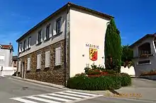
Administration
List of Successive Mayors of Agnin[6]
| From | To | Name | Party | Position |
|---|---|---|---|---|
| 2001 | 2008 | Gérard Giraud | ||
| 2008 | Current | Christian Monteyremard |
(Not all data is known)
Population
|
| |||||||||||||||||||||||||||||||||||||||||||||||||||||||||||||||||||||||||||||||||||||||||||||||||||||||||||||||
| Source: EHESS[7] and INSEE[8] | ||||||||||||||||||||||||||||||||||||||||||||||||||||||||||||||||||||||||||||||||||||||||||||||||||||||||||||||||
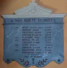
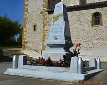
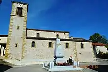
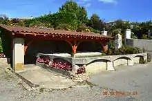
Sites and Monuments
- The portal and tower of Bâtie Manor
 are registered as historical monuments.[9]
 - Gaulas Castle
- A Church from the 12th century
- Typical houses
- Gallo-Roman remains at Golat
See also
References
- "Populations légales 2017". INSEE. Retrieved 6 January 2020.
- Inhabitants of Isère (in French)
- Agnin in the Competition for Towns and Villages in Bloom Archived 2014-12-10 at the Wayback Machine (in French)
- Google Maps
- André Plank, The Origin of the names of the Communes of the department of Isère, Bourg-d'Oisans: L'atelier, 2006, ISBN 978-2-84424-043-9
- List of Mayors of France (in French)
- Données Cassini, EHESS
- Population en historique depuis 1968, INSEE
- Ministry of Culture, Mérimée PA00117114 Bâtie Manor (in French)
External links
| Wikimedia Commons has media related to Agnin. |
- Agnin Official website (in French)
- Agnin on the old IGN website (in French)
- Agnin on Lion1906
- Agnin on the 1750 Cassini Map
| Authority control |
|---|