Oytier-Saint-Oblas
Oytier-Saint-Oblas is a commune in the Isère department in southeastern France.
Oytier-Saint Oblas | |
|---|---|
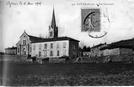 Oytier in 1907 | |
 Coat of arms | |
Location of Oytier-Saint Oblas 
| |
 Oytier-Saint Oblas  Oytier-Saint Oblas | |
| Coordinates: 45°33′42″N 5°01′18″E | |
| Country | France |
| Region | Auvergne-Rhône-Alpes |
| Department | Isère |
| Arrondissement | Vienne |
| Canton | La Verpillière |
| Intercommunality | Collines du Nord Dauphiné |
| Government | |
| • Mayor (2014–2020) | René Poretta |
| Area 1 | 14.3 km2 (5.5 sq mi) |
| Population (2017-01-01)[1] | 1,637 |
| • Density | 110/km2 (300/sq mi) |
| Time zone | UTC+01:00 (CET) |
| • Summer (DST) | UTC+02:00 (CEST) |
| INSEE/Postal code | 38288 /38780 |
| Elevation | 232–376 m (761–1,234 ft) (avg. 236 m or 774 ft) |
| 1 French Land Register data, which excludes lakes, ponds, glaciers > 1 km2 (0.386 sq mi or 247 acres) and river estuaries. | |
Population
| Year | Pop. | ±% |
|---|---|---|
| 1793 | 658 | — |
| 1806 | 710 | +7.9% |
| 1821 | 754 | +6.2% |
| 1831 | 804 | +6.6% |
| 1841 | 931 | +15.8% |
| 1851 | 969 | +4.1% |
| 1861 | 845 | −12.8% |
| 1872 | 841 | −0.5% |
| 1881 | 785 | −6.7% |
| 1891 | 744 | −5.2% |
| 1901 | 652 | −12.4% |
| 1911 | 613 | −6.0% |
| 1921 | 570 | −7.0% |
| 1931 | 522 | −8.4% |
| 1946 | 480 | −8.0% |
| 1954 | 493 | +2.7% |
| 1962 | 503 | +2.0% |
| 1968 | 550 | +9.3% |
| 1975 | 558 | +1.5% |
| 1982 | 686 | +22.9% |
| 1990 | 1,022 | +49.0% |
| 1999 | 1,353 | +32.4% |
| 2006 | 1,506 | +11.3% |
| 2011 | 1,580 | +4.9% |
See also
References
- "Populations légales 2017". INSEE. Retrieved 6 January 2020.
| Wikimedia Commons has media related to Oytier-Saint-Oblas. |
| Authority control |
|---|
This article is issued from Wikipedia. The text is licensed under Creative Commons - Attribution - Sharealike. Additional terms may apply for the media files.