Faramans, Isère
Faramans is a commune in the Isère department of southeastern France.
Faramans | |
|---|---|
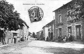 The main road in 1910 | |
Location of Faramans 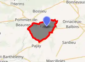
| |
 Faramans  Faramans | |
| Coordinates: 45°23′39″N 5°09′51″E | |
| Country | France |
| Region | Auvergne-Rhône-Alpes |
| Department | Isère |
| Arrondissement | Vienne |
| Canton | Bièvre |
| Intercommunality | Pays de Bièvre-Liers |
| Government | |
| • Mayor (2014–2020) | Gilles Bourdat |
| Area 1 | 10.79 km2 (4.17 sq mi) |
| Population (2017-01-01)[1] | 1,038 |
| • Density | 96/km2 (250/sq mi) |
| Time zone | UTC+01:00 (CET) |
| • Summer (DST) | UTC+02:00 (CEST) |
| INSEE/Postal code | 38161 /38260 |
| Elevation | 342–444 m (1,122–1,457 ft) |
| 1 French Land Register data, which excludes lakes, ponds, glaciers > 1 km2 (0.386 sq mi or 247 acres) and river estuaries. | |
Population
| Year | Pop. | ±% |
|---|---|---|
| 1793 | 1,154 | — |
| 1806 | 1,104 | −4.3% |
| 1821 | 1,402 | +27.0% |
| 1831 | 1,593 | +13.6% |
| 1841 | 1,067 | −33.0% |
| 1851 | 1,293 | +21.2% |
| 1861 | 1,040 | −19.6% |
| 1872 | 975 | −6.2% |
| 1881 | 897 | −8.0% |
| 1891 | 884 | −1.4% |
| 1901 | 790 | −10.6% |
| 1911 | 715 | −9.5% |
| 1921 | 657 | −8.1% |
| 1931 | 654 | −0.5% |
| 1946 | 592 | −9.5% |
| 1954 | 567 | −4.2% |
| 1962 | 541 | −4.6% |
| 1968 | 528 | −2.4% |
| 1975 | 515 | −2.5% |
| 1982 | 614 | +19.2% |
| 1990 | 679 | +10.6% |
| 1999 | 734 | +8.1% |
| 2006 | 836 | +13.9% |
| 2011 | 963 | +15.2% |
See also
References
- "Populations légales 2017". INSEE. Retrieved 6 January 2020.
| Wikimedia Commons has media related to Faramans (Isère). |
| Authority control |
|---|
This article is issued from Wikipedia. The text is licensed under Creative Commons - Attribution - Sharealike. Additional terms may apply for the media files.