Chantepérier
Chantepérier is a commune in the Isère department in southeastern France. It was established on 1 January 2019 by merger of the former communes of Chantelouve (the seat) and Le Périer.[2]
Chantepérier | |
|---|---|
Location of Chantepérier 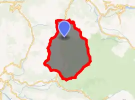
| |
 Chantepérier  Chantepérier | |
| Coordinates: 44°59′05″N 5°58′09″E | |
| Country | France |
| Region | Auvergne-Rhône-Alpes |
| Department | Isère |
| Arrondissement | Grenoble |
| Canton | Matheysine-Trièves |
| Intercommunality | Matheysine |
| Area 1 | 81.40 km2 (31.43 sq mi) |
| Population (2017-01-01)[1] | 203 |
| • Density | 2.5/km2 (6.5/sq mi) |
| Time zone | UTC+01:00 (CET) |
| • Summer (DST) | UTC+02:00 (CEST) |
| INSEE/Postal code | 38073 /38740 |
| Elevation | 897–3,023 m (2,943–9,918 ft) |
| 1 French Land Register data, which excludes lakes, ponds, glaciers > 1 km2 (0.386 sq mi or 247 acres) and river estuaries. | |
See also
References
- "Populations légales 2017". INSEE. Retrieved 6 January 2020.
- Arrêté préfectoral 18 December 2018 (in French)
| Wikimedia Commons has media related to Chantepérier. |
This article is issued from Wikipedia. The text is licensed under Creative Commons - Attribution - Sharealike. Additional terms may apply for the media files.
