Montrevel, Isère
Montrevel is a commune in the Isère department in southeastern France.
Montrevel | |
|---|---|
.jpg.webp) Biol and Montrevel in 1912 | |
Location of Montrevel 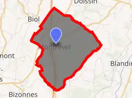
| |
 Montrevel  Montrevel | |
| Coordinates: 45°28′47″N 5°24′10″E | |
| Country | France |
| Region | Auvergne-Rhône-Alpes |
| Department | Isère |
| Arrondissement | La Tour-du-Pin |
| Canton | Le Grand-Lemps |
| Government | |
| • Mayor (2014–2020) | Daniel Vitte |
| Area 1 | 9.37 km2 (3.62 sq mi) |
| Population (2017-01-01)[1] | 451 |
| • Density | 48/km2 (120/sq mi) |
| Time zone | UTC+01:00 (CET) |
| • Summer (DST) | UTC+02:00 (CEST) |
| INSEE/Postal code | 38257 /38690 |
| Elevation | 441–705 m (1,447–2,313 ft) (avg. 510 m or 1,670 ft) |
| 1 French Land Register data, which excludes lakes, ponds, glaciers > 1 km2 (0.386 sq mi or 247 acres) and river estuaries. | |
Population
| Year | Pop. | ±% |
|---|---|---|
| 1793 | 1,075 | — |
| 1806 | 1,406 | +30.8% |
| 1821 | 1,625 | +15.6% |
| 1831 | 1,517 | −6.6% |
| 1841 | 615 | −59.5% |
| 1851 | 601 | −2.3% |
| 1861 | 563 | −6.3% |
| 1872 | 557 | −1.1% |
| 1881 | 495 | −11.1% |
| 1891 | 416 | −16.0% |
| 1901 | 376 | −9.6% |
| 1911 | 350 | −6.9% |
| 1921 | 272 | −22.3% |
| 1931 | 283 | +4.0% |
| 1946 | 281 | −0.7% |
| 1954 | 250 | −11.0% |
| 1962 | 241 | −3.6% |
| 1968 | 245 | +1.7% |
| 1975 | 246 | +0.4% |
| 1982 | 233 | −5.3% |
| 1990 | 262 | +12.4% |
| 1999 | 356 | +35.9% |
| 2006 | 439 | +23.3% |
| 2011 | 469 | +6.8% |
See also
References
- "Populations légales 2017". INSEE. Retrieved 6 January 2020.
| Wikimedia Commons has media related to Montrevel (Isère). |
| Authority control |
|---|
This article is issued from Wikipedia. The text is licensed under Creative Commons - Attribution - Sharealike. Additional terms may apply for the media files.