La Tour-du-Pin
La Tour-du-Pin (French pronunciation: [la tuʁ dy pɛ̃] (![]() listen); Francoprovençal: La Tor-du-Pin) is a commune in the Isère department in southeastern France, 502 km from Paris.
listen); Francoprovençal: La Tor-du-Pin) is a commune in the Isère department in southeastern France, 502 km from Paris.
La Tour-du-Pin | |
|---|---|
Subprefecture and commune | |
 The church of Notre-Dame de l'Assomption, in La-Tour-du-Pin | |
 Coat of arms | |
Location of La Tour-du-Pin 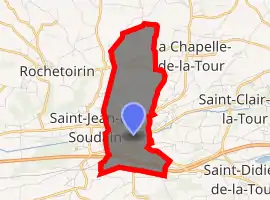
| |
 La Tour-du-Pin  La Tour-du-Pin | |
| Coordinates: 45°33′54″N 5°26′40″E | |
| Country | France |
| Region | Auvergne-Rhône-Alpes |
| Department | Isère |
| Arrondissement | La Tour-du-Pin |
| Canton | La Tour-du-Pin |
| Government | |
| • Mayor (2020–2026) | Fabien Rajon |
| Area 1 | 4.77 km2 (1.84 sq mi) |
| Population (2017-01-01)[1] | 8,080 |
| • Density | 1,700/km2 (4,400/sq mi) |
| Time zone | UTC+01:00 (CET) |
| • Summer (DST) | UTC+02:00 (CEST) |
| INSEE/Postal code | 38509 /38110 |
| Elevation | 309–461 m (1,014–1,512 ft) (avg. 339 m or 1,112 ft) |
| 1 French Land Register data, which excludes lakes, ponds, glaciers > 1 km2 (0.386 sq mi or 247 acres) and river estuaries. | |
Geography
The Bourbre flows west through the southern part of the commune and crosses the town. The town's lowest point is at 309 m and the highest at 461 m.
Population
| Year | Pop. | ±% |
|---|---|---|
| 1793 | 3,098 | — |
| 1806 | 1,540 | −50.3% |
| 1821 | 1,971 | +28.0% |
| 1831 | 2,334 | +18.4% |
| 1841 | 2,456 | +5.2% |
| 1851 | 2,572 | +4.7% |
| 1861 | 2,699 | +4.9% |
| 1872 | 2,857 | +5.9% |
| 1881 | 3,571 | +25.0% |
| 1891 | 3,520 | −1.4% |
| 1901 | 3,803 | +8.0% |
| 1911 | 4,032 | +6.0% |
| 1921 | 3,959 | −1.8% |
| 1931 | 4,465 | +12.8% |
| 1946 | 4,117 | −7.8% |
| 1954 | 4,459 | +8.3% |
| 1962 | 4,694 | +5.3% |
| 1968 | 5,649 | +20.3% |
| 1975 | 6,641 | +17.6% |
| 1982 | 6,913 | +4.1% |
| 1990 | 6,770 | −2.1% |
| 1999 | 6,553 | −3.2% |
| 2006 | 7,431 | +13.4% |
| 2012 | 7,927 | +6.7% |
| 2013 | 7,922 | −0.1% |
| 2014 | 7,934 | +0.2% |
See also
References
- "Populations légales 2017". INSEE. Retrieved 6 January 2020.
| Wikimedia Commons has media related to La Tour-du-Pin. |
| Authority control |
|---|
This article is issued from Wikipedia. The text is licensed under Creative Commons - Attribution - Sharealike. Additional terms may apply for the media files.