Le Passage, Isère
Le Passage is a commune in the Isère department in southeastern France.
Le Passage | |
|---|---|
 Chateau | |
Location of Le Passage 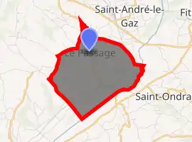
| |
 Le Passage  Le Passage | |
| Coordinates: 45°32′00″N 5°30′46″E | |
| Country | France |
| Region | Auvergne-Rhône-Alpes |
| Department | Isère |
| Arrondissement | La Tour-du-Pin |
| Canton | La Tour-du-Pin |
| Government | |
| • Mayor (2014–2020) | Laurent Michel |
| Area 1 | 6.68 km2 (2.58 sq mi) |
| Population (2017-01-01)[1] | 793 |
| • Density | 120/km2 (310/sq mi) |
| Time zone | UTC+01:00 (CET) |
| • Summer (DST) | UTC+02:00 (CEST) |
| INSEE/Postal code | 38296 /38490 |
| Elevation | 365–521 m (1,198–1,709 ft) (avg. 471 m or 1,545 ft) |
| 1 French Land Register data, which excludes lakes, ponds, glaciers > 1 km2 (0.386 sq mi or 247 acres) and river estuaries. | |
Geography
The Bourbre forms the commune's southeastern border.
Population
| Year | Pop. | ±% |
|---|---|---|
| 1793 | 774 | — |
| 1806 | 894 | +15.5% |
| 1821 | 822 | −8.1% |
| 1831 | 940 | +14.4% |
| 1941 | 910 | −3.2% |
| 1951 | 842 | −7.5% |
| 1861 | 824 | −2.1% |
| 1872 | 838 | +1.7% |
| 1881 | 766 | −8.6% |
| 1891 | 807 | +5.4% |
| 1901 | 696 | −13.8% |
| 1911 | 639 | −8.2% |
| 1921 | 552 | −13.6% |
| 1931 | 518 | −6.2% |
| 1946 | 463 | −10.6% |
| 1954 | 449 | −3.0% |
| 1962 | 360 | −19.8% |
| 1968 | 343 | −4.7% |
| 1975 | 339 | −1.2% |
| 1982 | 431 | +27.1% |
| 1990 | 516 | +19.7% |
| 1999 | 648 | +25.6% |
| 2006 | 749 | +15.6% |
| 2011 | 775 | +3.5% |
See also
References
- "Populations légales 2017". INSEE. Retrieved 6 January 2020.
| Wikimedia Commons has media related to Le Passage (Isère). |
| Authority control |
|---|
This article is issued from Wikipedia. The text is licensed under Creative Commons - Attribution - Sharealike. Additional terms may apply for the media files.