National Register of Historic Places listings in Aroostook County, Maine
This is a list of the National Register of Historic Places listings in Aroostook County, Maine.
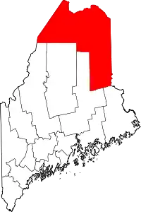
Location of Aroostook County in Maine
This is intended to be a complete list of the properties and districts on the National Register of Historic Places in Aroostook County, Maine, United States. Latitude and longitude coordinates are provided for many National Register properties and districts; these locations may be seen together in a map.[1]
There are 59 properties and districts listed on the National Register in the county, including 1 National Historic Landmark. Six properties were once listed, but have since been removed.
- This National Park Service list is complete through NPS recent listings posted February 5, 2021.[2]
| Androscoggin - Aroostook - Cumberland - Franklin - Hancock - Kennebec - Knox - Lincoln - Oxford - Penobscot - Piscataquis - Sagadahoc - Somerset - Waldo - Washington - York |
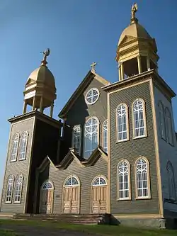
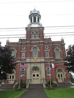
Current listings


.jpg.webp)


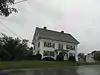
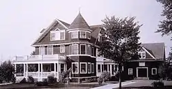


Former listings
| [3] | Name on the Register | Image | Date listed | Date removed | Location | City or town | Summary |
|---|---|---|---|---|---|---|---|
| 1 | Corriveau Mill | October 28, 1994 (#94001246) | December 18, 2013 | Southern side of U.S. Route 1, 0.3 miles southwest of its junction with Paridis Rd. 47°16′53″N 68°24′47″W |
Upper Frenchville | 1907 mill; torn down in 2005.[6] | |
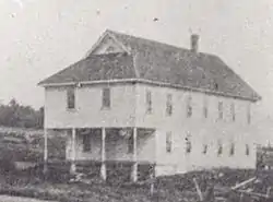
| 2 | Elmbrook Farm Barn | January 10, 1986 (#86000072) | December 18, 2013 | Parsons Rd. 46°42′26″N 68°01′23″W |
Presque Isle | 1891 barn; deteriorated and collapsed in 2002.[7] | |
| 3 | Lagassey Farm | January 21, 2009 (#08001356) | September 21, 2020 | 786 Main St. 47°12′56″N 68°16′14″W |
St. Agatha | ||
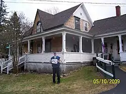
| 4 | McElwain House | April 12, 1982 (#82000739) | July 14, 2015 | 11 West Presque Isle Rd. 46°49′57″N 68°00′40″W |
Caribou | Now the Northern Maine Development Commission offices. | |
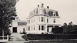
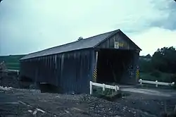
| 5 | Smith Bridge | .jpg.webp) Smith Bridge |
April 2, 1993 (#93000202) | December 18, 2013 | Lowery Rd. at its junction with Foxcroft Rd., across the Meduxnekeag River 46°10′52″N 67°48′16″W |
Houlton | A 1910 two-span Warren through truss bridge; dismantled in 1993.[8] |
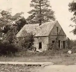
| 6 | Violette House | May 17, 1976 (#76000088) | December 18, 2013 | 464 Main St. 47°09′58″N 67°56′35″W |
Van Buren | A mid-19th century Acadian log house; disassembled and stored in 1984.[9] |
See also
| Wikimedia Commons has media related to National Register of Historic Places in Aroostook County, Maine. |
References
- The latitude and longitude information provided in this table was derived originally from the National Register Information System, which has been found to be fairly accurate for about 99% of listings. Some locations in this table may have been corrected to current GPS standards.
- "National Register of Historic Places: Weekly List Actions". National Park Service, United States Department of the Interior. Retrieved on February 5, 2021.
- Numbers represent an alphabetical ordering by significant words. Various colorings, defined here, differentiate National Historic Landmarks and historic districts from other NRHP buildings, structures, sites or objects.
- "National Register Information System". National Register of Historic Places. National Park Service. April 24, 2008.
- The eight-digit number below each date is the number assigned to each location in the National Register Information System database, which can be viewed by clicking the number.
- "Removal of Corriveau Mill" (PDF). National Park Service. Retrieved 2014-12-10.
- "Removal of Elmbrook Farm Barn" (PDF). National Park Service. Retrieved 2014-12-10.
- "Removal of Smith Bridge" (PDF). National Park Service. Retrieved 2014-12-10.
- "Removal of Violette House" (PDF). National Park Service. Retrieved 2014-12-10.
| Topics | |
|---|---|
| Lists by state |
|
| Lists by insular areas | |
| Lists by associated state | |
| Other areas | |
| Related | |
| |
Municipalities and communities of Aroostook County, Maine, United States | ||
|---|---|---|
| Cities | Aroostook County map | |
| Towns |
| |
| Plantations | ||
| Unorganized territories | ||
| CDPs | ||
| Other villages | ||
| Indian reservations | ||
| ||
This article is issued from Wikipedia. The text is licensed under Creative Commons - Attribution - Sharealike. Additional terms may apply for the media files.