Aubigny-en-Plaine
Aubigny-en-Plaine is a commune in the Côte-d'Or department in the Bourgogne-Franche-Comté region of eastern France.
Aubigny-en-Plaine | |
|---|---|
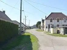
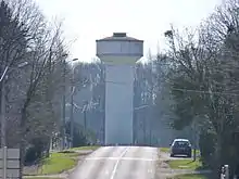
 The main road in Aubigny-en-Plaine | |
Location of Aubigny-en-Plaine 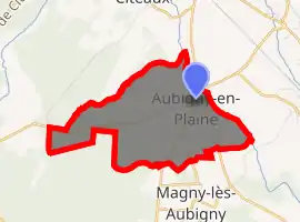
| |
 Aubigny-en-Plaine  Aubigny-en-Plaine | |
| Coordinates: 47°07′59″N 5°10′40″E | |
| Country | France |
| Region | Bourgogne-Franche-Comté |
| Department | Côte-d'Or |
| Arrondissement | Beaune |
| Canton | Brazey-en-Plaine |
| Intercommunality | CC Rives de Saône |
| Government | |
| • Mayor (2014-2020) | Jean-Claude Dinet |
| Area 1 | 6.34 km2 (2.45 sq mi) |
| Population (2017-01-01)[1] | 507 |
| • Density | 80/km2 (210/sq mi) |
| Time zone | UTC+01:00 (CET) |
| • Summer (DST) | UTC+02:00 (CEST) |
| INSEE/Postal code | 21031 /21170 |
| Elevation | 183–207 m (600–679 ft) |
| 1 French Land Register data, which excludes lakes, ponds, glaciers > 1 km2 (0.386 sq mi or 247 acres) and river estuaries. | |
The inhabitants of the commune are known as Albineyais or Albineyaises.[2] from the original name of the commune of Albineyum in the 13th century.[3]
Geography
Aubigny-en-Plaine is located some 27 km south by south-east of Dijon, 30 km north-east of Beaune and 17 km east of Nuits-Saint-Georges. Access to the commune is by the D8 road from Brazey-en-Plaine in the east passing through the village then the width of the commune as it goes west to Saint-Nicolas-lès-Cîteaux. The D 34 road comes from Charrey-sur-Saône in the south-west and passes through the village before continuing north to join the D 968 south of Aiserey. The D 20G goes south-east from the village to Esbarres. The western half of the commune is heavily forested while the eastern half is farmland.[4]
The Vouge river forms the eastern border of the commune as it flows south to join the Saône west of Saint-Jean-de-Losne. The Ruisseau du Bas de Bessey forms the northern border of the commune as it flows east to join the Vouge. An unnamed stream flows through the village to the Vouge.[4]
Neighbouring communes and villages
Places adjacent to Aubigny-en-Plaine | |
|---|---|
Administration
List of Successive Mayors[5]
| From | To | Name | Party | Position |
|---|---|---|---|---|
| 2001 | 2008 | Bernard Roth | ||
| 2008 | 2020 | Jean Claude Dinet |
(Not all data is known)
Demography
In 2017 the commune had 507 inhabitants.
|
| ||||||||||||||||||||||||||||||||||||||||||||||||||||||||||||||||||||||||||||||||||||||||||||||||||||||||||||||||||
| Source: EHESS[6] and INSEE[7] | |||||||||||||||||||||||||||||||||||||||||||||||||||||||||||||||||||||||||||||||||||||||||||||||||||||||||||||||||||
Sites and monuments
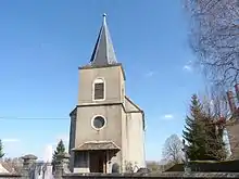
The Church of Aubigny-en-Plaine has the peculiarity of not having a transept. It has only a Nave. It contains one item that is registered as a historical object:
- A Statue: Saint Vincent (17th century)
 [8]
[8]
- Interior of the Church
 Altar and Choir
 Suspended lamp
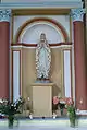 Statue of Saint Mary
 The Statue of Saint Vincent
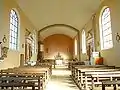 The Nave and Choir
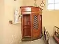 The Confessional
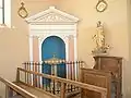 The Baptistery
See also
References
- "Populations légales 2017". INSEE. Retrieved 6 January 2020.
- Inhabitants of Côte-d'Or (in French)
- Inhabitants of Aubigny-en-Plaine (in French)
- Google Maps
- List of Mayors of France (in French)
- Données Cassini, EHESS
- Population en historique depuis 1968, INSEE
- Ministry of Culture, Palissy PM21000103 Statue: Saint Vincent (in French)

External links
- Aubigny-en-Plaine on Géoportail, National Geographic Institute (IGN) website (in French)
- Aubigny on the 1750 Cassini Map
| Wikimedia Commons has media related to Aubigny-en-Plaine. |
| Authority control |
|---|