Avelanges
Avelanges is a commune in the Côte-d'Or department in the Bourgogne-Franche-Comté region of eastern France.
Avelanges | |
|---|---|
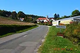 The road into Avelanges | |
Location of Avelanges 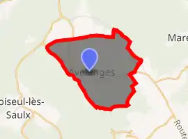
| |
 Avelanges  Avelanges | |
| Coordinates: 47°35′11″N 5°01′34″E | |
| Country | France |
| Region | Bourgogne-Franche-Comté |
| Department | Côte-d'Or |
| Arrondissement | Dijon |
| Canton | Is-sur-Tille |
| Intercommunality | CC Vallées Tille Ignon |
| Government | |
| • Mayor (2014-2020) | Jean-Michel Moyemont |
| Area 1 | 6.08 km2 (2.35 sq mi) |
| Population (2017-01-01)[1] | 35 |
| • Density | 5.8/km2 (15/sq mi) |
| Time zone | UTC+01:00 (CET) |
| • Summer (DST) | UTC+02:00 (CEST) |
| INSEE/Postal code | 21039 /21120 |
| Elevation | 348–467 m (1,142–1,532 ft) (avg. 370 m or 1,210 ft) |
| 1 French Land Register data, which excludes lakes, ponds, glaciers > 1 km2 (0.386 sq mi or 247 acres) and river estuaries. | |
The inhabitants of the commune are known as Avelangeais or Avelangeaises.[2]
Geography
Avelanges is located some 45 km north of Dijon and 35 km east by south-east of Aignay-le-Duc. Access to the commune is by the D120 road which branches from the D112 south of Avot in the north and passes through the commune and village before continuing south-west to Marey-sur-Tille. The commune has extensive forests mixed with smaller areas of farmland.[3]
Neighbouring communes and villages
Places adjacent to Avelanges | |
|---|---|
Toponymy
The name was Arclenglis or Avelengiis in 1028, Avallangiae in 1244, and Avelanges in 1793.
Administration
Avelanges Landscape
List of Successive Mayors[4]
| From | To | Name | Party | Position |
|---|---|---|---|---|
| 2001 | 2020 | Jean Michel Moyemont |
(Not all data is known)
Demography
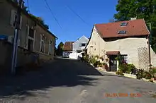
A street in Avelanges
In 2017 the commune had 35 inhabitants.
|
| ||||||||||||||||||||||||||||||||||||||||||||||||||||||||||||||||||||||||||||||||||||||||||||||||||||||||||||||||||
| Source: EHESS[5] and INSEE[6] | |||||||||||||||||||||||||||||||||||||||||||||||||||||||||||||||||||||||||||||||||||||||||||||||||||||||||||||||||||
Avelanges Picture Gallery
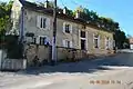 Avelanges School
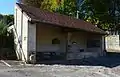 Avelanges Lavoir (Public Laundry)
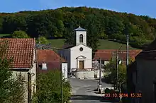
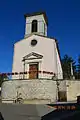 Avelanges Church
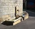 A Water Trough in Avalanges
See also
References
- "Populations légales 2017". INSEE. Retrieved 6 January 2020.
- Inhabitants of Côte-d'Or (in French)
- Google Maps
- List of Mayors of France (in French)
- Des villages de Cassini aux communes d'aujourd'hui: Commune data sheet Avelanges, EHESS. (in French)
- Population en historique depuis 1968, INSEE
External links
- Avelanges on Lion1906
- Avelanges on Géoportail, National Geographic Institute (IGN) website (in French)
- Avelanges on the 1750 Cassini Map
| Wikimedia Commons has media related to Avelanges. |
| Authority control |
|---|
This article is issued from Wikipedia. The text is licensed under Creative Commons - Attribution - Sharealike. Additional terms may apply for the media files.