Pagny-le-Château
Pagny-le-Château is a commune of the Côte-d'Or department in eastern France. In 2017 its population was 514.
Pagny-le-Château | |
|---|---|
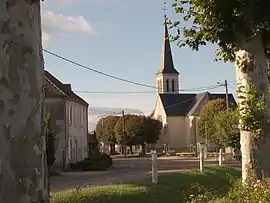 The church in Pagny-le-Château | |
.svg.png.webp) Coat of arms | |
Location of Pagny-le-Château 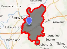
| |
 Pagny-le-Château  Pagny-le-Château | |
| Coordinates: 47°02′54″N 5°11′41″E | |
| Country | France |
| Region | Bourgogne-Franche-Comté |
| Department | Côte-d'Or |
| Arrondissement | Beaune |
| Canton | Brazey-en-Plaine |
| Intercommunality | Rives de Saône |
| Government | |
| • Mayor (2020–2026) | Hubert Moindrot |
| Area 1 | 24.23 km2 (9.36 sq mi) |
| Population (2017-01-01)[1] | 514 |
| • Density | 21/km2 (55/sq mi) |
| Time zone | UTC+01:00 (CET) |
| • Summer (DST) | UTC+02:00 (CEST) |
| INSEE/Postal code | 21475 /21250 |
| Elevation | 177–193 m (581–633 ft) (avg. 183 m or 600 ft) |
| 1 French Land Register data, which excludes lakes, ponds, glaciers > 1 km2 (0.386 sq mi or 247 acres) and river estuaries. | |
The village is situated between Seurre and Saint-Jean-de-Losne, in the "Val de Saône" on the RD 976.[2]
History
Over the centuries, the village has had several names. The first one was Pancium. Afterwards, it was called Paygnay-le-Château, then Pagny-la-Brûlée. Even though the fortified castles were destroyed the village is now called Pagny-le-Château.
Population
| Year | Pop. | ±% |
|---|---|---|
| 1962 | 422 | — |
| 1968 | 428 | +1.4% |
| 1975 | 335 | −21.7% |
| 1982 | 343 | +2.4% |
| 1990 | 477 | +39.1% |
| 1999 | 491 | +2.9% |
| 2008 | 501 | +2.0% |
The inhabitants are called Pagnitains.
Administration
| Period | Identity | Party | Quality |
|---|---|---|---|
| 1965 - 1971 | Robert Marchand | SE | Courier |
| 1971 - 1989 | Jacques Grenot | SE | Farmer |
| 1989 - 2020 | Jacques Chossat de Montburon | UMP-LR | Retiree |
| 2020 - | Hubert Moindrot | SE | Retiree |
| Other data unknown | |||
See also
References
- "Populations légales 2017". INSEE. Retrieved 6 January 2020.
- The departmental road #976
Photos gallery
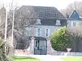 Pagny-le-Château : view of the castel.
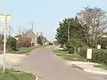 Pagny-le-Château : way to Franxault
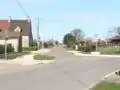 Pagny-le-Château : way to Franxault
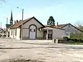 Pagny-le-Château : communal house
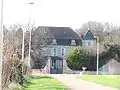 Pagny-le-Château : view of the castel
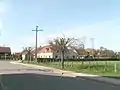 Pagny-le-Château : crossroad between the road to Franxault and the road to Montagny-lès-Seurre
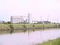 Pagny-le-Château : technoport
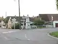 Pagny-le-Château : War Memorial (1914-1918 and 1939-1945)
External links
| Wikimedia Commons has media related to Pagny-le-Château. |
| Authority control |
|
|---|
This article is issued from Wikipedia. The text is licensed under Creative Commons - Attribution - Sharealike. Additional terms may apply for the media files.