Montlay-en-Auxois
Montlay-en-Auxois is a commune in the Côte-d'Or department in eastern France.
Montlay-en-Auxois | |
|---|---|
 The church in Montlay-en-Auxois | |
Location of Montlay-en-Auxois 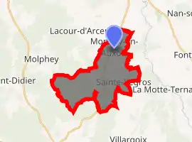
| |
 Montlay-en-Auxois  Montlay-en-Auxois | |
| Coordinates: 47°21′02″N 4°16′53″E | |
| Country | France |
| Region | Bourgogne-Franche-Comté |
| Department | Côte-d'Or |
| Arrondissement | Montbard |
| Canton | Semur-en-Auxois |
| Government | |
| • Mayor (2008–2014) | Jean-Louis Choublier |
| Area 1 | 17.36 km2 (6.70 sq mi) |
| Population (2017-01-01)[1] | 185 |
| • Density | 11/km2 (28/sq mi) |
| Time zone | UTC+01:00 (CET) |
| • Summer (DST) | UTC+02:00 (CEST) |
| INSEE/Postal code | 21434 /21210 |
| Elevation | 336–527 m (1,102–1,729 ft) (avg. 384 m or 1,260 ft) |
| 1 French Land Register data, which excludes lakes, ponds, glaciers > 1 km2 (0.386 sq mi or 247 acres) and river estuaries. | |
Population
|
|
References
- "Populations légales 2017". INSEE. Retrieved 6 January 2020.
| Wikimedia Commons has media related to Montlay-en-Auxois. |
| Authority control |
|---|
This article is issued from Wikipedia. The text is licensed under Creative Commons - Attribution - Sharealike. Additional terms may apply for the media files.