Avot, Côte-d'Or
Avot is a commune in the Côte-d'Or department in the Bourgogne-Franche-Comté region of eastern France.
Avot | |
|---|---|
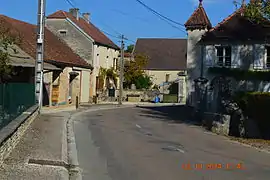 A street in Avot | |
.svg.png.webp) Coat of arms | |
Location of Avot 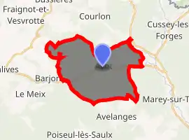
| |
 Avot  Avot | |
| Coordinates: 47°37′09″N 5°00′48″E | |
| Country | France |
| Region | Bourgogne-Franche-Comté |
| Department | Côte-d'Or |
| Arrondissement | Dijon |
| Canton | Is-sur-Tille |
| Intercommunality | CC Tille Venelle |
| Government | |
| • Mayor (2014-2020) | Bernard Guillemot |
| Area 1 | 21.67 km2 (8.37 sq mi) |
| Population (2017-01-01)[1] | 187 |
| • Density | 8.6/km2 (22/sq mi) |
| Time zone | UTC+01:00 (CET) |
| • Summer (DST) | UTC+02:00 (CEST) |
| INSEE/Postal code | 21041 /21580 |
| Elevation | 307–501 m (1,007–1,644 ft) (avg. 315 m or 1,033 ft) |
| 1 French Land Register data, which excludes lakes, ponds, glaciers > 1 km2 (0.386 sq mi or 247 acres) and river estuaries. | |
Geography
Avot is located some 40 km north by north-west of Dijon and 17 km west by north-west of Selongey. Access to the commune is by road D19 from Salives in the west which passes through the centre of the commune and the village before continuing east to join the D959 north of Marey-sur-Tille. The D19K goes north from the village to join the D112C east of Fraignot-et-Vesvrotte. Most of the commune is heavily forested with some small areas of farmland.[2]
The Tille river flows through the heart of the commune from west to east then continues southwards to join the Saône near Les Maillys. The Creuse flows from the north of the commune and joins the Tille at the village.[2]
Neighbouring communes and villages
Places adjacent to Avot, Côte-d'Or | |
|---|---|
Heraldry
Arms of Avot |
Blazon: Paly of Argent and Gules of 6 pieces, debruised by a cross moline Sable, in chief Or charged with 3 escallops Azure. |
Administration
List of Successive Mayors[3]
| From | To | Name | Party | Position |
|---|---|---|---|---|
| 2001 | 2008 | Joël Leroy | ||
| 2008 | 2020 | Bernard Guillemot |
(Not all data is known)
Demography
In 2017 the commune had 187 inhabitants.
|
| ||||||||||||||||||||||||||||||||||||||||||||||||||||||||||||||||||||||||||||||||||||||||||||||||||||||||||||||||||
| Source: EHESS[4] and INSEE[5] | |||||||||||||||||||||||||||||||||||||||||||||||||||||||||||||||||||||||||||||||||||||||||||||||||||||||||||||||||||
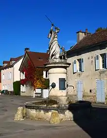
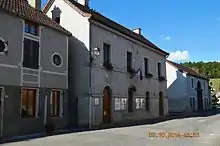
Avot Picture Gallery
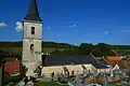 Avot Church
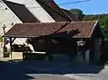 A Lavoir (Public Laundry) in Avot
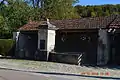 A Lavoir (Public Laundry) in Avot
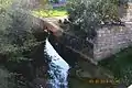 The Tille river at Avot
See also
References
- "Populations légales 2017". INSEE. Retrieved 6 January 2020.
- Google Maps
- List of Mayors of France (in French)
- Données Cassini, EHESS
- Population en historique depuis 1968, INSEE
External links
| Wikimedia Commons has media related to Avot. |
- Avot on the old IGN website (in French)
- Avot on Lion1906
- Avot on Géoportail, National Geographic Institute (IGN) website (in French)
- Avot on the 1750 Cassini Map
| Authority control |
|---|