Baraut
Baraut is a city and municipal board in Baghpat district, Uttar Pradesh, India.
Baraut | |
|---|---|
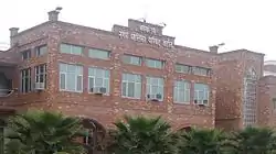 Office of Baraut Municipality | |
 Baraut  Baraut | |
| Coordinates: 29°10′02″N 77°26′29″E | |
| Country | India |
| State | Uttar Pradesh |
| Division | Meerut |
| District | Baghpat |
| Government | |
| • Body | Municipality |
| • Chairperson | Dushyant Tomar |
| Area | |
| • Total | 10.36 km2 (4.00 sq mi) |
| Elevation | 231 m (758 ft) |
| Population (2011) | |
| • Total | 103,764 |
| Language | |
| • Official | Hindi[1] |
| • Additional official | Urdu[1] |
| • Regional | Khari Boli, Haryanvi |
| Time zone | UTC+5:30 (IST) |
| PIN | 250611 |
| Telephone code | 91-1234 xxx xxx |
| Vehicle registration | UP-17 |
| Sex ratio | 70.22% ♂/51.12% ♀ |
| Literacy rate | Crude (66.2%), Effective (76.7%) |
Geography
Baraut is located at 29.6°N 77.16°E, covering an area of 10.36 square kilometers (4.00 sq mi) and lying between the Ganga and Yamuna river plains. Its average elevation is 231 m (758 feet). Baraut is served by two state highways, SH-57 and SH-82.
Baraut is located 55 kilometers (34 mi) from Delhi (the national capital of India) and 55 kilometers from Meerut, and is within the National Capital Region (NCR). It is within Baghpat district; prior to that, within Meerut district. Baraut is well linked by road to Binauli to the east, to Chhaprauli to the northwest, and Kotana to the west.
Demographics
Population
As of 2011 Indian Census, Baraut had a total population of 103,764, of which 55,013 were males and 48,751 were females. Population within the age group of 0 to 6 years was 14,149. The total number of literates in Baraut was 68,690 , which constituted 66.2% of the population with male literacy of 71.8% and female literacy of 59.9%. The effective literacy rate of 7+ population of Baraut was 76.7%, of which male literacy rate was 83.5% and female literacy rate was 69.0%. The Scheduled Castes population was 6,357. Baraut had 17924 in 2011.[2]
Administration and politics
Baraut is one of the 410 constituencies of the Uttar Pradesh Legislative Assembly, India. The first election of this assembly constituency was held in 1957 after the "DPACO (1956)" (delimitation order 1956) was passed in 1956.[4] After the 1969 elections, the constituency was dissolved. In 2008, when the "Delimitation of Parliamentary and Assembly Constituencies Order, 2008" was passed, the constituency was re-constituted and elections were held in 2012. The constituency is assigned identification number 51.
Baraut is part of the National Capital Region (NCR).
See also
References
- "52nd Report of the Commissioner for Linguistic Minorities in India" (PDF). nclm.nic.in. Ministry of Minority Affairs. Archived from the original (PDF) on 25 May 2017. Retrieved 23 November 2020.
- "Census of India: Baraut". www.censusindia.gov.in. Retrieved 23 November 2020.
- "About Baraut". 2002. Archived from the original on 10 April 2007. Retrieved 15 July 2018.
- "DPACO (1956)". Election Commission of India. Retrieved 16 December 2018.