Barges, Côte-d'Or
Barges is a commune in the Côte-d'Or department in the Bourgogne-Franche-Comté region of eastern France.[2]
Barges | |
|---|---|
.JPG.webp) The Parish Church of the Assumption | |
.svg.png.webp) Coat of arms | |
Location of Barges 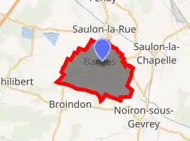
| |
 Barges  Barges | |
| Coordinates: 47°12′48″N 5°03′43″E | |
| Country | France |
| Region | Bourgogne-Franche-Comté |
| Department | Côte-d'Or |
| Arrondissement | Beaune |
| Canton | Nuits-Saint-Georges |
| Intercommunality | Sud Dijonnais |
| Government | |
| • Mayor (2014–2020) | André Daller |
| Area 1 | 3.85 km2 (1.49 sq mi) |
| Population | 621 |
| • Density | 160/km2 (420/sq mi) |
| Time zone | UTC+01:00 (CET) |
| • Summer (DST) | UTC+02:00 (CEST) |
| INSEE/Postal code | 21048 /21910 |
| Elevation | 203–227 m (666–745 ft) |
| 1 French Land Register data, which excludes lakes, ponds, glaciers > 1 km2 (0.386 sq mi or 247 acres) and river estuaries. | |
The inhabitants of the commune are known as Bargeois or Bargeoises.[3]
Geography
Barges is located some 12 km due south of Dijon. Access to the commune is by the D996 road from Saulon-la-Rue in the north which passes down the eastern side of the commune and continues south-east to Noiron-sous-Gevrey. Access to the village is by the D109 from Épernay-sous-Gevrey in the south which enters the commune in the west and continues north-east through the village and continues east as the D31 to Bretenière. Apart from a significant-sized urban area around the village the commune is entirely farmland.[4][5]
The Chairon river rises near the village and flows south-east to join the Sans Fond at Beau-Vallon.[4]
Neighbouring communes and villages[4] | |
|---|---|
History
Barges appears as Berge dit Barge (Berge known as Barge) on the 1750 Cassini Map[6] and as Barge on the 1790 version.[7]
Heraldry
Arms of Barges |
Blazon: Vert, a fess wavy of Or between a sailboat Argent in chief sailing to sinister on fess and a crescent the same in base. |
Administration
| From | To | Name | Party | Position |
|---|---|---|---|---|
| 2001 | 2014 | Pierre Coquillet | ||
| 2014 | 2020 | André Daller |
(Not all data is known)
Demography
In 2017 the commune had 621 inhabitants.
|
| ||||||||||||||||||||||||||||||||||||||||||||||||||||||||||||||||||||||||||||||||||||||||||||||||||||||||||||||||||
| Source: EHESS[9] and INSEE[10] | |||||||||||||||||||||||||||||||||||||||||||||||||||||||||||||||||||||||||||||||||||||||||||||||||||||||||||||||||||
Sites and monuments
- The War Memorial
- The Parish Church of the Assumption contains a Group Sculpture: Virgin of Pity (16th century) which is registered as an historical object.
 [11]
[11]
See also
References
- "Populations légales 2017". INSEE. Retrieved 6 January 2020.
- Barges on Lion1906
- Inhabitants of Côte-d'Or (in French)
- Barges on Google Maps
- Barges on the Géoportail from National Geographic Institute (IGN) website (in French)
- Berge dit Barge on the 1750 Cassini Map
- Barge on the 1790 Cassini Map
- List of Mayors of France (in French)
- Des villages de Cassini aux communes d'aujourd'hui: Commune data sheet Barges, EHESS. (in French)
- Population en historique depuis 1968, INSEE
- Ministry of Culture, Palissy PM21000171 Group Sculpture: Virgin of Pity (in French)

| Wikimedia Commons has media related to Barges (Côte-d'Or). |
| Authority control |
|---|