Chancelade
Chancelade is a commune in the Dordogne department in Nouvelle-Aquitaine in southwestern France. The village is the site of Chancelade Abbey.
Chancelade | |
|---|---|
 The abbey in Chancelade | |
Location of Chancelade 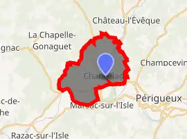
| |
 Chancelade  Chancelade | |
| Coordinates: 45°12′23″N 0°39′58″E | |
| Country | France |
| Region | Nouvelle-Aquitaine |
| Department | Dordogne |
| Arrondissement | Périgueux |
| Canton | Coulounieix-Chamiers |
| Government | |
| • Mayor (2020–2026) | Pascal Serre |
| Area 1 | 16.23 km2 (6.27 sq mi) |
| Population (2017-01-01)[1] | 4,262 |
| • Density | 260/km2 (680/sq mi) |
| Time zone | UTC+01:00 (CET) |
| • Summer (DST) | UTC+02:00 (CEST) |
| INSEE/Postal code | 24102 /24650 |
| Elevation | 73–198 m (240–650 ft) |
| 1 French Land Register data, which excludes lakes, ponds, glaciers > 1 km2 (0.386 sq mi or 247 acres) and river estuaries. | |
The so-called "Chancelade man" was found in the nearby Raymonden rock shelter in 1888, the skeleton of an approximately 60-year-old male who was buried there in the Magdalenian, roughly 15,000 years ago.
Population
|
|
See also
References
- "Populations légales 2017". INSEE. Retrieved 6 January 2020.
| Wikimedia Commons has media related to Chancelade. |
| Authority control |
|---|
This article is issued from Wikipedia. The text is licensed under Creative Commons - Attribution - Sharealike. Additional terms may apply for the media files.
