Condat-sur-Trincou
Condat-sur-Trincou (Occitan: Condat de Trincor) is a commune in the Dordogne department in Nouvelle-Aquitaine in southwestern France.
Condat-sur-Trincou | |
|---|---|
.JPG.webp) A general view of Condat-sur-Trincou | |
Location of Condat-sur-Trincou 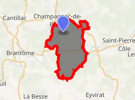
| |
 Condat-sur-Trincou  Condat-sur-Trincou | |
| Coordinates: 45°22′59″N 0°42′32″E | |
| Country | France |
| Region | Nouvelle-Aquitaine |
| Department | Dordogne |
| Arrondissement | Nontron |
| Canton | Brantôme en Périgord |
| Government | |
| • Mayor (2008–2014) | François Thomas |
| Area 1 | 16.54 km2 (6.39 sq mi) |
| Population (2017-01-01)[1] | 480 |
| • Density | 29/km2 (75/sq mi) |
| Time zone | UTC+01:00 (CET) |
| • Summer (DST) | UTC+02:00 (CEST) |
| INSEE/Postal code | 24129 /24530 |
| Elevation | 104–208 m (341–682 ft) (avg. 143 m or 469 ft) |
| 1 French Land Register data, which excludes lakes, ponds, glaciers > 1 km2 (0.386 sq mi or 247 acres) and river estuaries. | |
Geography
The village lies on the right bank of the Trincou, which flows southwest through the northern part of the commune, before to flow into the Côle.
The Côle flows west through the middle of the commune, forms part of its southwestern border, then flows into the Dronne, which forms part of the commune's western border.
Population
|
|
See also
References
- "Populations légales 2017". INSEE. Retrieved 6 January 2020.
| Wikimedia Commons has media related to Condat-sur-Trincou. |
| Authority control |
|---|
This article is issued from Wikipedia. The text is licensed under Creative Commons - Attribution - Sharealike. Additional terms may apply for the media files.