Lanouaille
Lanouaille is a commune in the Dordogne department in Nouvelle-Aquitaine in southwestern France. The departmental road D704 (Sarlat-Limoges) passes through the town.
Lanouaille | |
|---|---|
 The church in Lanouaille | |
.svg.png.webp) Coat of arms | |
Location of Lanouaille 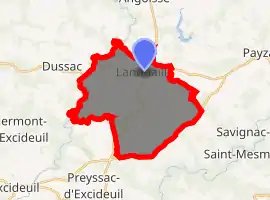
| |
 Lanouaille  Lanouaille | |
| Coordinates: 45°23′34″N 1°08′20″E | |
| Country | France |
| Region | Nouvelle-Aquitaine |
| Department | Dordogne |
| Arrondissement | Nontron |
| Canton | Isle-Loue-Auvézère |
| Intercommunality | Pays de Lanouaille |
| Government | |
| • Mayor (2008–2014) | Jean-Pierre Cubertafon |
| Area 1 | 23.78 km2 (9.18 sq mi) |
| Population (2017-01-01)[1] | 1,017 |
| • Density | 43/km2 (110/sq mi) |
| Time zone | UTC+01:00 (CET) |
| • Summer (DST) | UTC+02:00 (CEST) |
| INSEE/Postal code | 24227 /24270 |
| Elevation | 198–234 m (650–768 ft) (avg. 300 m or 980 ft) |
| 1 French Land Register data, which excludes lakes, ponds, glaciers > 1 km2 (0.386 sq mi or 247 acres) and river estuaries. | |
History
Lanouaille (la nouvelle - new) is a relatively new commune created from parts of the areas of Savignac-Lédrier and Dussac. It owes its development to its location on the road from Sarlat to Limoges via Saint Yrieix and Montignac (D704) and to its status as seat of the canton until 2015 (before 1801 Dussac was the seat of the canton).
Population
| Year | Pop. | ±% |
|---|---|---|
| 1962 | 965 | — |
| 1968 | 1,025 | +6.2% |
| 1975 | 1,026 | +0.1% |
| 1982 | 1,006 | −1.9% |
| 1990 | 976 | −3.0% |
| 1999 | 966 | −1.0% |
| 2008 | 988 | +2.3% |
See also
References
- "Populations légales 2017". INSEE. Retrieved 6 January 2020.
| Wikimedia Commons has media related to Lanouaille. |
| Authority control |
|
|---|
This article is issued from Wikipedia. The text is licensed under Creative Commons - Attribution - Sharealike. Additional terms may apply for the media files.