Villetoureix
Villetoureix is a commune in the Dordogne department in Nouvelle-Aquitaine in southwestern France.
Villetoureix | |
|---|---|
.jpg.webp) The town hall in Villetoureix | |
Location of Villetoureix 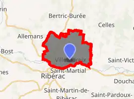
| |
 Villetoureix  Villetoureix | |
| Coordinates: 45°15′51″N 0°21′48″E | |
| Country | France |
| Region | Nouvelle-Aquitaine |
| Department | Dordogne |
| Arrondissement | Périgueux |
| Canton | Ribérac |
| Intercommunality | Ribéracois |
| Government | |
| • Mayor (2008–2014) | Rolland Torres |
| Area 1 | 16.4 km2 (6.3 sq mi) |
| Population (2017-01-01)[1] | 906 |
| • Density | 55/km2 (140/sq mi) |
| Time zone | UTC+01:00 (CET) |
| • Summer (DST) | UTC+02:00 (CEST) |
| INSEE/Postal code | 24586 /24600 |
| Elevation | 56–161 m (184–528 ft) (avg. 67 m or 220 ft) |
| 1 French Land Register data, which excludes lakes, ponds, glaciers > 1 km2 (0.386 sq mi or 247 acres) and river estuaries. | |
Geography
Villetoureix is situated on a hill on the right bank of the river Dronne, near Ribérac, in the Périgord blanc area. The commune consists of the village Villetoureix and the minor settlements of la Pouyade, la Borie, Mayac and la Dérame. Neighbouring communes are Ribérac and Saint-Méard-de-Drône to the south, Celles to the east, Bertric-Burée to the north and Allemans to the west.
Population
| Year | Pop. | ±% |
|---|---|---|
| 1962 | 649 | — |
| 1968 | 667 | +2.8% |
| 1975 | 728 | +9.1% |
| 1982 | 750 | +3.0% |
| 1990 | 779 | +3.9% |
| 1999 | 762 | −2.2% |
| 2008 | 877 | +15.1% |
History
The first traces of inhabitants date back to the Gallo-Roman era, but development of the village started in the 17th century, when the château de la Rigale was built.
See also
References
- "Populations légales 2017". INSEE. Retrieved 6 January 2020.
External links
| Wikimedia Commons has media related to Villetoureix. |
| Authority control |
|
|---|
This article is issued from Wikipedia. The text is licensed under Creative Commons - Attribution - Sharealike. Additional terms may apply for the media files.