County of Minburn No. 27
The County of Minburn No. 27 is a municipal district in east central Alberta, Canada. Its municipal office is located in the Town of Vegreville. Located in Census Division 10, the County of Minburn No. 27 was formed as a county on January 1, 1965 from the former Municipal District of Minburn No. 72.
County of Minburn No. 27 | |
|---|---|
Municipal district | |
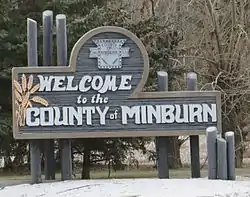 Boundary sign | |
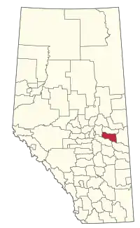 Location within Alberta | |
| Coordinates: 53°29′34″N 112°03′8″W | |
| Country | |
| Province | |
| Region | Central Alberta |
| Census division | No. 10 |
| Established | 1942 |
| Incorporated | 1965 (County) |
| Government | |
| • Reeve | Roger Konieczny |
| • Governing body | County of Minburn Council |
| • Office location | Vegreville |
| Area (2016)[2] | |
| • Land | 2,913.02 km2 (1,124.72 sq mi) |
| Population (2016)[2] | |
| • Total | 3,188 |
| • Density | 1.1/km2 (3/sq mi) |
| Time zone | UTC-7 (MST) |
| Website | Official website |
Demographics
In the 2016 Census of Population conducted by Statistics Canada, the County of Minburn No. 27 recorded a population of 3,188 living in 1,184 of its 1,380 total private dwellings, a -5.8% change from its 2011 population of 3,383. With a land area of 2,913.02 km2 (1,124.72 sq mi), it had a population density of 1.1/km2 (2.8/sq mi) in 2016.[2]
In the 2011 Census, the County of Minburn No. 27 had a population of 3,278 living in 1,161 of its 1,359 total dwellings, a -1.2% change from its 2006 population of 3,319. With a land area of 2,910.71 km2 (1,123.83 sq mi), it had a population density of 1.1/km2 (2.9/sq mi) in 2011.[3]
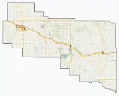
Communities and localities
|
The following urban municipalities are surrounded by the County of Minburn No. 27:[4]
The following hamlets are located within the County of Minburn No. 27:[4]
|
The following localities are located within the County of Minburn No. 27:[6]
|
References
- "Municipal Officials Search". Alberta Municipal Affairs. September 22, 2017. Retrieved September 25, 2017.
- "Population and dwelling counts, for Canada, provinces and territories, and census subdivisions (municipalities), 2016 and 2011 censuses – 100% data (Alberta)". Statistics Canada. February 8, 2017. Retrieved February 8, 2017.
- "Population and dwelling counts, for Canada, provinces and territories, and census subdivisions (municipalities), 2011 and 2006 censuses (Alberta)". Statistics Canada. February 8, 2012. Retrieved February 8, 2012.
- "Specialized and Rural Municipalities and Their Communities" (PDF). Alberta Municipal Affairs. 2012-03-01. Archived from the original (PDF) on 2012-04-09. Retrieved 2012-08-11.
- "O.C. 152/2015". Government of Alberta. June 24, 2015. Retrieved June 30, 2015.
- "Standard Geographical Classification (SGC) 2006, Economic Regions: 4810026 - Minburn County No. 27, geographical codes and localities, 2006". Statistics Canada. 2010-03-05. Archived from the original on 2013-05-25. Retrieved 2012-08-11.
External links
Places adjacent to County of Minburn No. 27 | |
|---|---|