Lethbridge County
Lethbridge County is a municipal district in southern Alberta. It is in Census Division No. 2 and part of the Lethbridge census agglomeration. It was known as the County of Lethbridge prior to December 4, 2013.[2] Its name was changed in time for 2014 to coincide with its 50th anniversary.[5]
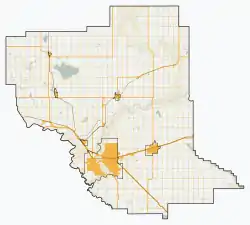
Lethbridge County | |
|---|---|
Municipal district | |
 Location within Alberta | |
| Country | |
| Province | |
| Region | Southern Alberta |
| Census division | No. 2 |
| Incorporated | January 1, 1954[1] |
| Name changes | January 1, 1964[1] September 6, 2000[1] December 4, 2013[2] |
| Government | |
| • Reeve | Lorne Hickey |
| • Governing body | Lethbridge County Council
|
| • CAO | Ann Mitchell |
| • Office location | Lethbridge |
| Area (2016)[4] | |
| • Land | 2,836.64 km2 (1,095.23 sq mi) |
| Population (2016)[4] | |
| • Total | 10,353 |
| • Density | 3.6/km2 (9/sq mi) |
| Time zone | UTC-7 (MST) |
| Website | lethcounty.ca |
History
Lethbridge County encompasses an area that was originally under the jurisdiction of six municipalities. It was originally formed as the Municipal District of Lethbridge No. 25 on January 1, 1954 by amalgamating the municipal districts of Bright No. 16 and Barons No. 25 and portions of Special Area No. 4, the County of Vulcan No. 2 and the municipal districts of Warner No. 4 and Sugar City No. 5.[1] Ten years later, on January 1, 1964, the Municipal District of Lethbridge No. 25 joined with Lethbridge School Division No. 7 to become the County of Lethbridge No. 26.[1] It subsequently changed its name to the County of Lethbridge on September 6, 2000 and then again to Lethbridge County on December 4, 2013.[1][2]
Demographics
In the 2016 Census of Population conducted by Statistics Canada, Lethbridge County recorded a population of 10,353 living in 2,968 of its 3,129 total private dwellings, a 3.1% change from its 2011 population of 10,046. With a land area of 2,836.64 km2 (1,095.23 sq mi), it had a population density of 3.6/km2 (9.5/sq mi) in 2016.[4]
In the 2011 Census, Lethbridge County had a population of 10,061 living in 2,866 of its 3,052 total dwellings, a -1.9% change from its 2006 adjusted population of 10,254. With a land area of 2,837.8 km2 (1,095.7 sq mi), it had a population density of 3.5/km2 (9.2/sq mi) in 2011.[6]
Economy
The economy of the county is primarily agricultural, including the well known "Feedlot Alley", a 500 km² area of intensive livestock operations.
Government
The county is governed by a council of seven councillors, elected every four years, from seven electoral divisions. The last election was in October 2013. The council chooses a reeve to be their head. It meets in offices located in Lethbridge.
Communities and localities
|
The following urban municipalities are surrounded by Lethbridge County:[7][8]
The following hamlets are located within Lethbridge County:[8]
|
The following localities are located within Lethbridge County:[9]
|
References
- "Location and History Profile: County of Lethbridge". Alberta Municipal Affairs. September 27, 2013. Retrieved September 27, 2013.
- "O.C. 393/2013". Government of Alberta. December 4, 2013. Retrieved December 4, 2013.
- "Municipal Officials Search". Alberta Municipal Affairs. September 22, 2017. Retrieved September 25, 2017.
- "Population and dwelling counts, for Canada, provinces and territories, and census subdivisions (municipalities), 2016 and 2011 censuses – 100% data (Alberta)". Statistics Canada. February 8, 2017. Retrieved February 8, 2017.
- "County Council Adopts New Logo and Approves Changing Name" (PDF). County of Lethbridge. September 27, 2013. Retrieved September 27, 2013.
- "Population and dwelling counts, for Canada, provinces and territories, and census subdivisions (municipalities), 2011 and 2006 censuses (Alberta)". Statistics Canada. February 8, 2012. Retrieved February 8, 2012.
- "Lethbridge, City (Census Subdivision), Alberta". Statistics Canada. June 20, 2012. Retrieved August 13, 2012.
- "Specialized and Rural Municipalities and Their Communities" (PDF). Alberta Municipal Affairs. March 1, 2012. Archived from the original (PDF) on April 9, 2012. Retrieved August 11, 2012.
- "Standard Geographical Classification (SGC) 2006, Economic Regions: 4802011 - Lethbridge County, geographical codes and localities, 2006". Statistics Canada. March 5, 2010. Retrieved August 11, 2012.
- "Wilson Siding". County of Lethbridge. Archived from the original on May 3, 2014. Retrieved May 24, 2012.
External links
Places adjacent to Lethbridge County | |
|---|---|