County of St. Paul No. 19
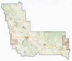
The County of St. Paul No. 19 is a municipal district in eastern central Alberta, Canada. Located in Census Division No. 12, its municipal office is located in the Town of St. Paul.[3]
County of St. Paul No. 19 | |
|---|---|
Municipal district | |
 Welcome sign | |
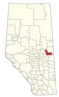 Location within Alberta | |
| Country | |
| Province | |
| Region | Northern Alberta |
| Census division | No. 12 |
| Established | 1942 |
| Incorporated | 1962 (County) |
| Government | |
| • Reeve | Steve Upham |
| • Governing body | County of St. Paul Council |
| • Office location | St. Paul |
| Area (2016)[2] | |
| • Land | 3,309.44 km2 (1,277.78 sq mi) |
| Population (2016)[2] | |
| • Total | 6,036 |
| • Density | 1.8/km2 (5/sq mi) |
| Time zone | UTC-7 (MST) |
| Website | county.stpaul.ab.ca |
History
It was previously known as the Municipal District of St. Paul No. 86 until January 1, 1962 when it became the County of St. Paul No. 19.
Demographics
The population of the County of St. Paul No. 19 according to its 2017 municipal census is 6,468,[4] a change of 4.9% from its 2012 municipal census population of 6,168.[5]
In the 2016 Census of Population conducted by Statistics Canada, the County of St. Paul No. 19 recorded a population of 6,036 living in 2,334 of its 3,562 total private dwellings, a 3.6% change from its 2011 population of 5,826. With a land area of 3,309.44 km2 (1,277.78 sq mi), it had a population density of 1.8/km2 (4.7/sq mi) in 2016.[2]
In the 2011 Census, the County of St. Paul No. 19 had a population of 5,831 living in 2,207 of its 2,608 total dwellings, a -1.6% change from its 2006 population of 5,925. With a land area of 3,296.72 km2 (1,272.87 sq mi), it had a population density of 1.8/km2 (4.6/sq mi) in 2011.[6] Following St. Paul's 2011 annexation, Statistics Canada adjusted the County of St. Paul No. 19's 2011 population downward by 5 people to 5,826.[7]
Communities and localities
|
The following urban municipalities are surrounded by the County of St. Paul No. 19:[8]
The following hamlets are located within the County of St. Paul No. 19:[8]
|
The following localities are located within the County of St. Paul No. 19:[9]
|
|
References
- Alberta Municipal Affairs: Municipal Officials Search
- "Population and dwelling counts, for Canada, provinces and territories, and census subdivisions (municipalities), 2016 and 2011 censuses – 100% data (Alberta)". Statistics Canada. February 8, 2017. Retrieved February 8, 2017.
- "County of St. Paul No. 19 - Location and History Profile". Alberta Municipal Affairs. 2011-05-13. Retrieved 2011-05-17.
- "2017 Municipal Affairs Population List" (PDF). Alberta Municipal Affairs. ISBN 978-1-4601-3652-2. Retrieved January 13, 2018.
- "2016 Municipal Affairs Population List" (PDF). Alberta Municipal Affairs. ISBN 978-1-4601-3127-5. Retrieved January 13, 2018.
- "Population and dwelling counts, for Canada, provinces and territories, and census subdivisions (municipalities), 2011 and 2006 censuses (Alberta)". Statistics Canada. February 8, 2012. Retrieved February 8, 2012.
- "Interim List of Changes to Municipal Boundaries, Status, and Names From January 2, 2011 to January 1, 2012 (Table 1 – Changes to census subdivisions in alphabetical order by province and territory)" (XLSX). Statistics Canada. November 14, 2012. Retrieved August 17, 2013.
- "Specialized and Rural Municipalities and Their Communities" (PDF). Alberta Municipal Affairs. 2012-03-01. Archived from the original (PDF) on 2012-04-09. Retrieved 2012-08-12.
- "Standard Geographical Classification (SGC) 2006, Economic Regions: 4812014 - St. Paul County No. 19, geographical codes and localities, 2006". Statistics Canada. 2010-03-05. Archived from the original on 2013-05-25. Retrieved 2012-08-12.
External links
Places adjacent to County of St. Paul No. 19 | |
|---|---|