Dongkha La
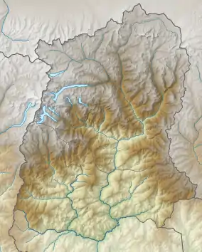
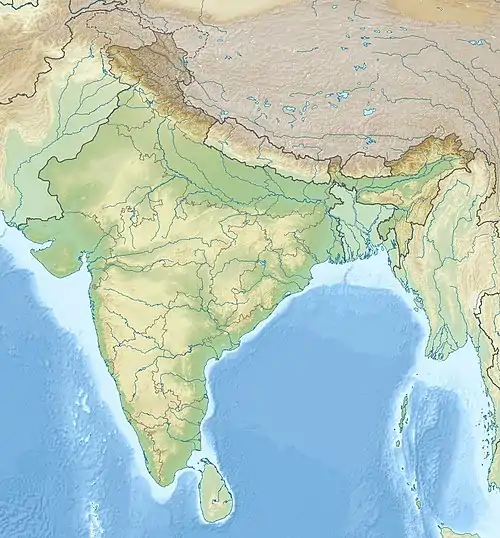
The Dongkha la or Donkia Pass[1] (el. 18,156.2 ft or 5,534.0 m)[2][3][4] is a high mountain pass in the Himalaya connecting Sikkim in India with Tibet.
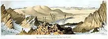
Painting by J D Hooker (1854)
| Dongkha la | |
|---|---|
  | |
| Elevation | 18,156.2 ft (5,534 m) |
| Location | Sikkim, India Tibet |
| Range | Himalaya |
Located in North Sikkim, the pass offers a view of the Tibetan Plateau. The nearby Tso Lhamo Lake[1] 6.5 km (4.0 mi) is long and 2.5 km (1.6 mi) wide.[5] and is the source of the Teesta River. Gurudongmar Lake, some 5 kilometres (3.1 mi) to west-northwest, also feeds the Teesta.
The first observer to record the pass in western literature was botanist Joseph Dalton Hooker, who crossed the pass on 7 September 1849.
| Dongkha La | |||||||
|---|---|---|---|---|---|---|---|
| Traditional Chinese | 凍嘎拉山口 | ||||||
| Simplified Chinese | 冻嘎拉山口 | ||||||
| |||||||
References
- White, J. Claude; White, J. Claude (4 May 1996). Sikkim & Bhutan. Asian Educational Services. p. 89. ISBN 978-81-206-1183-2. Retrieved 11 September 2009.
- Joshi, H.G. (15 October 2004). Sikkim ; Past and Present. New Delhi, India: Mittal Publications. p. 41. ISBN 978-81-7099-932-4. Retrieved 11 September 2009.
- Hooker, Joseph Dalton (15 October 2008). Himalayan Journals, Notes of a Naturalist: In Bengal, The Sikkim and Nepal Himalayas, The Khasia Mountains, Etc. Forgotten Books. p. 637. ISBN 978-1-60620-983-7. Archived from the original on 7 March 2012. Retrieved 11 September 2009.
- Hooker, Joseph Dalton (15 October 2008). Himalayan Journals, Notes of a Naturalist: In Bengal, The Sikkim and Nepal Himalayas, The Khasia Mountains, Etc. Forgotten Books. p. 619. ISBN 978-1-60620-983-7. Archived from the original on 7 March 2012. Retrieved 11 September 2009.
- Krishnan, J. K (2005). Academic Dictionary of Tourism. Delhi, India: Isha Books. p. 89. ISBN 978-81-8205-259-8. Retrieved 11 September 2009.
External links
Mountain passes of China | |||||||||||||||
|---|---|---|---|---|---|---|---|---|---|---|---|---|---|---|---|
| On the border | |||||||||||||||
| In the interior |
| ||||||||||||||
| |||||||||||||||
This article is issued from Wikipedia. The text is licensed under Creative Commons - Attribution - Sharealike. Additional terms may apply for the media files.