Mana Pass
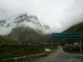
The pass is one of the highest vehicle-accessible passes in the world, containing a road constructed in the 2005-2010 period for the Indian military by the Border Roads Organisation and visible on 2011 imagery on visual globe systems such as Google Earth.[1] The well-graded gravel-dirt road is higher on the Indian side than the new road on the Tibetan side, and rises to 5,610 metres (18,406 ft) on the Indian side of the border, 250 m west of the low point of the 5,632 metres (18,478 ft) Mana Pass SRTM.
| Mana Pass | |
|---|---|
 Mana Village, Badrinath, Uttarakhand, India | |
| Elevation | 5,632 m (18,478 ft) (SRTM2) |
| Location | China–India border |
| Range | Himalayas |
| Coordinates | 31°04′06″N 79°25′00″E |
 Location of Mana Pass | |
Geography
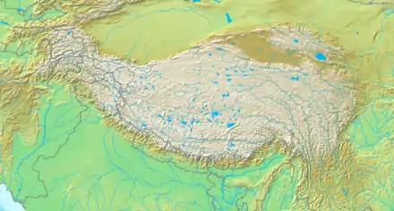
Mana Pass is located within the Nanda Devi Biosphere Reserve, 47 km north of the town of Mana, India and 52 km north of the Hindu pilgrimage town of Badrinath in Uttarakhand. It is the source of the Saraswati River, the longest stem of one of the longest Ganges tributaries, the Alaknanda River.[2] That river trickles through several scenic small ponds between the pass and Lake Deo Tal three km southwest of the pass. Mana pass is also the key col for climbing Chaukhamba peak.
Mana as a name derives from "Manibhadra Ashram", the ancient name of the town of Mana.[2]
History
Mana Pass was an ancient trade route between Uttarakhand and Tibet. Mana Pass led from Badrinath to the kingdom, now province, of Guge in Tibet. The Portuguese Jesuits António de Andrade and Manuel Marques became the first known Europeans to enter Tibet across Mana Pass in 1624. The pass continued as a minor trade route until its closure in 1951 by the Chinese. On April 29, 1954, China and India signed an agreement granting pilgrims and indigenous travelers the right to travel between the two countries through Mana Pass.
Access
The pass is reached from the south by an extension of India National Highway 7 (NH-7, old number NH-58) that connects Fazilka with Badrinath, though beyond Badrinath the graded road is subject to landslides. Group of enthusiast motorcycle riders often can be seen on this road. Free Souls Rider Motorcycle Club was first non military citizens to scale the heights of Mana Pass and hold the record in The Limca Book Of Records.[3]
References
- Sharma, Seema. "Women bikers attempt record at Mana Pass". Times of India. Retrieved 9 June 2017.
- "Tourism in Mana, India". New Delhi, India. Archived from the original on 2009-04-13. Retrieved 2009-06-23.
- "Limca Book of Records". www.limcabookofrecords.in.
Bibliography
- Holdich, Sir Thomas H; Tibet the Mysterious, (1906) University Press, Cambridge, Massachusetts
- MacGregor, John. Tibet: A Chronicle of Exploration, (1970) Routledge & Kegan Paul, London, SBN 7100-6615-5
External links
Mountain passes of China | |||||||||||||||
|---|---|---|---|---|---|---|---|---|---|---|---|---|---|---|---|
| On the border | |||||||||||||||
| In the interior |
| ||||||||||||||
| |||||||||||||||
