Marsimik La
Marsimik La or Marsemik La,[2] also called Lankar La,[2] elevation 5,582 metres (18,314 ft) is a high mountain pass in the Chang Chenmo Range in the Indian union territory of Ladakh, 96 km (60 mi) east of Leh as the crow flies. Ladakh's route to the Chang Chenmo Valley traverses the pass.
| Marsimik La | |
|---|---|
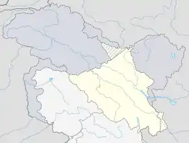 Location of Marsimik La in Ladakh  Marsimik La (India) | |
| Elevation | 5,582 m (18,314 ft)[1] |
| Location | Ladakh, India |
| Range | Himalaya |
| Coordinates | 34°05′36″N 78°37′04″E |
Geography

Marsimik La is located about 20 km (10 mi) northeast of Lukung, on the northwest tip of Pangong Lake. The campsite of Pamzal in the Chang Chenmo Valley is about 15 km (9 mi) from here. The ridge line of Marsimik La divides the basin of the Pangong Lake to the south from that of the Chang Chenmo River to the north.
About 4 km to the east is another ridge line with the pass Kiu La (also called Kangseng La). Via this pass lay the Ladakhi route to the valley of Chang Parma (also called Changlung Lungpa), leading to the Khurnak Plain in the middle of the Pangong Lake.
The description of Marsimik La in the Gazetteer of Kashmir and Ladak (1890) states:
This pass, though very high, is by no means difficult in summer. It is free from glaciers, and generally clear of snow during the summer and early autumn.[2]
Sino-Indian border
The pass is on the shortest route from Lukung to Kongka Pass area some 45 km (28 mi) away, where the China-India Line of Actual Control runs. Within the vicinity of Marsimik La, the line runs at a distance of 4 kilometres (2.5 mi) to the east on a sharp ridgeline.
Transportation
The Marsimik La Road from Lukung to Pamzal, constructed by India's Border Roads Organisation, traversses the pass. It is regarded as one of the highest motorable passes in the world.[3]
References
- "Google Maps Terrain for Marsimik showing elevation of circa 5590m La". Google Maps. Retrieved 18 February 2016.
- Gazetteer of Kashmir and Ladak (1890), p. 591.
- "Amid Doklam standoff, MHA asks BRO to build stand-alone road for access to vantage points". The Indian Express. 23 August 2017.
Bibliography
- Gazetteer of Kashmir and Ladak, Calcutta: Superintendent of Government Printing, 1890
| History |
| ||||||||||||||||||
|---|---|---|---|---|---|---|---|---|---|---|---|---|---|---|---|---|---|---|---|
| Administration | |||||||||||||||||||
| Geography |
| ||||||||||||||||||
| Human settlements | |||||||||||||||||||
| Culture |
| ||||||||||||||||||
| Tourism and wildlife |
| ||||||||||||||||||
| Transport |
| ||||||||||||||||||
| Infrastructure |
| ||||||||||||||||||
| See also |
| ||||||||||||||||||